MyTopo
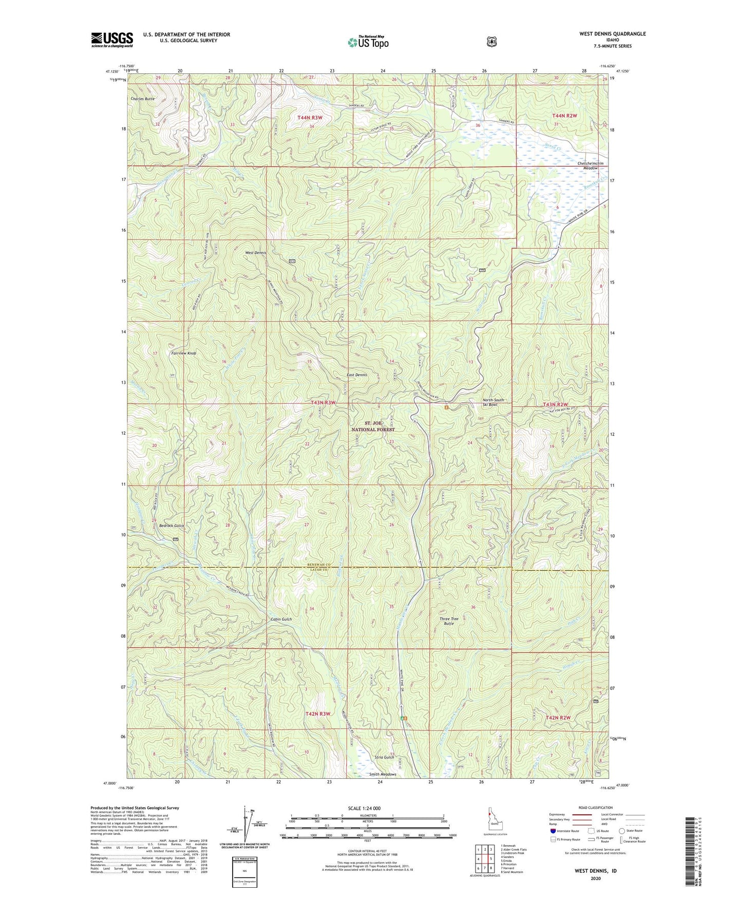
West Dennis Idaho US Topo Map
Couldn't load pickup availability
Also explore the West Dennis Forest Service Topo of this same quad for updated USFS data
2024 topographic map quadrangle West Dennis in the state of Idaho. Scale: 1:24000. Based on the newly updated USGS 7.5' US Topo map series, this map is in the following counties: Benewah, Latah. The map contains contour data, water features, and other items you are used to seeing on USGS maps, but also has updated roads and other features. This is the next generation of topographic maps. Printed on high-quality waterproof paper with UV fade-resistant inks.
Quads adjacent to this one:
West: Sanders
Northwest: Benewah
North: Alder Creek Flats
Northeast: Lindstrom Peak
East: Emida
Southeast: Sand Mountain
South: Harvard
Southwest: Princeton
This map covers the same area as the classic USGS quad with code o47116a6.
Contains the following named places: Bedrock Gulch, Blakes Fork, Bunnel Creek, Cabin Gulch, Cedar Grove Camp, Charles Butte, Chetche'mch'm Meadow, East Dennis, Fairview Knob, Giant White Pine Recreation Site, Hardpan Creek, Hill Creek, North South Ski Bowl, North-South Ski Bowl, Piah Creek, Prospect Creek, Ramskull Creek, South Fork Santa Creek, Stewah Creek, Stria Gulch, Three Tree Butte, Wepah Creek, West Dennis, White Pine Creek, White Pine National Recreation Trail, White Pine Scenic Drive, Willow Creek