MyTopo
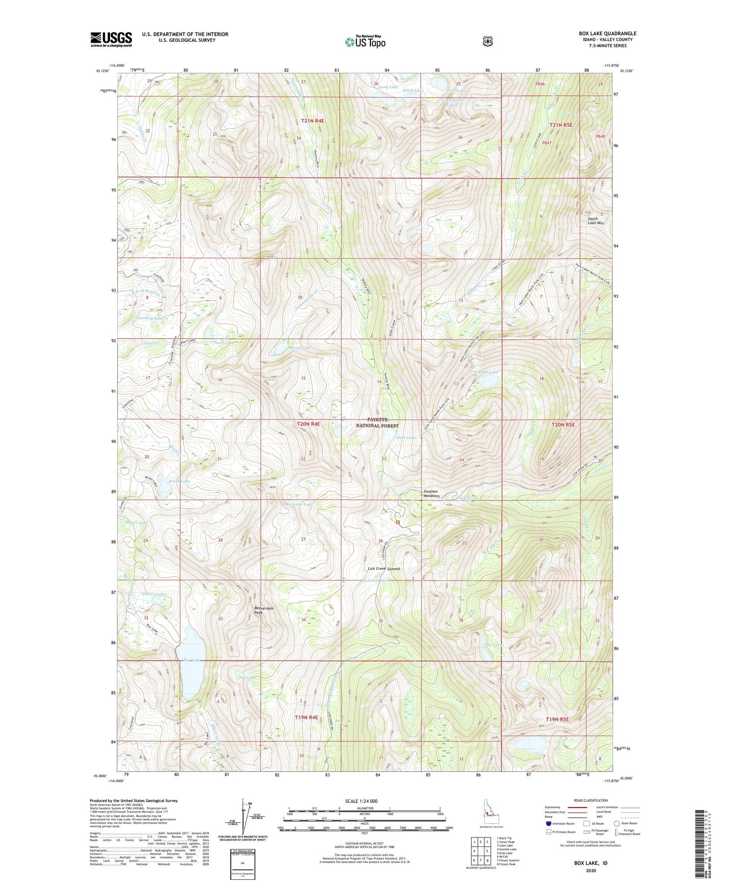
Box Lake Idaho US Topo Map
Couldn't load pickup availability
Also explore the Box Lake Forest Service Topo of this same quad for updated USFS data
2024 topographic map quadrangle Box Lake in the state of Idaho. Scale: 1:24000. Based on the newly updated USGS 7.5' US Topo map series, this map is in the following counties: Valley. The map contains contour data, water features, and other items you are used to seeing on USGS maps, but also has updated roads and other features. This is the next generation of topographic maps. Printed on high-quality waterproof paper with UV fade-resistant inks.
Quads adjacent to this one:
West: Granite Lake
Northwest: Black Tip
North: Victor Peak
Northeast: Loon Lake
East: Enos Lake
Southeast: Fitsum Peak
South: Fitsum Summit
Southwest: McCall
This map covers the same area as the classic USGS quad with code o45115a8.
Contains the following named places: Beaverdam Peak, Box Lake, Box Lake Dam, Box Lake Trail, Brush Lake, Burnside Lake, Cly Creek, Cly Lakes, Crestline Trail, Duck Lake, East Lake, Foolhen Meadows, Heart Lake, Hum Creek, Hum Lake, Lick Creek Summit, Long Lake, Marge Lake, North Lake, Pearl Lake, Pot Lake, Sisters Lakes, South Lake, South Loon Mountain, Summit Lake, Teardrop Lake, Thirtythree Lake, Tsum Creek, Twentymile Lakes, ZIP Code: 83638