MyTopo
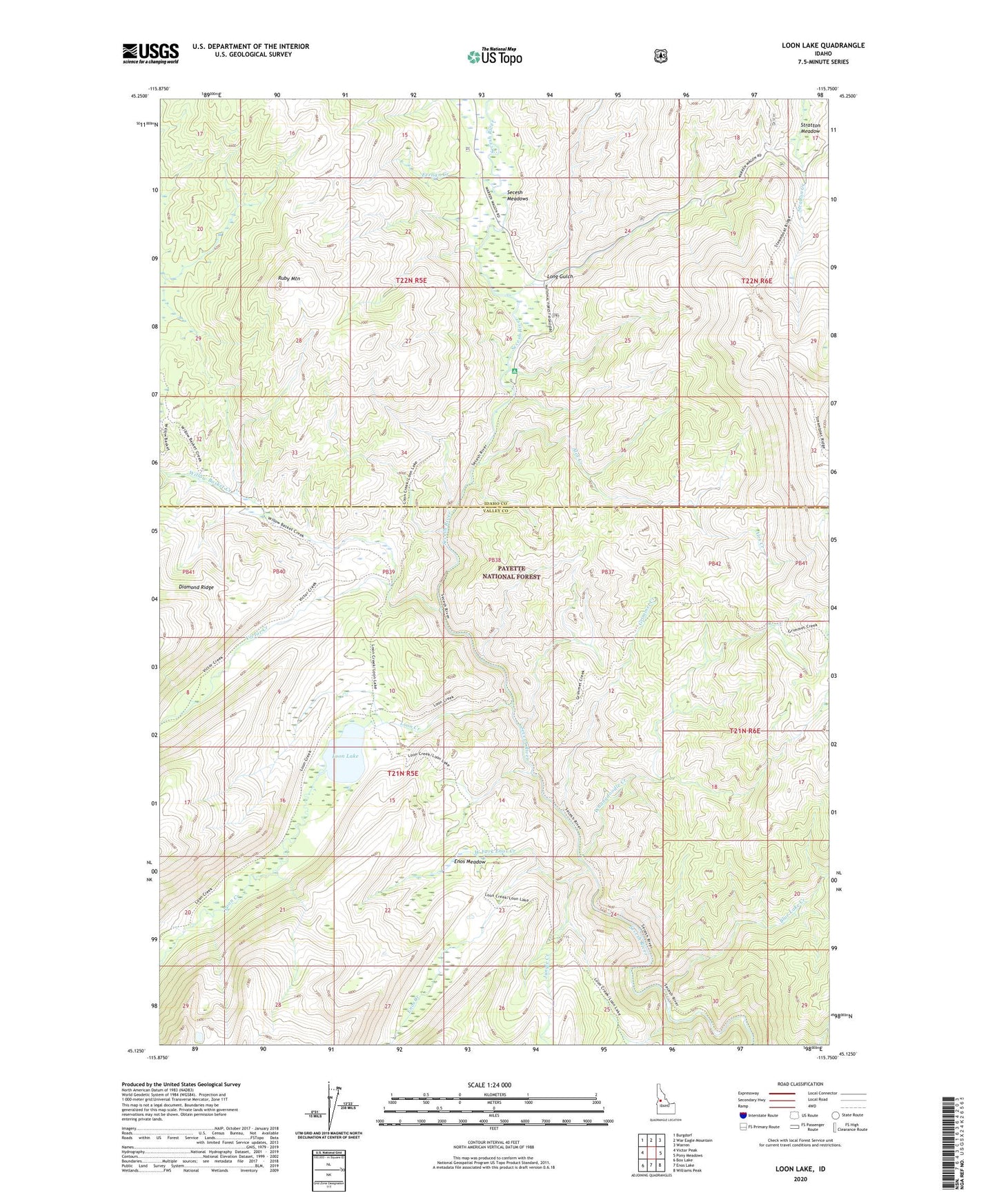
Loon Lake Idaho US Topo Map
Couldn't load pickup availability
Also explore the Loon Lake Forest Service Topo of this same quad for updated USFS data
2024 topographic map quadrangle Loon Lake in the state of Idaho. Scale: 1:24000. Based on the newly updated USGS 7.5' US Topo map series, this map is in the following counties: Valley, Idaho. The map contains contour data, water features, and other items you are used to seeing on USGS maps, but also has updated roads and other features. This is the next generation of topographic maps. Printed on high-quality waterproof paper with UV fade-resistant inks.
Quads adjacent to this one:
West: Victor Peak
Northwest: Burgdorf
North: War Eagle Mountain
Northeast: Warren
East: Pony Meadows
Southeast: Williams Peak
South: Enos Lake
Southwest: Box Lake
This map covers the same area as the classic USGS quad with code o45115b7.
Contains the following named places: Alex Creek, Blue Lake Creek, Chinook Campground, Enos Creek, Enos Meadow, Fernan Creek, Grimmet Creek, Jungle Creek, Long Gulch, Loon Creek, Loon Lake, Ruby Mountain, Secesh Meadows, Stratton Meadow, Victor Creek, West Fork Enos Creek, Whangdoodle Creek, Willow Basket Creek