
MyTopo
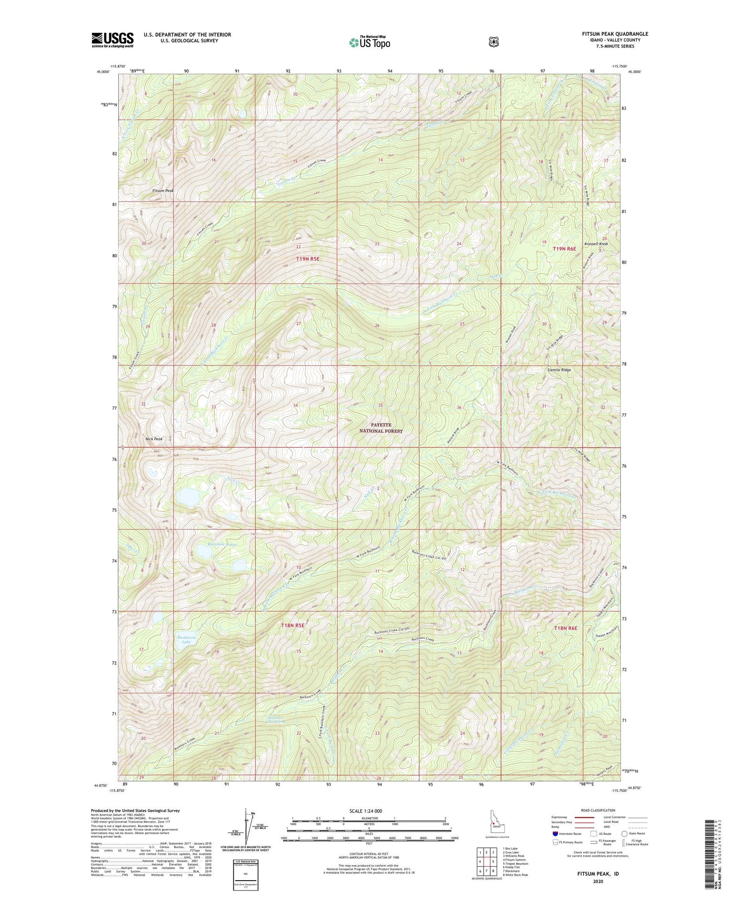
Fitsum Peak Idaho US Topo Map
Couldn't load pickup availability
Also explore the Fitsum Peak Forest Service Topo of this same quad for updated USFS data
2024 topographic map quadrangle Fitsum Peak in the state of Idaho. Scale: 1:24000. Based on the newly updated USGS 7.5' US Topo map series, this map is in the following counties: Valley. The map contains contour data, water features, and other items you are used to seeing on USGS maps, but also has updated roads and other features. This is the next generation of topographic maps. Printed on high-quality waterproof paper with UV fade-resistant inks.
Quads adjacent to this one:
West: Fitsum Summit
Northwest: Box Lake
North: Enos Lake
Northeast: Williams Peak
East: Teapot Mountain
Southeast: White Rock Peak
South: Blackmare
Southwest: Paddy Flat
This map covers the same area as the classic USGS quad with code o44115h7.
Contains the following named places: Buckhorn Hot Spring, Buckhorn Lake, Fitsum Peak, Homedale Creek, Krassell Knob, Little Buckhorn Creek, Nick Creek, Nick Peak, North Fork Buckhorn Creek, Rainbow Lakes, Sixmile Ridge, South Fork Buckhorn Creek, South Fork Fitsum Creek, Wee Creek


