MyTopo
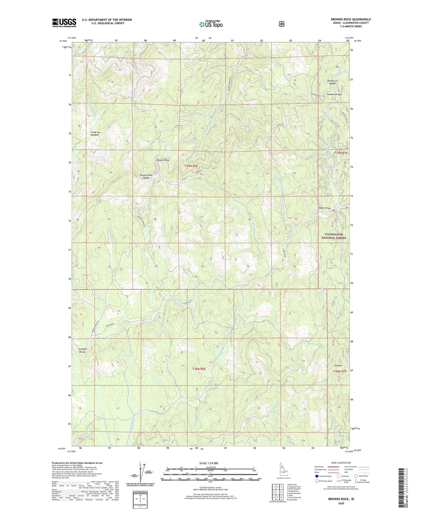
Browns Rock Idaho US Topo Map
Couldn't load pickup availability
Also explore the Browns Rock Forest Service Topo of this same quad for updated USFS data
2024 topographic map quadrangle Browns Rock in the state of Idaho. Scale: 1:24000. Based on the newly updated USGS 7.5' US Topo map series, this map is in the following counties: Clearwater. The map contains contour data, water features, and other items you are used to seeing on USGS maps, but also has updated roads and other features. This is the next generation of topographic maps. Printed on high-quality waterproof paper with UV fade-resistant inks.
Quads adjacent to this one:
West: Headquarters
Northwest: Bertha Hill
North: Thompson Point
Northeast: Sheep Mountain
East: Clarke Mountain
Southeast: Larch Butte
South: French Mountain
Southwest: Jaype
This map covers the same area as the classic USGS quad with code o46115f6.
Contains the following named places: Bertha Creek, Bradbury Creek, Browns Rock, Browns Rock Saddle, Bush Creek, Camp Sixty, Camp Ten Meadow, Clearwater County, Deadhorse Mountain, Deadhorse Saddle, Elk Mountain Lookout, Flannery Creek, Flume Creek, Kinney Creek, Lodge Creek, Middleton Creek, Moose Creek, Old Camp 10, Old Camp 11, Otter Creek, Rettig Creek, Scofield Creek, Scofield Divide, Tepee Creek, Trapper Creek, Washington Cabin, Water Draw