MyTopo
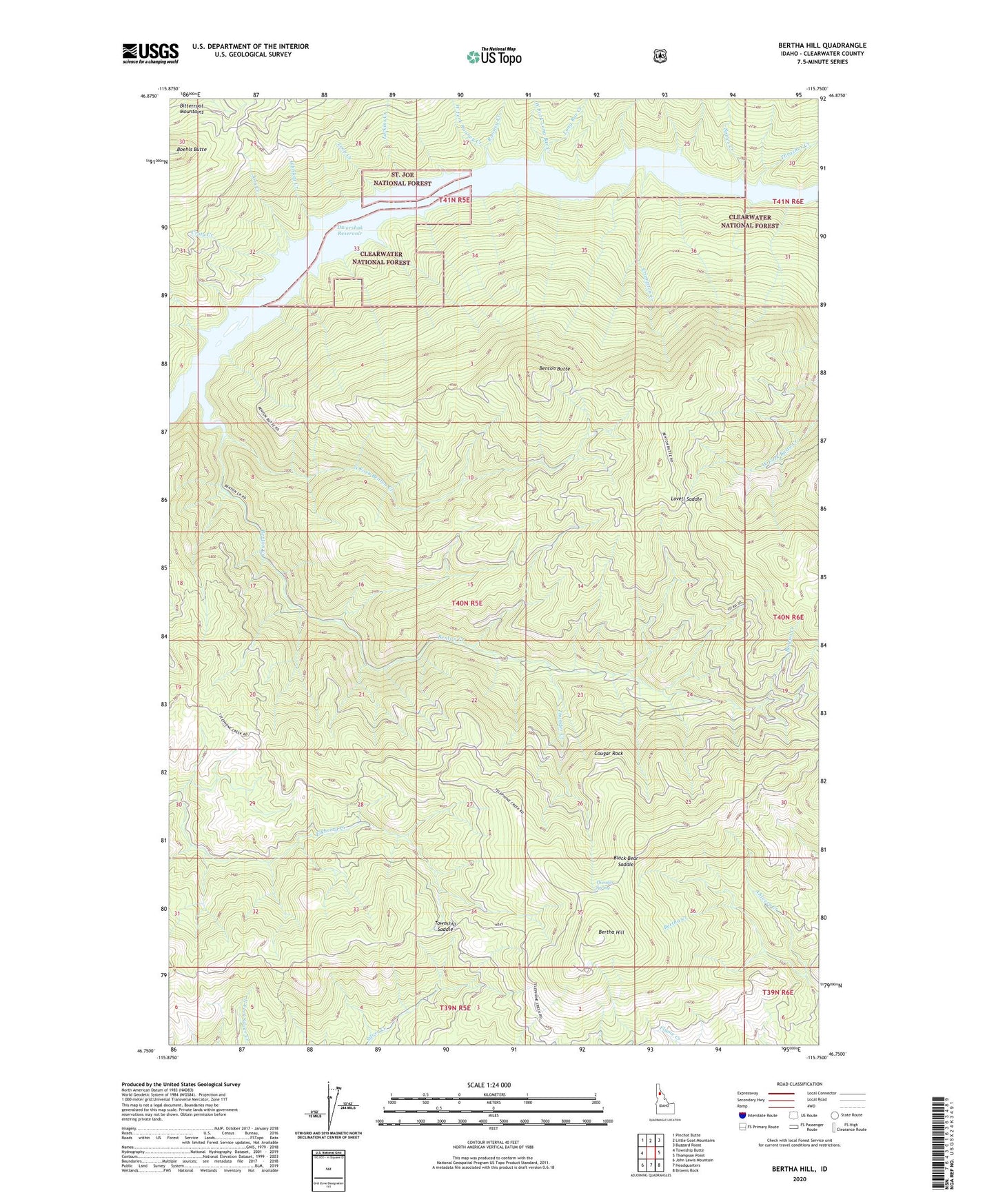
Bertha Hill Idaho US Topo Map
Couldn't load pickup availability
Also explore the Bertha Hill Forest Service Topo of this same quad for updated USFS data
2024 topographic map quadrangle Bertha Hill in the state of Idaho. Scale: 1:24000. Based on the newly updated USGS 7.5' US Topo map series, this map is in the following counties: Clearwater. The map contains contour data, water features, and other items you are used to seeing on USGS maps, but also has updated roads and other features. This is the next generation of topographic maps. Printed on high-quality waterproof paper with UV fade-resistant inks.
Quads adjacent to this one:
West: Township Butte
Northwest: Pinchot Butte
North: Little Goat Mountains
Northeast: Buzzard Roost
East: Thompson Point
Southeast: Browns Rock
South: Headquarters
Southwest: John Lewis Mountain
This map covers the same area as the classic USGS quad with code o46115g7.
Contains the following named places: Ahlvers Creek, Benton Butte, Benton Creek, Bertha Hill, Black Bear Saddle, Boehls Butte, Carson Cabin, Cougar Rock, Crampton Creek, Croty Creek, Joes Creek, Larkins Cabin, Larkins Creek, Larson Bar Landing Area, Larson Cabin, Long Bar Creek, Loop Creek, Lovell Saddle, North Fork Benton Creek, Rooney Creek, Spires Creek, Thrasher Creek, Thunder Creek, Thunder Spring, Township Saddle, West Fork Long Bar Creek, West Fork Rooney Creek, Whiskey Creek