MyTopo
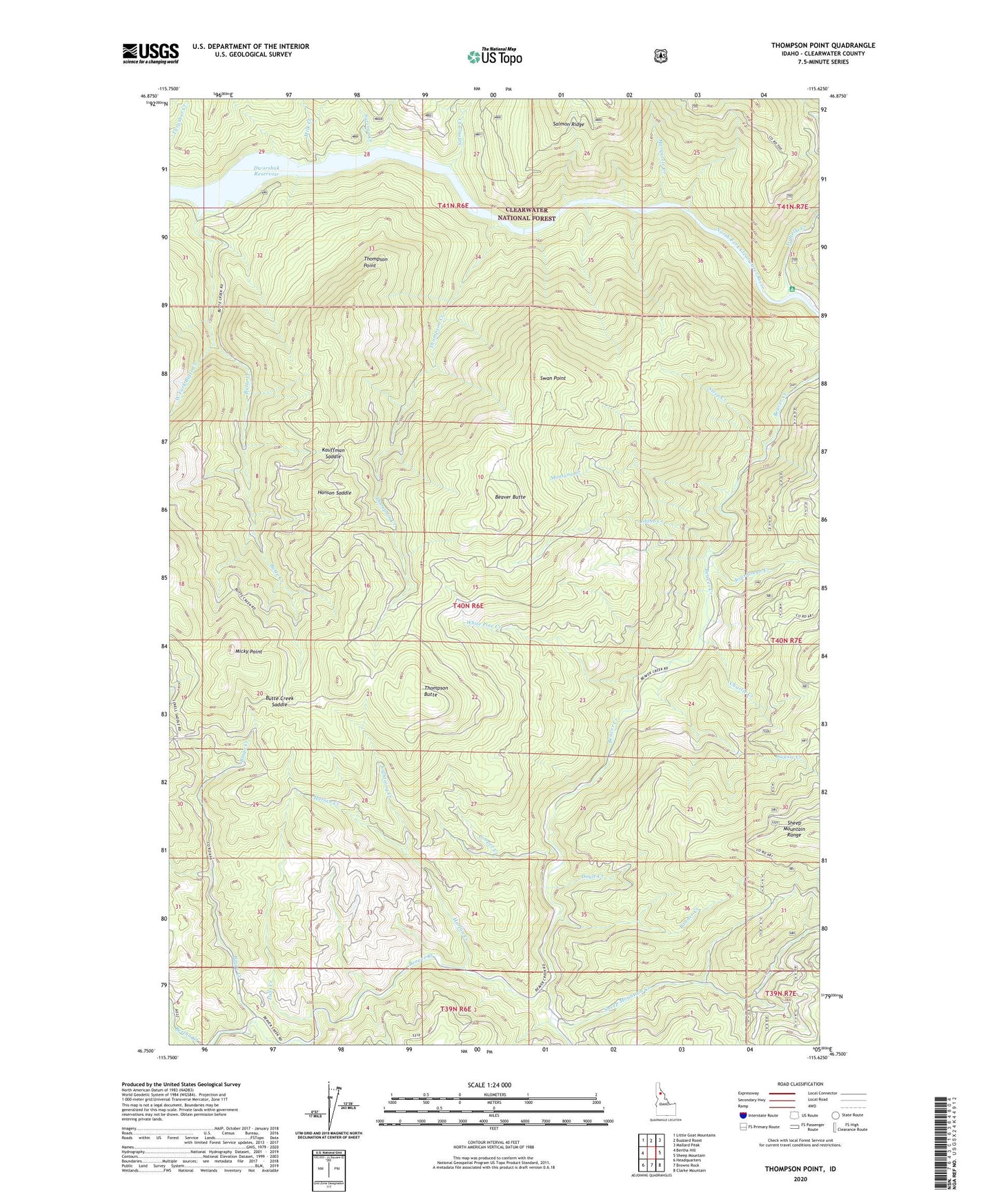
Thompson Point Idaho US Topo Map
Couldn't load pickup availability
Also explore the Thompson Point Forest Service Topo of this same quad for updated USFS data
2024 topographic map quadrangle Thompson Point in the state of Idaho. Scale: 1:24000. Based on the newly updated USGS 7.5' US Topo map series, this map is in the following counties: Clearwater. The map contains contour data, water features, and other items you are used to seeing on USGS maps, but also has updated roads and other features. This is the next generation of topographic maps. Printed on high-quality waterproof paper with UV fade-resistant inks.
Quads adjacent to this one:
West: Bertha Hill
Northwest: Little Goat Mountains
North: Buzzard Roost
Northeast: Mallard Peak
East: Sheep Mountain
Southeast: Clarke Mountain
South: Browns Rock
Southwest: Headquarters
This map covers the same area as the classic USGS quad with code o46115g6.
Contains the following named places: Beaver Butte, Bingo Creek, Bingo Creek Landing, Bingo Saddle, Bonner Creek, Butte Creek, Butte Creek Landing, Butte Creek Saddle, Camp, Charlie Creek, Cooper Creek, Doyle Creek, East Fork Beaver Creek, Falls Creek, Hanson Saddle, Harlan Creek, Idaho Creek, Isabella Creek, Isabella Landing, Kauffman Saddle, Lightning Creek, Marquette Creek, Micky Point, Milk Creek, Montana Creek, Old Camp J, Salmon Creek, Sheep Mountain Creek, Sourdough Creek, Sousie Creek, Sousie Creek Campground, Steep Creek, Swan Point, Syringa Creek, Thompson Butte, Thompson Creek, Thompson Point, West Fork Butte Creek, White Pine Creek