MyTopo
Buckhorn Idaho US Topo Map
Couldn't load pickup availability
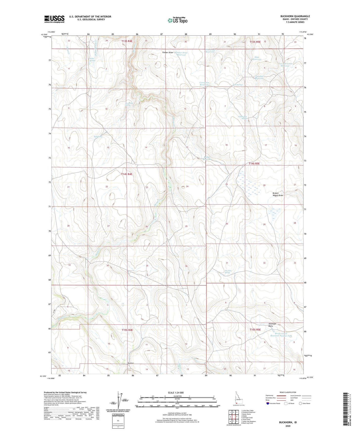
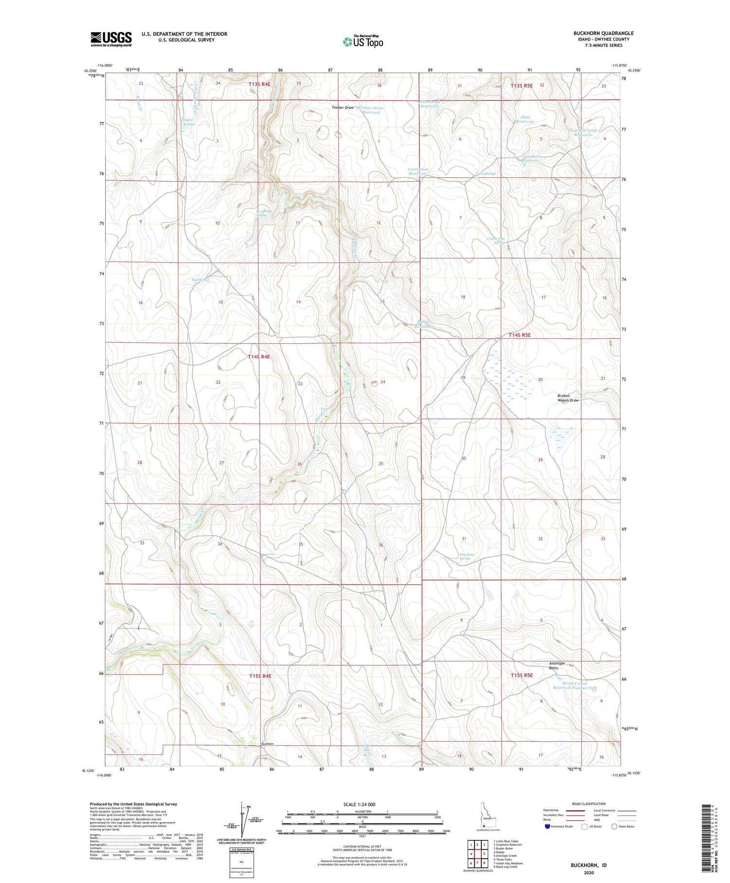
2023 topographic map quadrangle Buckhorn in the state of Idaho. Scale: 1:24000. Based on the newly updated USGS 7.5' US Topo map series, this map is in the following counties: Owyhee. The map contains contour data, water features, and other items you are used to seeing on USGS maps, but also has updated roads and other features. This is the next generation of topographic maps. Printed on high-quality waterproof paper with UV fade-resistant inks.
Quads adjacent to this one:
West: Riddle
Northwest: Little Blue Table
North: Grasmere Reservoir
Northeast: Buster Butte
East: Antelope Creek
Southeast: Black Leg Creek
South: Indian Hay Meadows
Southwest: Three Forks
This map covers the same area as the classic USGS quad with code o42115b8.
Contains the following named places: Antelope Basin, Badger Reservoir, Bitterbrush Reservoir, Brush Corral Reservoir Number Two, Buckhorn, Buckhorn Corrals, Bull Creek Crossing, Bull Spring, Cavannah Spring, Cinnabar Reservoir, Correction Reservoir, Coyote Pup Spring, Dickens Place, Dry Hole Spring, Frost Place, Harris Lake, Heifer Springs, Slate Reservoir, Timber Draw Reservoir, Tindall Reservoir, Twin Springs, Two Mile Limit Reservoir