MyTopo
Riddle Idaho US Topo Map
Couldn't load pickup availability
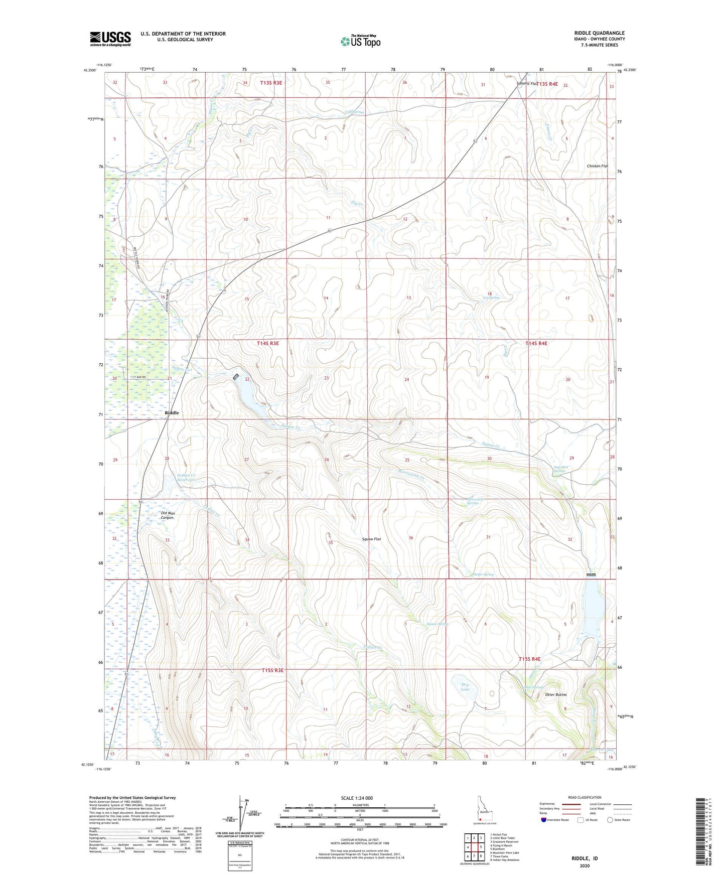
2023 topographic map quadrangle Riddle in the state of Idaho. Scale: 1:24000. Based on the newly updated USGS 7.5' US Topo map series, this map is in the following counties: Owyhee. The map contains contour data, water features, and other items you are used to seeing on USGS maps, but also has updated roads and other features. This is the next generation of topographic maps. Printed on high-quality waterproof paper with UV fade-resistant inks.
Quads adjacent to this one:
West: Flying H Ranch
Northwest: Nichol Flat
North: Little Blue Table
Northeast: Grasmere Reservoir
East: Buckhorn
Southeast: Indian Hay Meadows
South: Three Forks
Southwest: Mountain View Lake
This map covers the same area as the classic USGS quad with code o42116b1.
Contains the following named places: Alder Dam, Cat Spring, Chicken Flat, Cold Springs, Dry Creek, Dry Lake, Harris Lake, Heifer Spring, Indian Creek, Indian Creek Reservoir, Moorcastle Creek, Moorcastle Springs, Old Man Canyon, Otter Buttes, Otter Creek, Otter Reservoir, Otter Springs, Pig Creek, Riddle, Riddle Airport, Sage Hen Springs, Squaw Creek Dam, Squaw Creek Reservoir, Squaw Flat, Squaw Spring, Summit Flat