MyTopo
Indian Hay Meadows Idaho US Topo Map
Couldn't load pickup availability
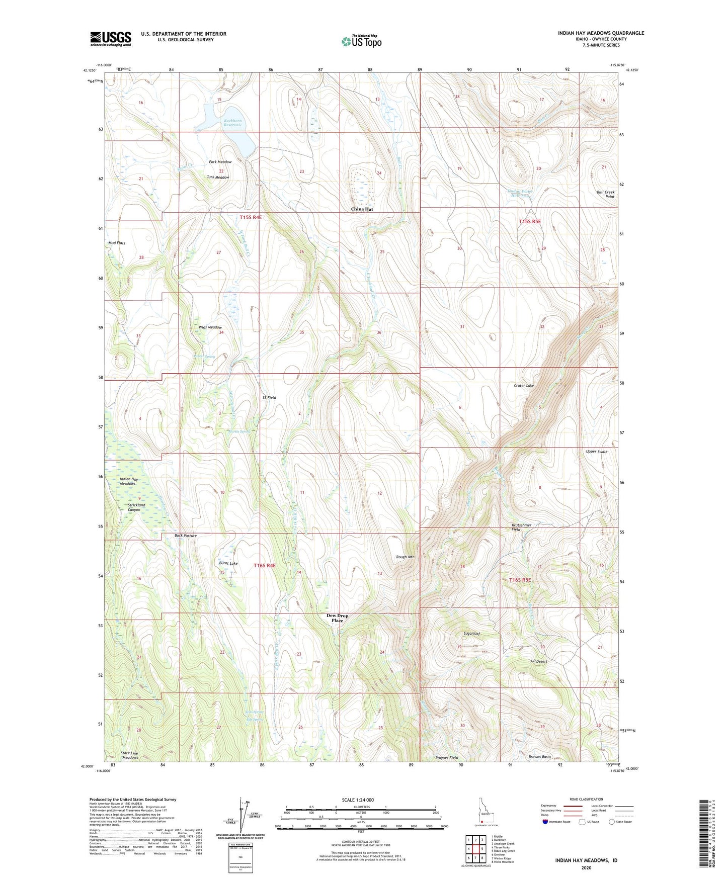
2023 topographic map quadrangle Indian Hay Meadows in the state of Idaho. Scale: 1:24000. Based on the newly updated USGS 7.5' US Topo map series, this map is in the following counties: Owyhee. The map contains contour data, water features, and other items you are used to seeing on USGS maps, but also has updated roads and other features. This is the next generation of topographic maps. Printed on high-quality waterproof paper with UV fade-resistant inks.
Quads adjacent to this one:
West: Three Forks
Northwest: Riddle
North: Buckhorn
Northeast: Antelope Creek
East: Black Leg Creek
Southeast: Hicks Mountain
South: Winter Ridge
Southwest: Owyhee
This map covers the same area as the classic USGS quad with code o42115a8.
Contains the following named places: Browns Basin, Brush Creek, Buck Pasture, Buckhorn Reservoir, Bull Creek Point, Bull Creek Reservoir, Burnt Lake, China Hat, Crater Lake, Dew Drop Place, East Fork Bull Creek, Eds Spring, Fork Meadow, Goat Pens, Indian Hay Meadows, Johnstons Camp, Katies Desert Place, Krutschmer Field, Martin Spring, Mud Flats, Parker Place, Parker Spring, Ratliff Place, Rough Mountain, Scarborough Waterhole, Snow Creek, Snow Creek Dam, SS Field, State Line Meadows, Strickland Canyon, Sugarloaf, Tate Place, Teds Spring, Tindall Dam, Tindall Water Hole Two, Turk Meadow, Twenty-Two Bar Desert Place, Wagner Field, West Fork Bull Creek, Wids Meadow