MyTopo
Buhl Idaho US Topo Map
Couldn't load pickup availability
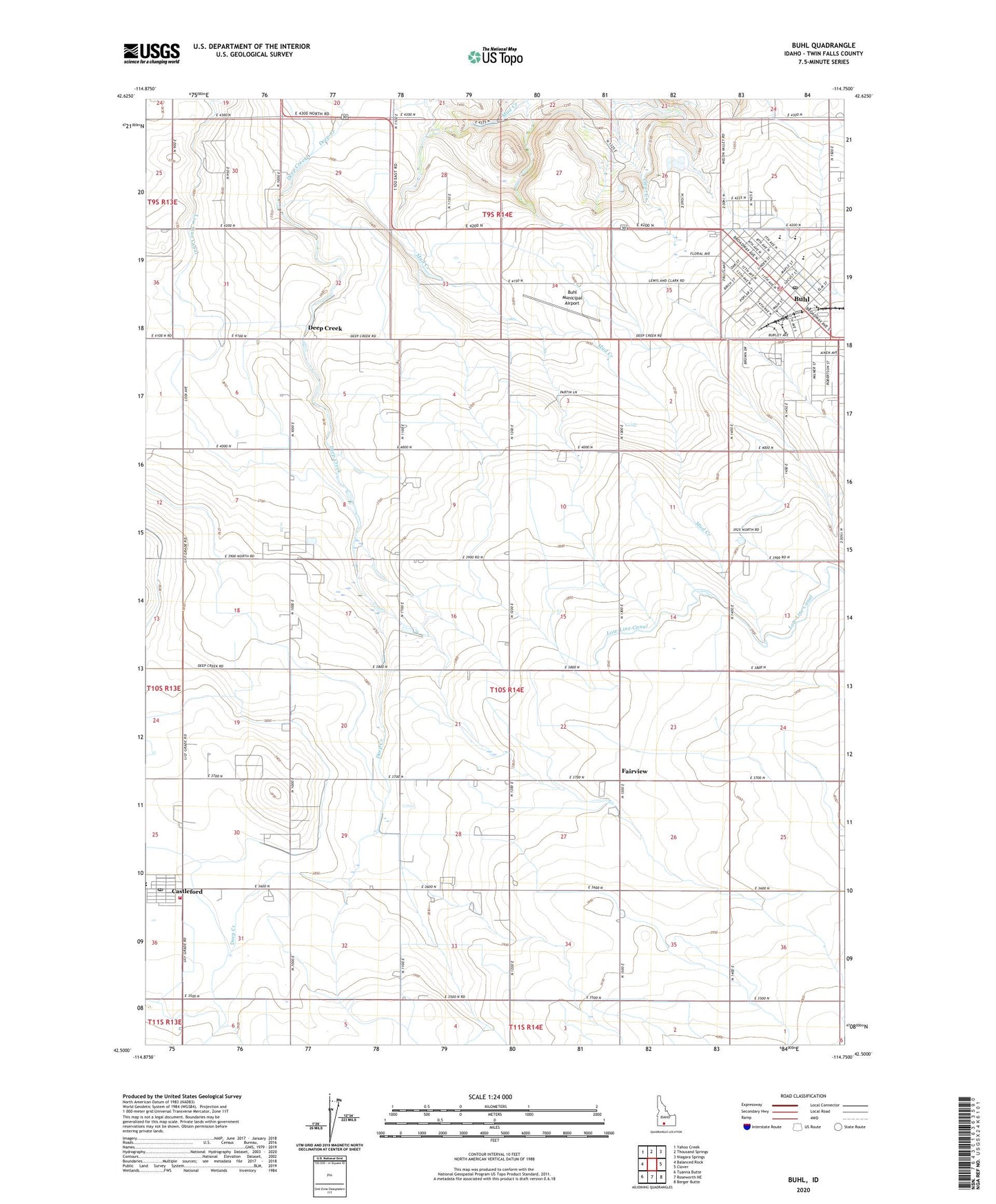
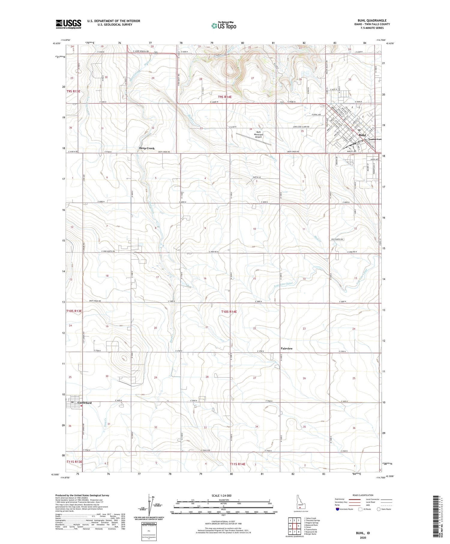
2023 topographic map quadrangle Buhl in the state of Idaho. Scale: 1:24000. Based on the newly updated USGS 7.5' US Topo map series, this map is in the following counties: Twin Falls. The map contains contour data, water features, and other items you are used to seeing on USGS maps, but also has updated roads and other features. This is the next generation of topographic maps. Printed on high-quality waterproof paper with UV fade-resistant inks.
Quads adjacent to this one:
West: Balanced Rock
Northwest: Yahoo Creek
North: Thousand Springs
Northeast: Niagara Springs
East: Clover
Southeast: Berger Butte
South: Roseworth NE
Southwest: Tuanna Butte
This map covers the same area as the classic USGS quad with code o42114e7.
Contains the following named places: Avelar's Dairy, Bokma Dairy, Buhl, Buhl City Hall, Buhl City Police Department, Buhl Division, Buhl Fire Department Station 1, Buhl High School, Buhl Library, Buhl Middle School, Buhl Municipal Airport, Buhl Post Office, Buhl School, Castleford, Castleford City Hall, Castleford Fire District, Castleford Post Office, Castleford School, Castleford Senior High School, City of Buhl, City of Castleford, Deep Creek, Devries Dairy, Diamond H Dairy, Eastman Park, Fairview, Fairview Dairy, Heritage Farms, Lincoln School, Lucerne Grange, Mid Valley Dairy, Pax Dairy Farm, Popplewell Elementary School, Rock Ridge Dairy, Saint Johns School, Schilder Dairy, Silva Dairy, Superior School, Triple J Dairy