MyTopo
Niagara Springs Idaho US Topo Map
Couldn't load pickup availability
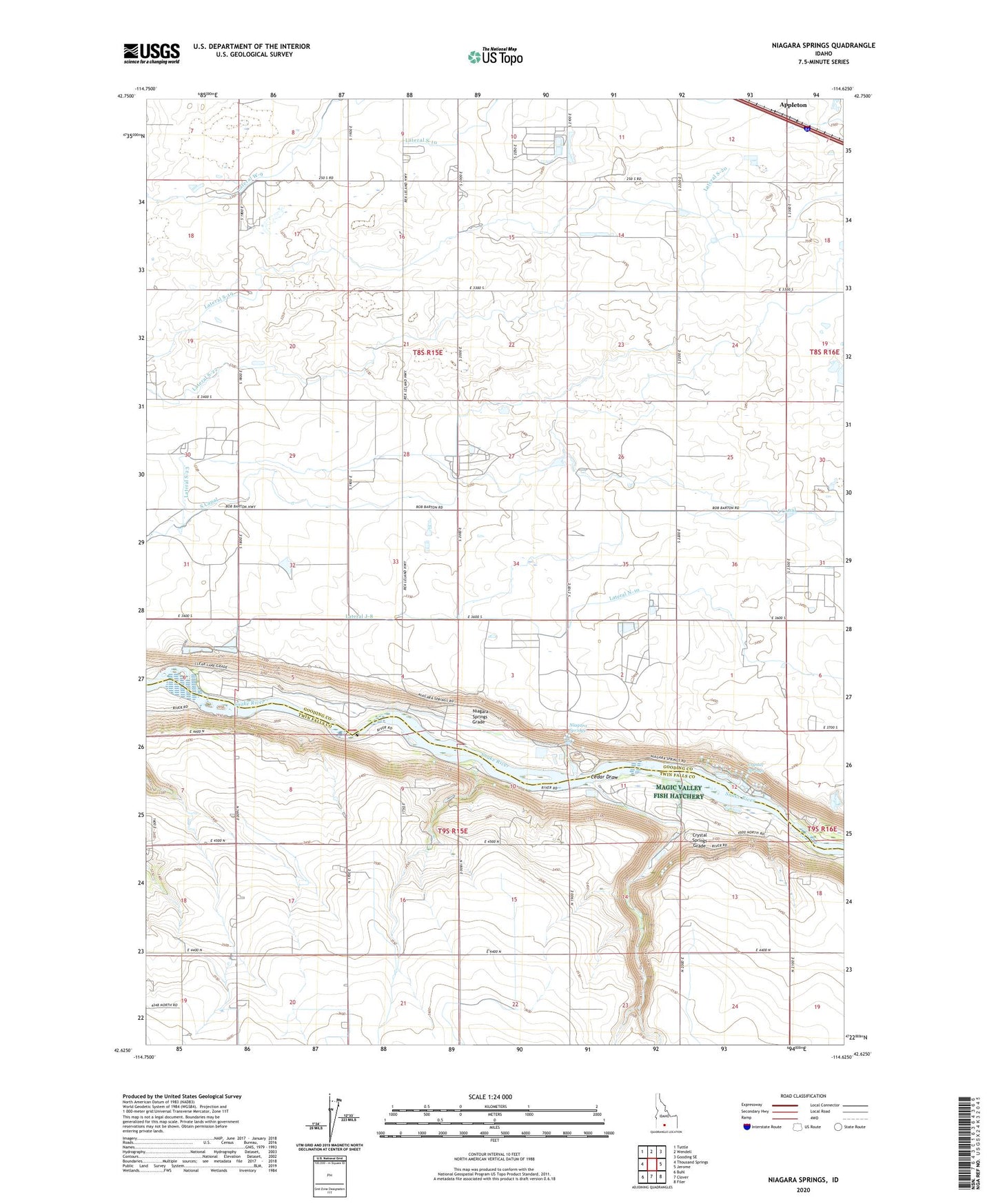
2023 topographic map quadrangle Niagara Springs in the state of Idaho. Scale: 1:24000. Based on the newly updated USGS 7.5' US Topo map series, this map is in the following counties: Gooding, Twin Falls. The map contains contour data, water features, and other items you are used to seeing on USGS maps, but also has updated roads and other features. This is the next generation of topographic maps. Printed on high-quality waterproof paper with UV fade-resistant inks.
Quads adjacent to this one:
West: Thousand Springs
Northwest: Tuttle
North: Wendell
Northeast: Gooding SE
East: Jerome
Southeast: Filer
South: Clover
Southwest: Buhl
This map covers the same area as the classic USGS quad with code o42114f6.
Contains the following named places: Appleton, Appleton Siding, Cedar Draw, Cedar Draw School, Crystal Springs, Crystal Springs Grade, Idaho Power Company Steelhead Trout Hatchery, J-11 Pipeline, Lateral J-8, Lateral N-10, Lateral N-23, Lateral S-10, Lateral S-20, Lateral S-23, Lateral S-25, Lateral S-8, Magic Valley National Fish Hatchery, Niagara Springs, Niagara Springs Grade, Niagara Springs Hatchery, Niagara Springs Wildlife Management Area, Northview Grange, Orchard Valley School, Waste Ditch