MyTopo
Bull Basin Camp Idaho US Topo Map
Couldn't load pickup availability
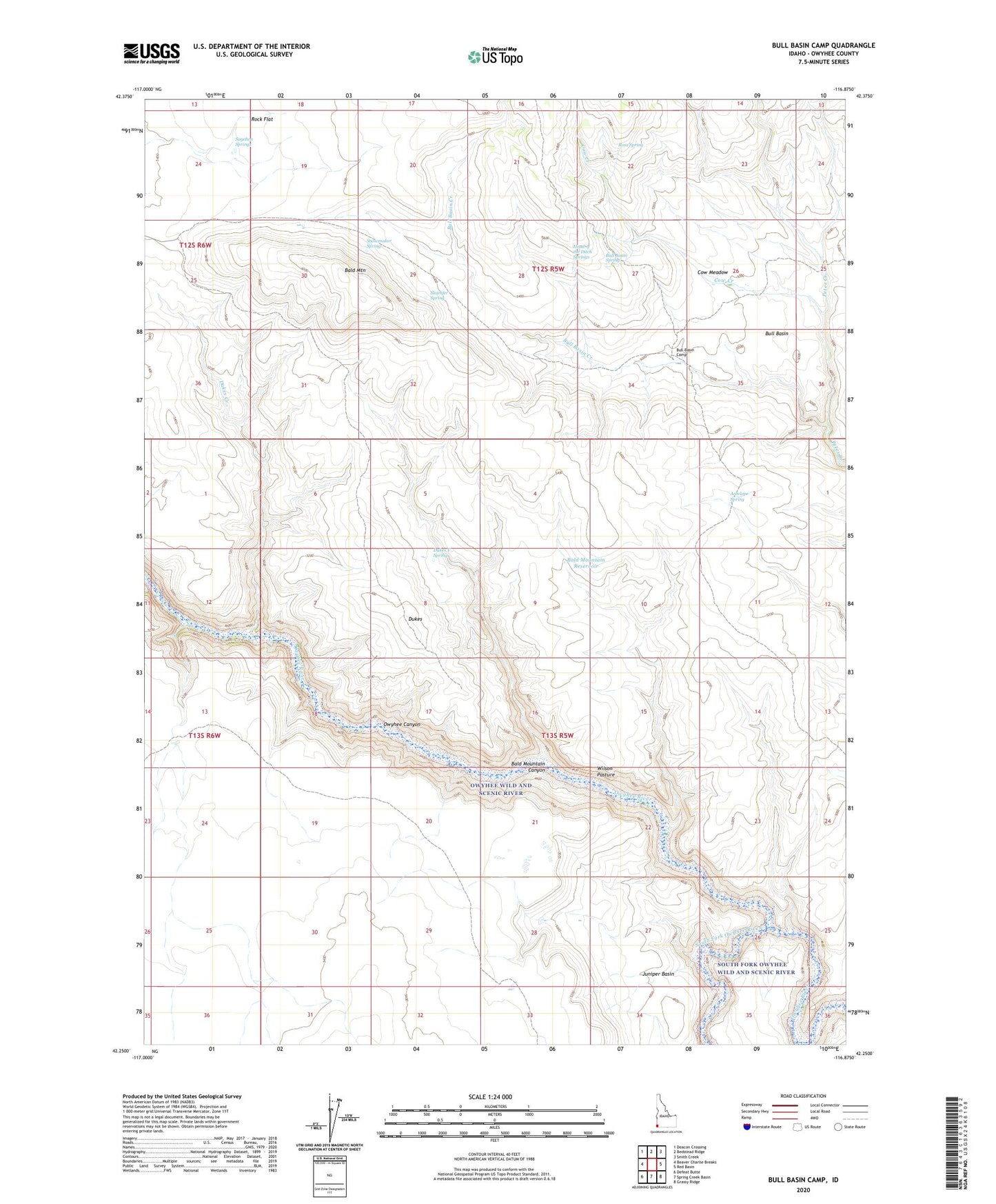
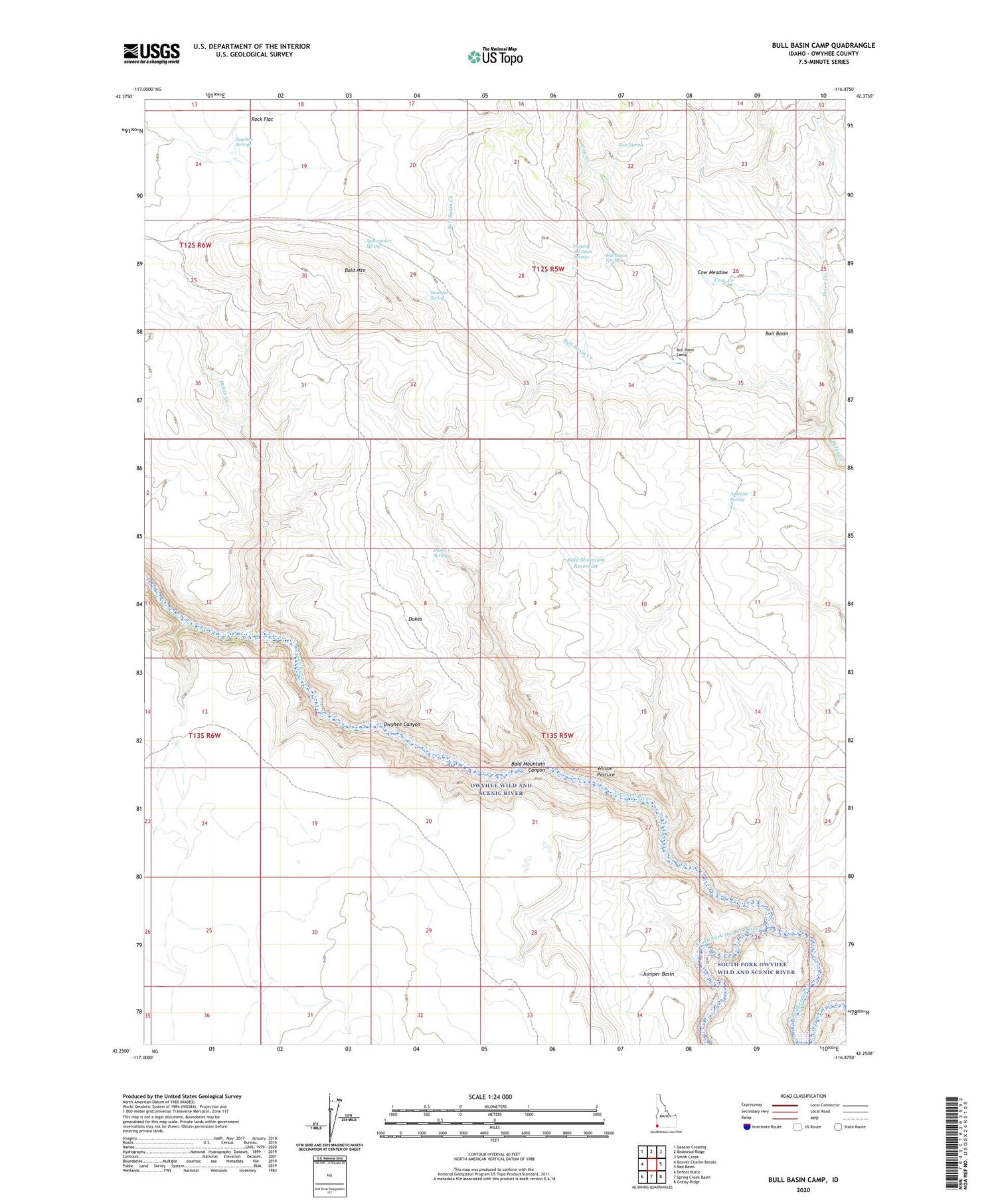
2023 topographic map quadrangle Bull Basin Camp in the state of Idaho. Scale: 1:24000. Based on the newly updated USGS 7.5' US Topo map series, this map is in the following counties: Owyhee. The map contains contour data, water features, and other items you are used to seeing on USGS maps, but also has updated roads and other features. This is the next generation of topographic maps. Printed on high-quality waterproof paper with UV fade-resistant inks.
Quads adjacent to this one:
West: Beaver Charlie Breaks
Northwest: Deacon Crossing
North: Bedstead Ridge
Northeast: Smith Creek
East: Red Basin
Southeast: Grassy Ridge
South: Spring Creek Basin
Southwest: Defeat Butte
This map covers the same area as the classic USGS quad with code o42116c8.
Contains the following named places: Antelope Spring, Bald Mountain, Bald Mountain Canyon, Bald Mountain Reservoir, Bull Basin, Bull Basin Camp, Bull Basin Creek, Bull Basin Spring, Cow Creek, Cow Meadow, Dukes, Dukes Creek, Dukes V Spring, Head of the Ditch Springs, Juniper Basin Reservoir, Long Pull Reservoir, Rock Flat, Ross Spring, Sagehen Springs, Skamfer Spring, Snowmaker Spring, South Fork Owyhee River, Wilson Pasture