MyTopo
Deacon Crossing Oregon US Topo Map
Couldn't load pickup availability
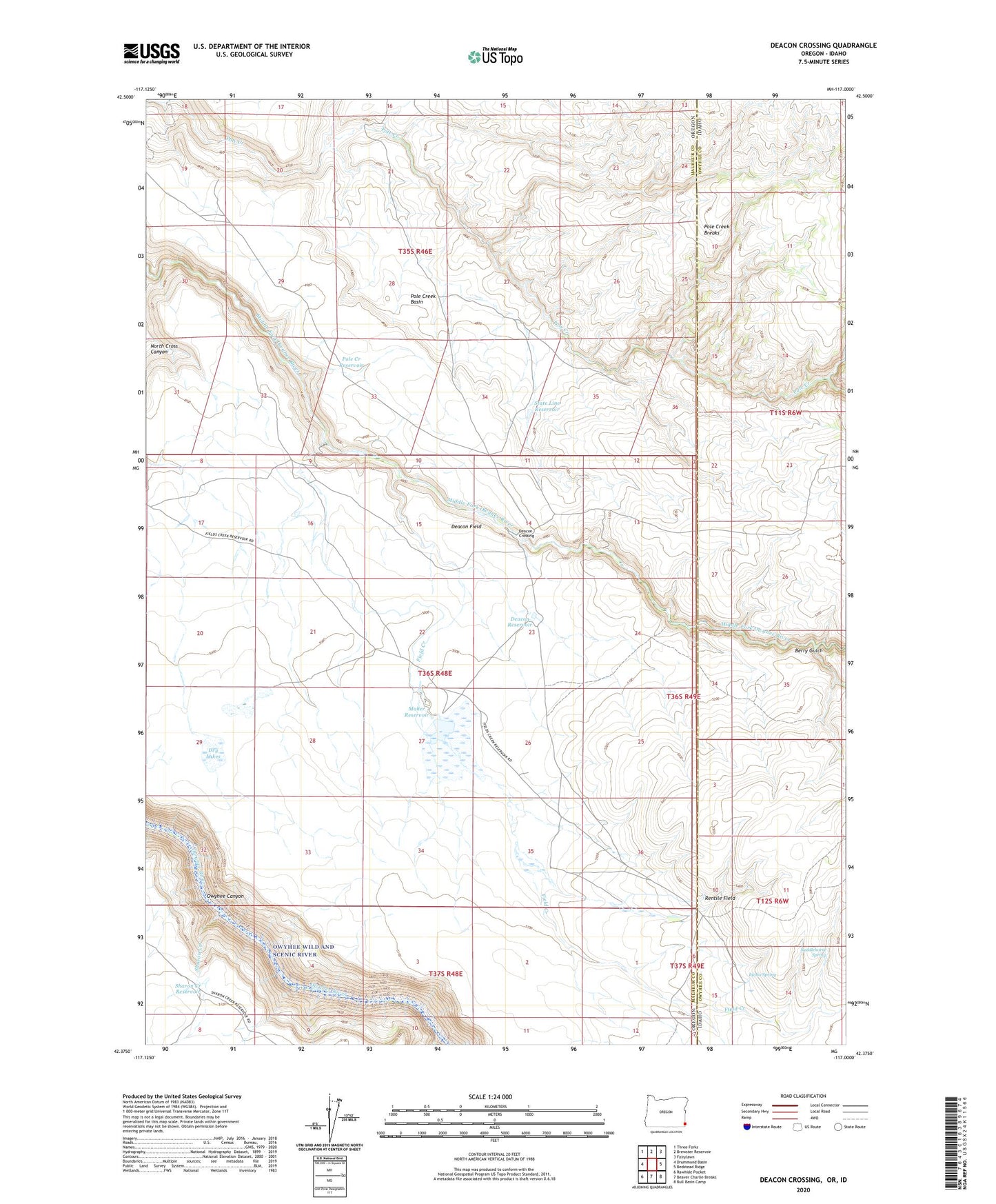
2024 topographic map quadrangle Deacon Crossing in the states of Oregon, Idaho. Scale: 1:24000. Based on the newly updated USGS 7.5' US Topo map series, this map is in the following counties: Malheur, Owyhee. The map contains contour data, water features, and other items you are used to seeing on USGS maps, but also has updated roads and other features. This is the next generation of topographic maps. Printed on high-quality waterproof paper with UV fade-resistant inks.
Quads adjacent to this one:
West: Drummond Basin
Northwest: Three Forks
North: Brewster Reservoir
Northeast: Fairylawn
East: Bedstead Ridge
Southeast: Bull Basin Camp
South: Beaver Charlie Breaks
Southwest: Rawhide Pocket
This map covers the same area as the classic USGS quad with code o42117d1.
Contains the following named places: Berry Gulch, Bull Creek, C Ranch, Deacon Crossing, Deacon Field, Deacon Reservoir, Dry Lakes, Dry Pit Lake, Field Creek, Idaho Spring, Maher Dam, Maher Reservoir, Pole Creek Basin, Pole Creek Breaks, Pole Creek Reservoir, Rentile Field, Saddlehorse Spring, Sharon Creek, Sharon Creek Reservoir, Soldier Meadows Creek, State Line Reservoir, The Difficulty, The Homestead Cabin