MyTopo
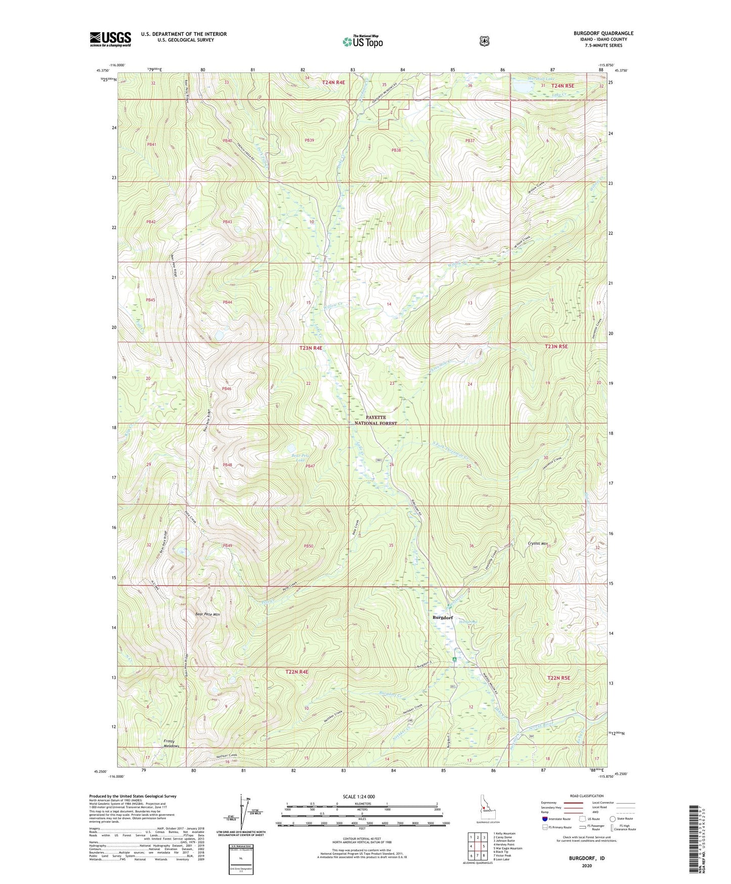
Burgdorf Idaho US Topo Map
Couldn't load pickup availability
Also explore the Burgdorf Forest Service Topo of this same quad for updated USFS data
2024 topographic map quadrangle Burgdorf in the state of Idaho. Scale: 1:24000. Based on the newly updated USGS 7.5' US Topo map series, this map is in the following counties: Idaho. The map contains contour data, water features, and other items you are used to seeing on USGS maps, but also has updated roads and other features. This is the next generation of topographic maps. Printed on high-quality waterproof paper with UV fade-resistant inks.
Quads adjacent to this one:
West: Hershey Point
Northwest: Kelly Mountain
North: Carey Dome
Northeast: Johnson Butte
East: War Eagle Mountain
Southeast: Loon Lake
South: Victor Peak
Southwest: Black Tip
This map covers the same area as the classic USGS quad with code o45115c8.
Contains the following named places: Bear Pete Lake, Bear Pete Mountain, Burgdorf, Burgdorf Campground, Burgdorf Creek, Burgdorf Guard Station, Burgdorf Post Office, Corduroy Creek, Crystal Mountain, Durden Mine, Frosty Meadows, Hot Springs, Jeanette Creek, Lake Creek, Marshall Lake, Nethker Creek, Pete Creek, Ruby Creek, South Fork Threemile Creek, Summit Creek, Threemile Creek, White Creek, Willow Creek