MyTopo
Castro Table Idaho US Topo Map
Couldn't load pickup availability
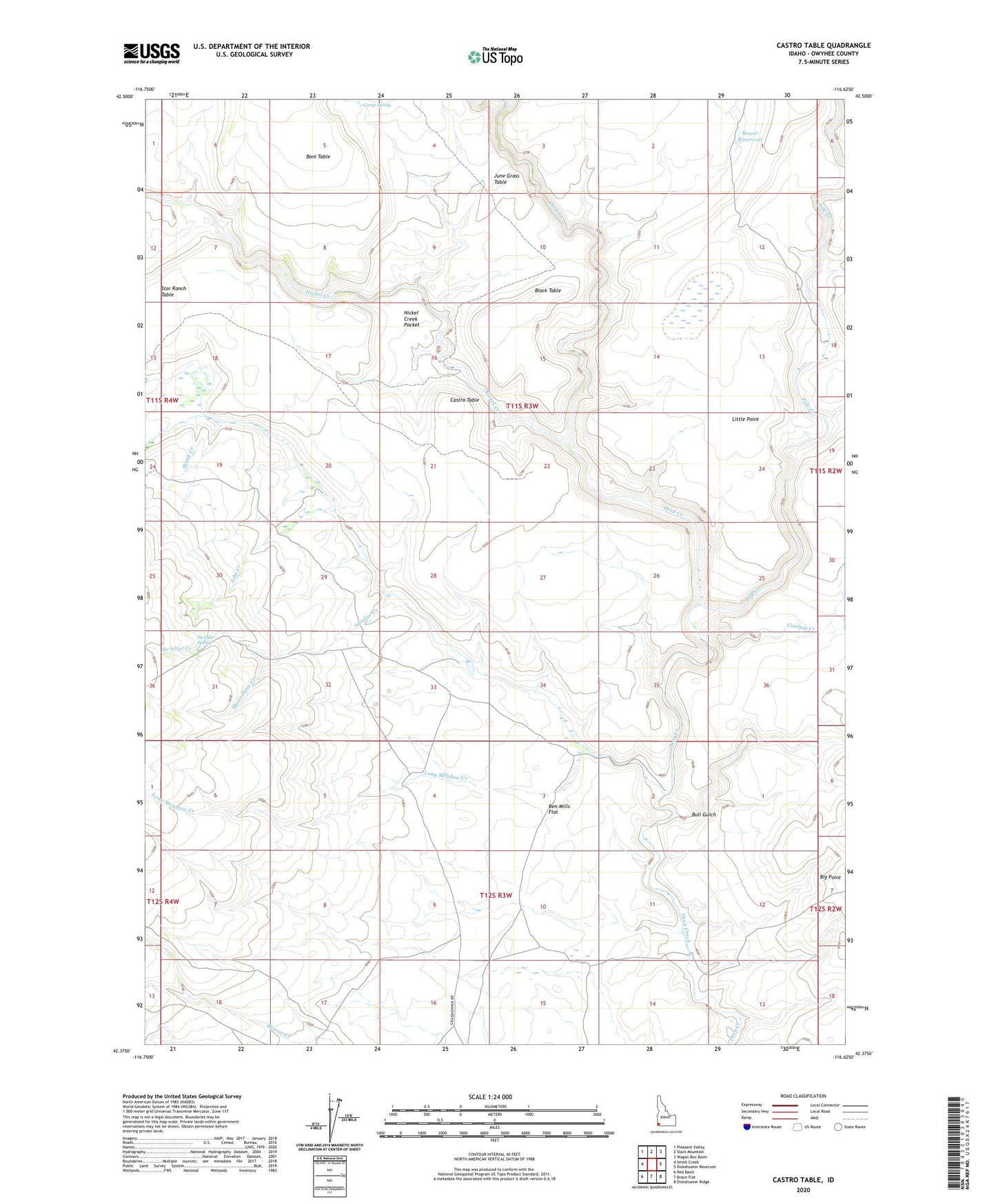
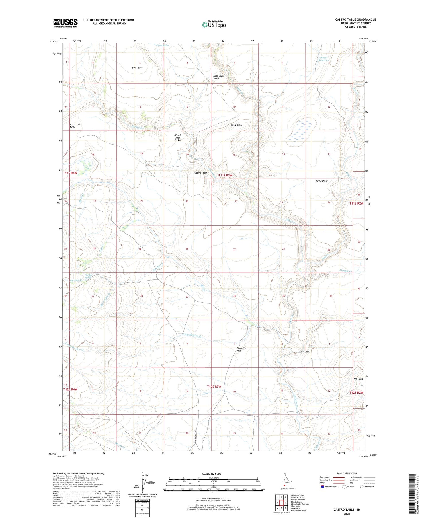
2024 topographic map quadrangle Castro Table in the state of Idaho. Scale: 1:24000. Based on the newly updated USGS 7.5' US Topo map series, this map is in the following counties: Owyhee. The map contains contour data, water features, and other items you are used to seeing on USGS maps, but also has updated roads and other features. This is the next generation of topographic maps. Printed on high-quality waterproof paper with UV fade-resistant inks.
Quads adjacent to this one:
West: Smith Creek
Northwest: Pleasant Valley
North: Slack Mountain
Northeast: Wagon Box Basin
East: Dickshooter Reservoir
Southeast: Dickshooter Ridge
South: Brace Flat
Southwest: Red Basin
This map covers the same area as the classic USGS quad with code o42116d6.
Contains the following named places: Ben Mills Flat, Black Table, Bower Reservoir, Bull Gulch, Camp Spring, Castle Creek, Castro Ranch, Castro Table, Cowboy Creek, Indian Lake, Jobe Creek, Lightning Creek, Little Point, Long Meadow Creek, Moonshine Creek, Nickel Creek, Nickel Creek Pocket, Pole Creek, Skunk Creek, Star Ranch Table, Swisher Creek, Swisher Spring