
MyTopo
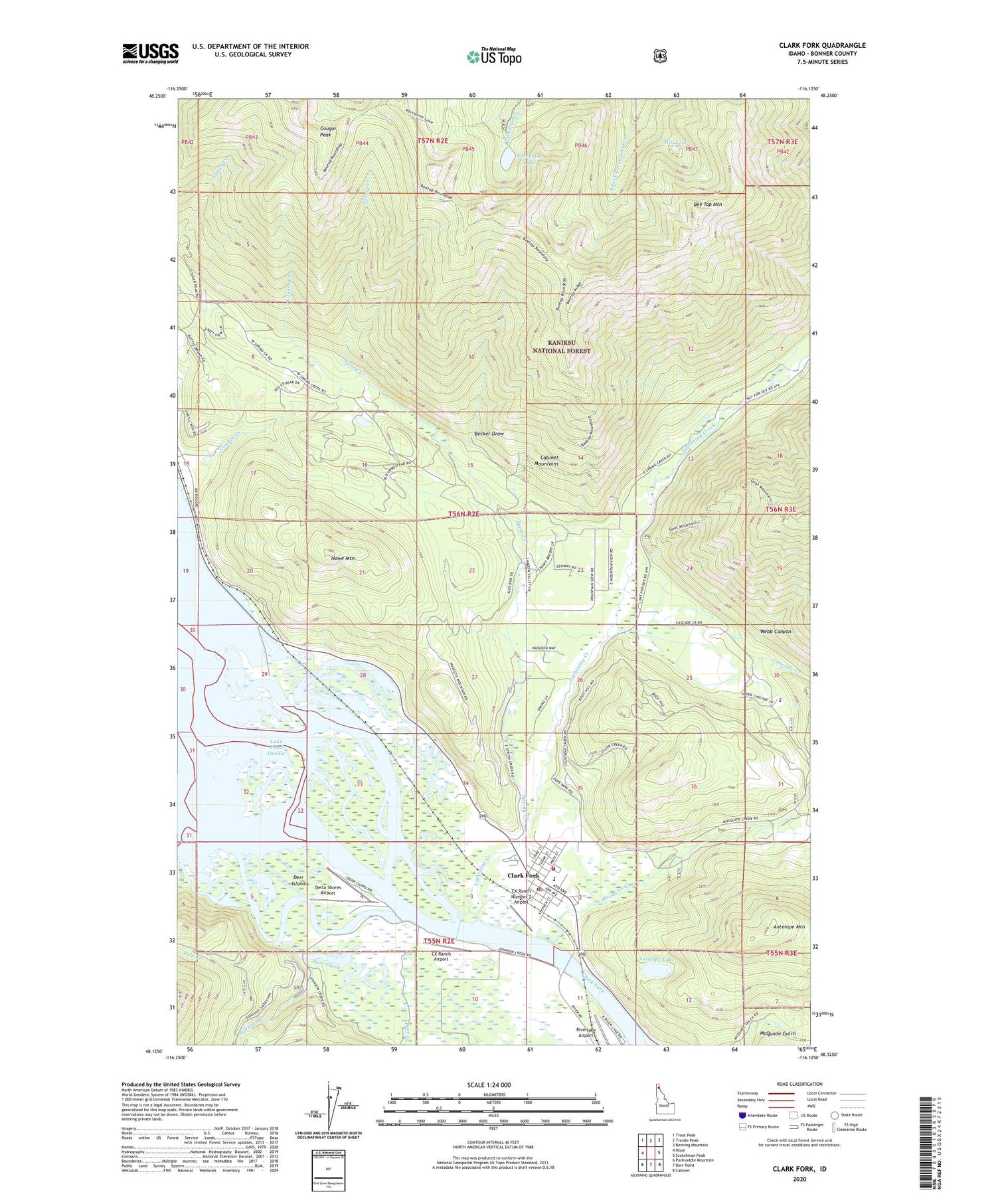
Clark Fork Idaho US Topo Map
Couldn't load pickup availability
Also explore the Clark Fork Forest Service Topo of this same quad for updated USFS data
2024 topographic map quadrangle Clark Fork in the state of Idaho. Scale: 1:24000. Based on the newly updated USGS 7.5' US Topo map series, this map is in the following counties: Bonner. The map contains contour data, water features, and other items you are used to seeing on USGS maps, but also has updated roads and other features. This is the next generation of topographic maps. Printed on high-quality waterproof paper with UV fade-resistant inks.
Quads adjacent to this one:
West: Hope
Northwest: Trout Peak
North: Trestle Peak
Northeast: Benning Mountain
East: Scotchman Peak
Southeast: Cabinet
South: Derr Point
Southwest: Packsaddle Mountain
This map covers the same area as the classic USGS quad with code o48116b2.
Contains the following named places: Alpine Trail, Antelope Lake, Antelope Mountain, Becker Draw, Bee Top Mountain, Cascade Creek, City of Clark Fork, Clark Fork, Clark Fork Ambulance Service, Clark Fork Division, Clark Fork Fish Hatchery, Clark Fork Junior - Senior High School, Clark Fork Post Office, Clark Fork Ranger Station, Clark Fork Valley Fire Department, Cougar Creek, Cougar Peak, CX Ranch Airport, CX Ranch Number 2 Airport, Delta Shores Airport, Denton, Derr Creek, Derr Island, Hope Mine, Howe Mountain, Idaho State Fish Hatchery, Johnson Creek, Lawrence Mine, Lightning Creek, Middle Fork Clark Fork, Mosquito Creek, Panhandle Wildlife Management Area, Pole Creek, Porcupine Lake, Porcupine Lake Campground, Riverlake Airport, South Fork Clark Fork, Spring Creek, Still Lake, University of Idaho Clark Fork Field Campus, Webb Canyon, Whitedelf Mine


