
MyTopo
Connor Ridge Idaho US Topo Map
Couldn't load pickup availability
Also explore the Connor Ridge Forest Service Topo of this same quad for updated USFS data
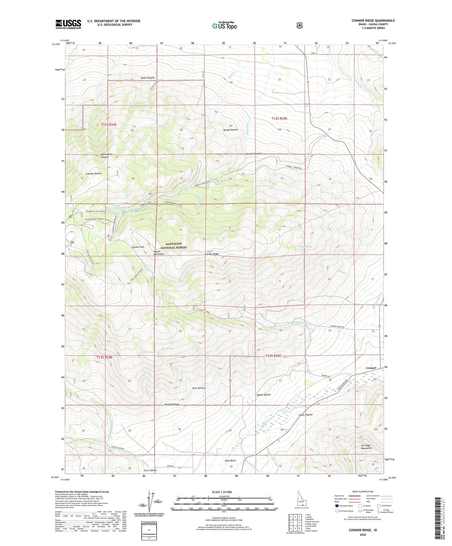
2023 topographic map quadrangle Connor Ridge in the state of Idaho. Scale: 1:24000. Based on the newly updated USGS 7.5' US Topo map series, this map is in the following counties: Cassia. The map contains contour data, water features, and other items you are used to seeing on USGS maps, but also has updated roads and other features. This is the next generation of topographic maps. Printed on high-quality waterproof paper with UV fade-resistant inks.
Quads adjacent to this one:
West: Mount Harrison
Northwest: View
North: Albion
Northeast: Idahome
East: Nibbs Creek
Southeast: Kane Canyon
South: Elba
Southwest: Cache Peak
This map covers the same area as the classic USGS quad with code o42113c5.
Contains the following named places: Amos Creek, Bennett Spring, Blacksmith Creek, Brim Canyon, Broad Hollow, Cassia County, Connor, Connor Creek, Connor Flat, Connor Ridge, Cottonwood Creek, Elba Basin, First Hollow, Howell Canyon, Howell Creek Spring, Jones Hollow, KCIR-FM (Twin Falls), Kemp Hollow, KNAQ-FM (Rupert), KZDX-FM (Burley), Melcher Mine, Pine Creek, Pomerelle Ski Area, Quaking Asp Creek, Rice Hollow, Rice Spring, Rock Spring, Rocky Hollow, Rose Creek, Sibley Creek, Sibley Spring, Thompson Flat Campground, Twin Lakes Picnic Area


