
MyTopo
Elba Idaho US Topo Map
Couldn't load pickup availability
Also explore the Elba Forest Service Topo of this same quad for updated USFS data
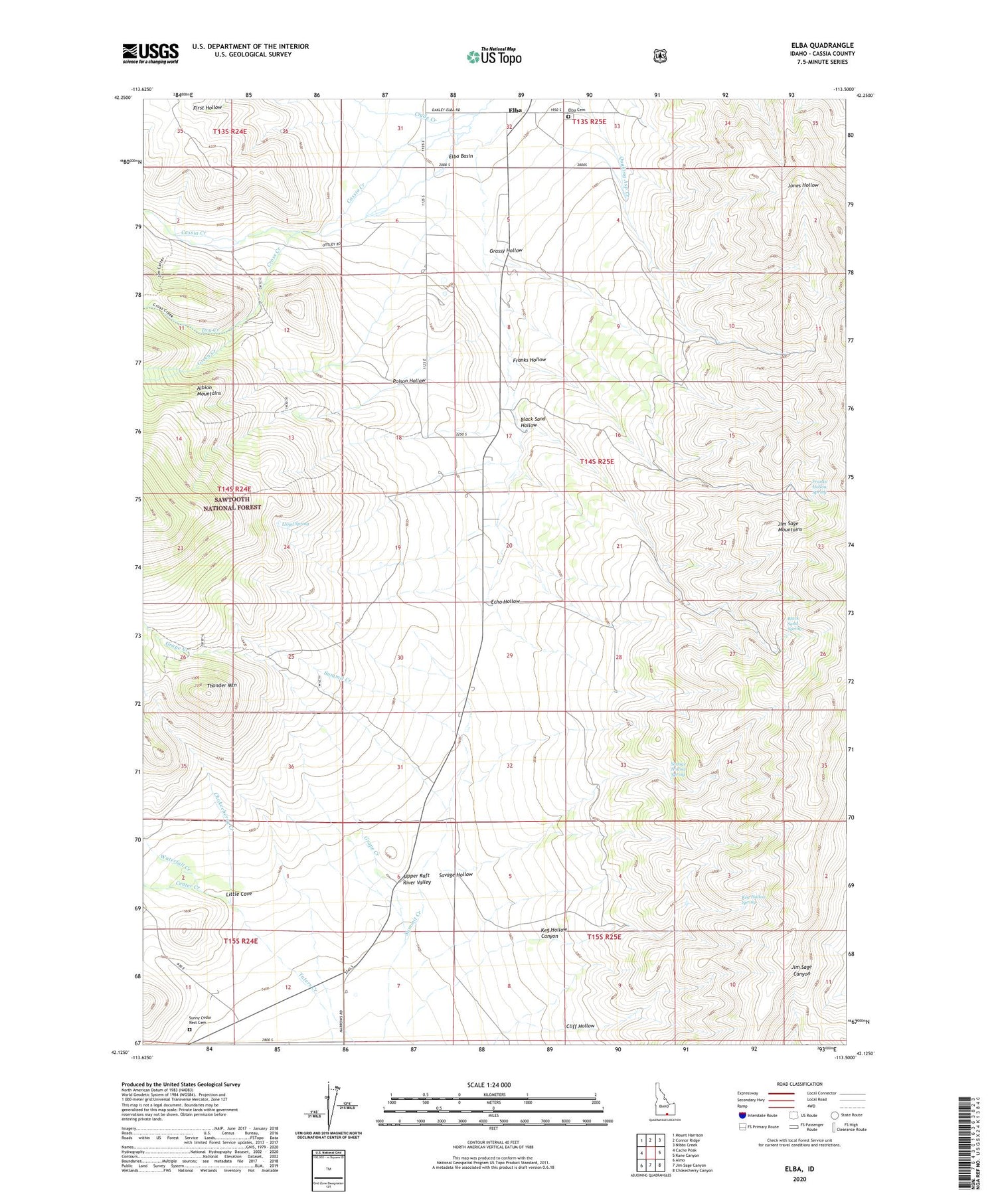
2023 topographic map quadrangle Elba in the state of Idaho. Scale: 1:24000. Based on the newly updated USGS 7.5' US Topo map series, this map is in the following counties: Cassia. The map contains contour data, water features, and other items you are used to seeing on USGS maps, but also has updated roads and other features. This is the next generation of topographic maps. Printed on high-quality waterproof paper with UV fade-resistant inks.
Quads adjacent to this one:
West: Cache Peak
Northwest: Mount Harrison
North: Connor Ridge
Northeast: Nibbs Creek
East: Kane Canyon
Southeast: Chokecherry Canyon
South: Jim Sage Canyon
Southwest: Almo
This map covers the same area as the classic USGS quad with code o42113b5.
Contains the following named places: Black Sand Hollow, Black Sand Spring, Center Creek, Chokecherry Creek, Cliff Hollow, Clyde Creek, Cross Creek, Dry Creek, Echo Hollow, Elba, Elba Cemetery, Elba Park, Franks Hollow, Franks Hollow Spring, Grassy Hollow, Green Creek, Keg Hollow Canyon, Keg Hollow Spring, Little Cove, Lloyd Spring, Poison Hollow, Savage Hollow, Savage Hollow Spring, South Creek, Summit Creek, Sunny Cedar Rest Cemetery, Thunder Mountain, Waterfall Creek


