MyTopo
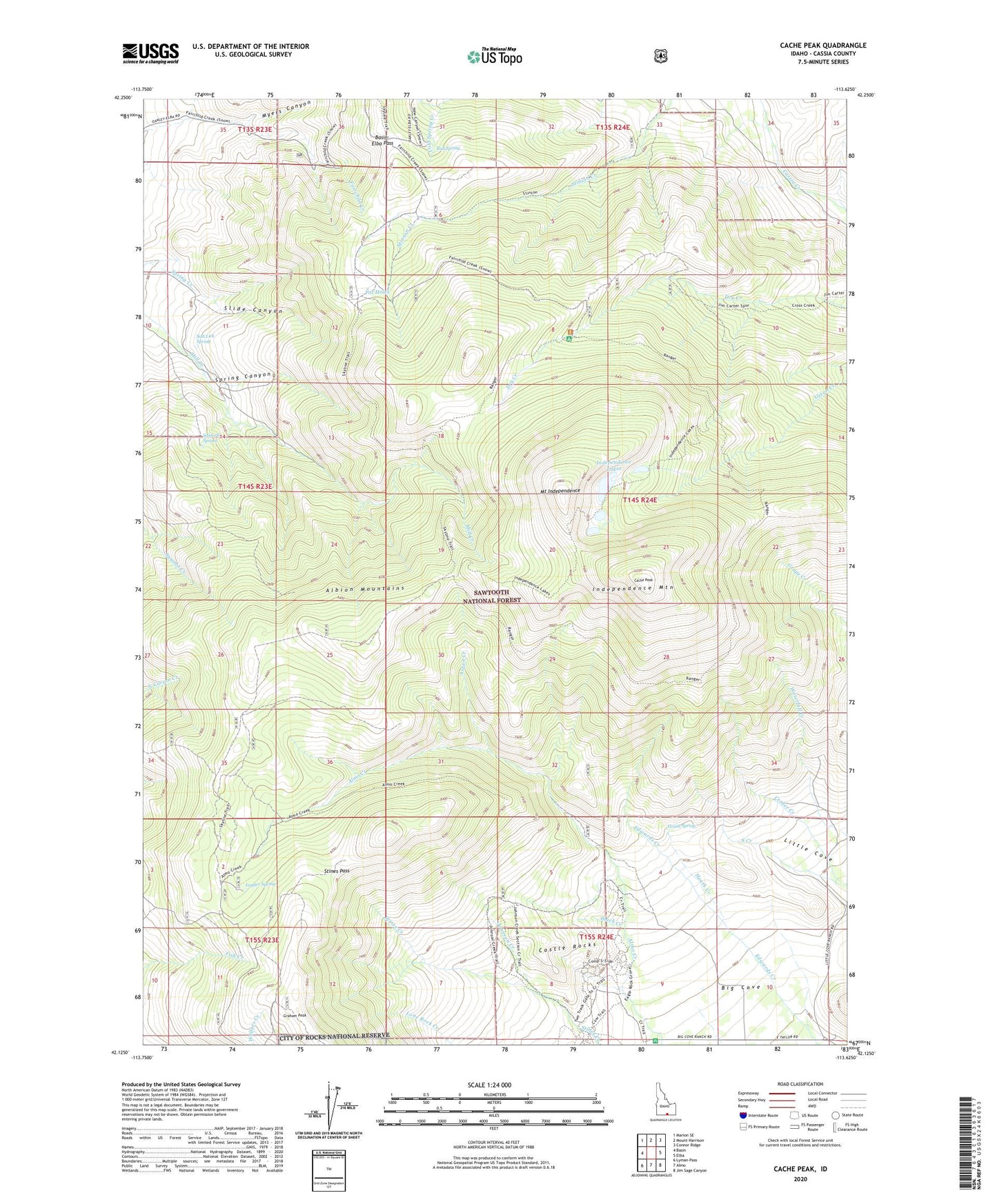
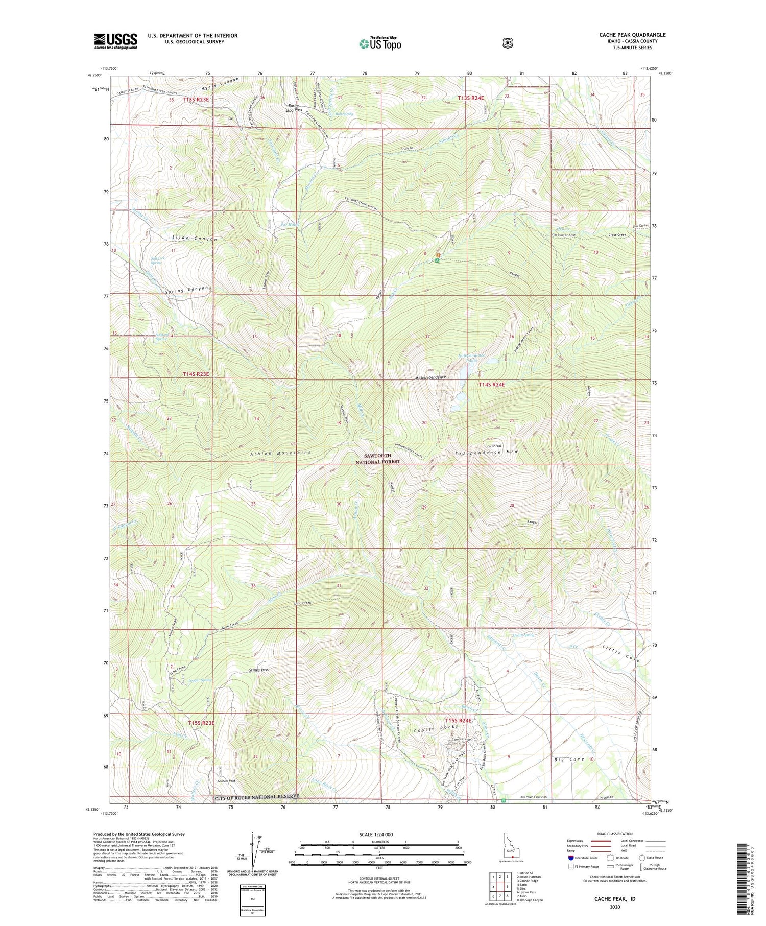
Cache Peak Idaho US Topo Map
Couldn't load pickup availability
Also explore the Cache Peak Forest Service Topo of this same quad for updated USFS data
2023 topographic map quadrangle Cache Peak in the state of Idaho. Scale: 1:24000. Based on the newly updated USGS 7.5' US Topo map series, this map is in the following counties: Cassia. The map contains contour data, water features, and other items you are used to seeing on USGS maps, but also has updated roads and other features. This is the next generation of topographic maps. Printed on high-quality waterproof paper with UV fade-resistant inks.
Quads adjacent to this one:
West: Basin
Northwest: Marion SE
North: Mount Harrison
Northeast: Connor Ridge
East: Elba
Southeast: Jim Sage Canyon
South: Almo
Southwest: Lyman Pass
This map covers the same area as the classic USGS quad with code o42113b6.
Contains the following named places: Albion Mountains, Almo Park, Aspen Creek, Basin-Elba Pass, Black Creek, Bull Spring, Cache Peak, Castle Rocks, Castle Rocks State Park, Cold Spring, Heath Creek, Heath Spring, Independence Lakes, Independence Mountain, Johnson Creek, Logger Spring, Mount Independence, Myers Canyon, Pot Holes, Rangers Trail, Salt Lick Spring, Sanford Spring, Slide Canyon, Spring Canyon, Stines Pass