MyTopo
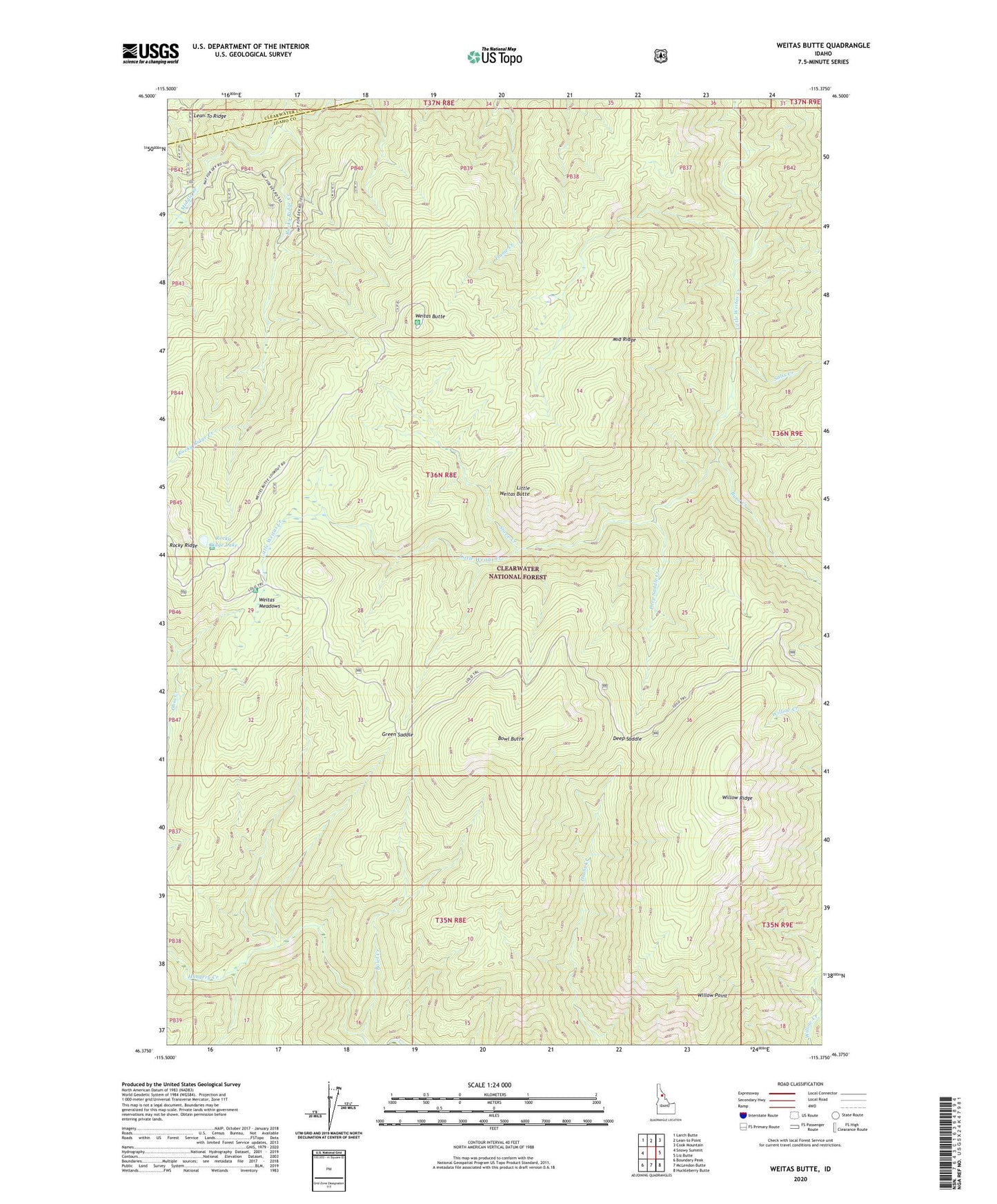
Weitas Butte Idaho US Topo Map
Couldn't load pickup availability
Also explore the Weitas Butte Forest Service Topo of this same quad for updated USFS data
2024 topographic map quadrangle Weitas Butte in the state of Idaho. Scale: 1:24000. Based on the newly updated USGS 7.5' US Topo map series, this map is in the following counties: Idaho, Clearwater. The map contains contour data, water features, and other items you are used to seeing on USGS maps, but also has updated roads and other features. This is the next generation of topographic maps. Printed on high-quality waterproof paper with UV fade-resistant inks.
Quads adjacent to this one:
West: Snowy Summit
Northwest: Larch Butte
North: Lean-to Point
Northeast: Cook Mountain
East: Liz Butte
Southeast: Huckleberry Butte
South: McLendon Butte
Southwest: Boundary Peak
This map covers the same area as the classic USGS quad with code o46115d4.
Contains the following named places: Bowl Butte, Bowl Creek, Burn Creek, Cache Mountain Camp, Deep Saddle, Deep Saddle Creek, Flame Creek, Green Saddle, Little Weitas Butte, Middle Ridge, Portable Soup Camp, Retreat Camp, Rocky Ridge Creek, Rocky Ridge Lake, Rocky Ridge Lake Campground, Salix Creek, Stove Creek, Weitas Butte, Weitas Meadows, Weitas Meadows Campground, Willow Point, Willow Ridge