
MyTopo
Dent Idaho US Topo Map
Couldn't load pickup availability
Also explore the Dent Forest Service Topo of this same quad for updated USFS data
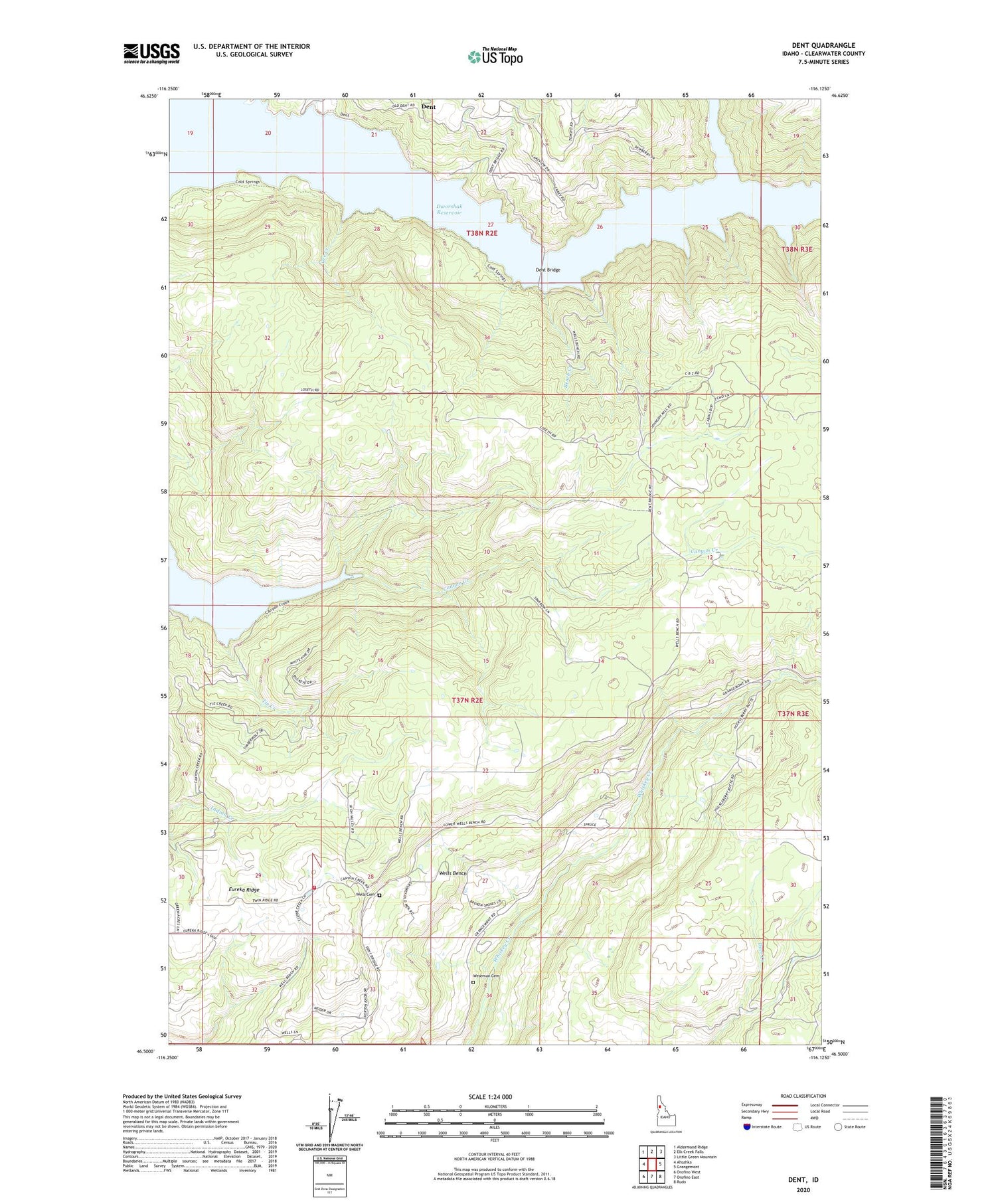
2024 topographic map quadrangle Dent in the state of Idaho. Scale: 1:24000. Based on the newly updated USGS 7.5' US Topo map series, this map is in the following counties: Clearwater. The map contains contour data, water features, and other items you are used to seeing on USGS maps, but also has updated roads and other features. This is the next generation of topographic maps. Printed on high-quality waterproof paper with UV fade-resistant inks.
Quads adjacent to this one:
West: Ahsahka
Northwest: Aldermand Ridge
North: Elk Creek Falls
Northeast: Little Green Mountain
East: Grangemont
Southeast: Rudo
South: Orofino East
Southwest: Orofino West
This map covers the same area as the classic USGS quad with code o46116e2.
Contains the following named places: Bench Creek, Best Corner, Canyon Creek Recreation Site, Cold Springs Recreation Site, Cranberry Creek, Dent, Dent Acres Recreation Site, Dent Bridge, Dent Orchards Recreation Site, Dworshak Reservoir, Eureka Ridge, Hansberg, KLER-FM (Orofino), Orofino-Grangemont Check Station, Ove Creek, Tie Creek, Twin Ridge Rural Fire Department, Wells Bench, Wells Cemetery, Weseman Cemetery


