MyTopo
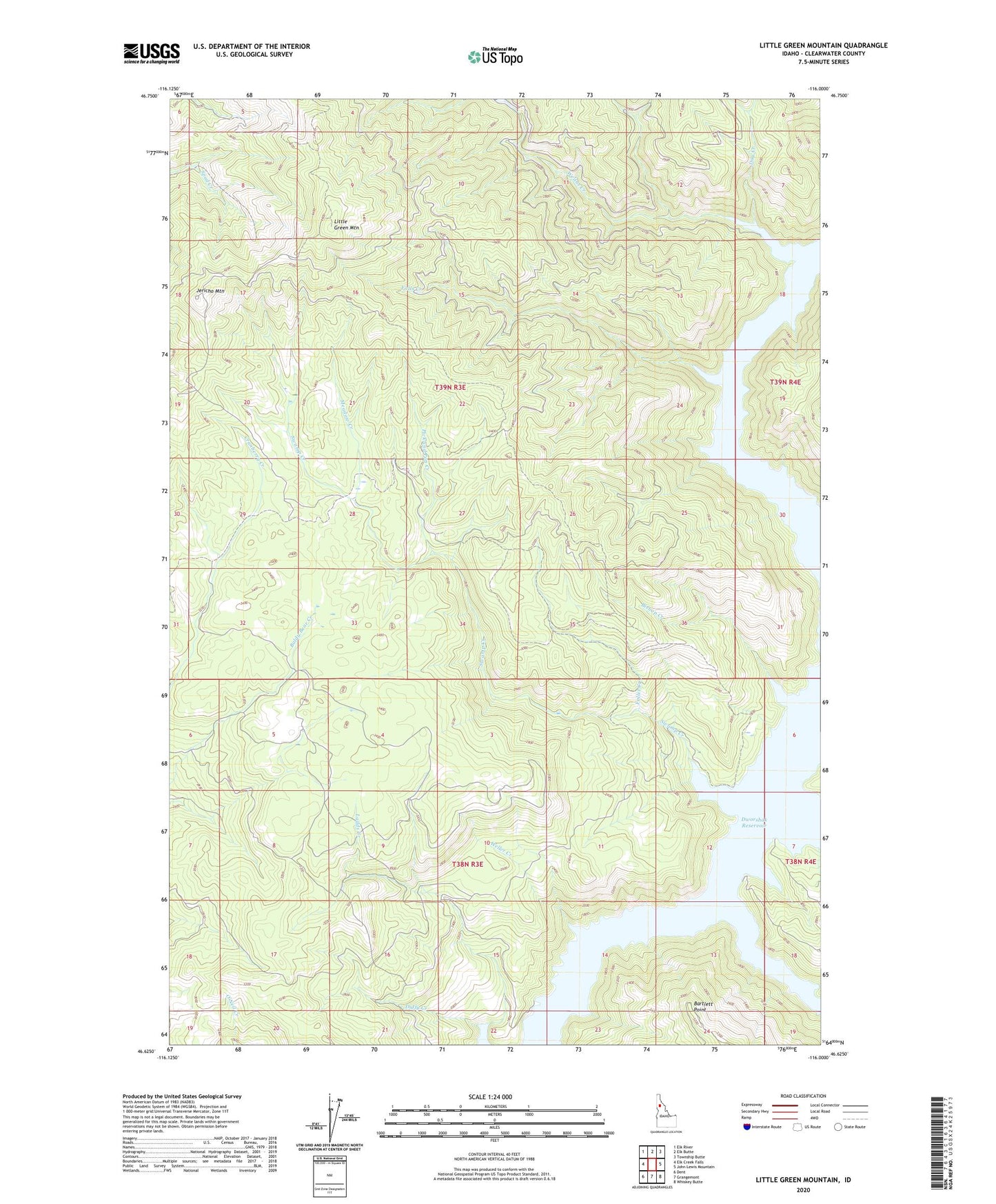
Little Green Mountain Idaho US Topo Map
Couldn't load pickup availability
Also explore the Little Green Mountain Forest Service Topo of this same quad for updated USFS data
2024 topographic map quadrangle Little Green Mountain in the state of Idaho. Scale: 1:24000. Based on the newly updated USGS 7.5' US Topo map series, this map is in the following counties: Clearwater. The map contains contour data, water features, and other items you are used to seeing on USGS maps, but also has updated roads and other features. This is the next generation of topographic maps. Printed on high-quality waterproof paper with UV fade-resistant inks.
Quads adjacent to this one:
West: Elk Creek Falls
Northwest: Elk River
North: Elk Butte
Northeast: Township Butte
East: John Lewis Mountain
Southeast: Whiskey Butte
South: Grangemont
Southwest: Dent
This map covers the same area as the classic USGS quad with code o46116f1.
Contains the following named places: Bartlett Point, Big Island, Bishop Creek, Caldwell Creek, Day Creek, Duffy Creek, Falls Creek, Follet Creek, Jericho Mine, Jericho Mountain, Little Green Mountain, Meadow Creek, Pick and Pan Creek, Reeds Creek, Swamp Creek, Weitas Creek, Weller Creek