
MyTopo
Donnelly Idaho US Topo Map
Couldn't load pickup availability
Also explore the Donnelly Forest Service Topo of this same quad for updated USFS data
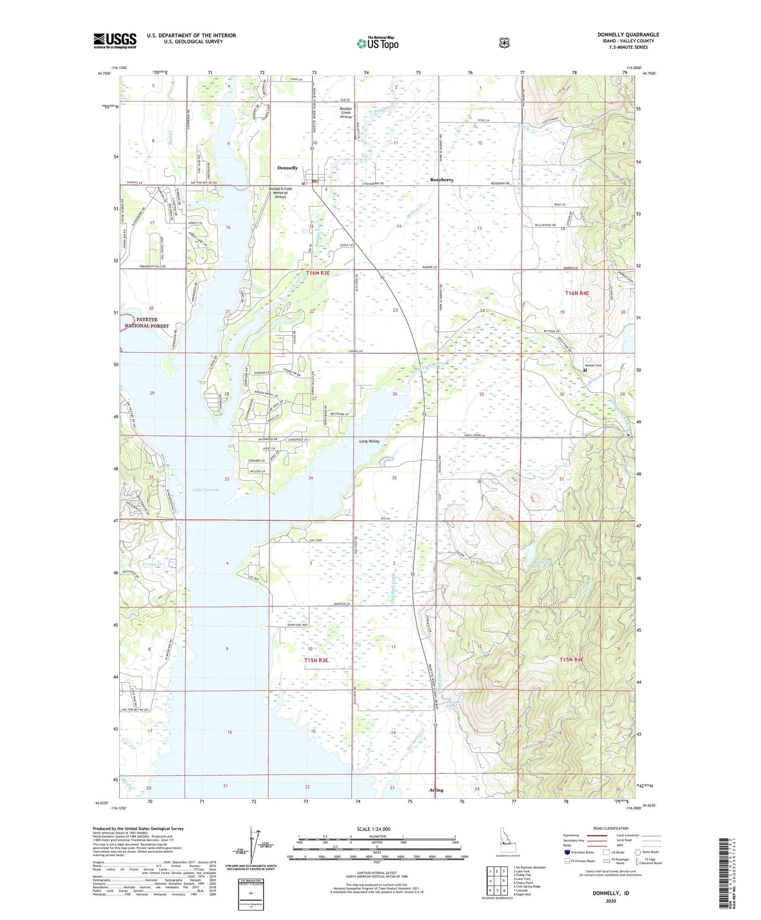
2024 topographic map quadrangle Donnelly in the state of Idaho. Scale: 1:24000. Based on the newly updated USGS 7.5' US Topo map series, this map is in the following counties: Valley. The map contains contour data, water features, and other items you are used to seeing on USGS maps, but also has updated roads and other features. This is the next generation of topographic maps. Printed on high-quality waterproof paper with UV fade-resistant inks.
Quads adjacent to this one:
West: Lone Tree
Northwest: No Business Mountain
North: Lake Fork
Northeast: Paddy Flat
East: Sloans Point
Southeast: Eagle Nest
South: Cascade
Southwest: Cold Spring Ridge
This map covers the same area as the classic USGS quad with code o44116f1.
Contains the following named places: Arling, Arling Hot Spring, Arling Station, Boulder Creek, Boulder Creek Airstrip, Cascade Lake 4H Camp, City of Donnelly, Davis Creek, Donald D Coski Memorial Airport, Donnelly, Donnelly Elementary School, Donnelly Post Office, Donnelly Rural Fire Protection District Donnelly Station, East Fork Roseberry Ditch, Eld Dam, Gold Fork Canal, Gold Fork River, Hayes School, Homes Cemetery, Koskella Dam, Koskella Reservoir, Laffinwell Creek, Lake Fork, MacGregor, Mud Creek, Poison Creek, Poison Creek Campground, Rock Creek, Roseberry, Willow Creek, ZIP Code: 83615


