
MyTopo
Cold Spring Ridge Idaho US Topo Map
Couldn't load pickup availability
Also explore the Cold Spring Ridge Forest Service Topo of this same quad for updated USFS data
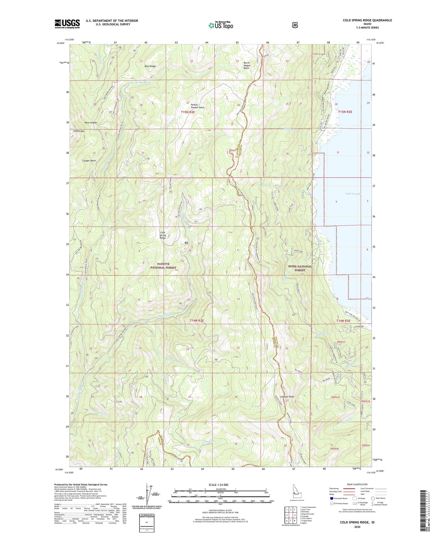
2024 topographic map quadrangle Cold Spring Ridge in the state of Idaho. Scale: 1:24000. Based on the newly updated USGS 7.5' US Topo map series, this map is in the following counties: Adams, Valley, Gem. The map contains contour data, water features, and other items you are used to seeing on USGS maps, but also has updated roads and other features. This is the next generation of topographic maps. Printed on high-quality waterproof paper with UV fade-resistant inks.
Quads adjacent to this one:
West: King Hill Creek
Northwest: Council Mountain
North: Lone Tree
Northeast: Donnelly
East: Cascade
Southeast: Alpha
South: Tripod Peak
Southwest: Twin Sisters
This map covers the same area as the classic USGS quad with code o44116e2.
Contains the following named places: Anderson Creek, Anderson Creek Trail, Beer Bottle Crossing, Bull Corral Creek, Burnt Wagon Basin, Cold Spring Ridge, Cougar Basin, Deer Creek, Deer Licks Creek, Evans Trail, Gibson Creek, Hurd Creek, Indian Mountain, Indian Mountain Lookout Station, Lookout Peak, Mica Saddle, Poison Timber Point, Rock Lake, Rutledge School, Scott Corral, Sheep Creek, Sheep Creek Trail, Sheep Trail, Silver Creek, Van Wyck Sheep Trail, Wolf Creek


