MyTopo
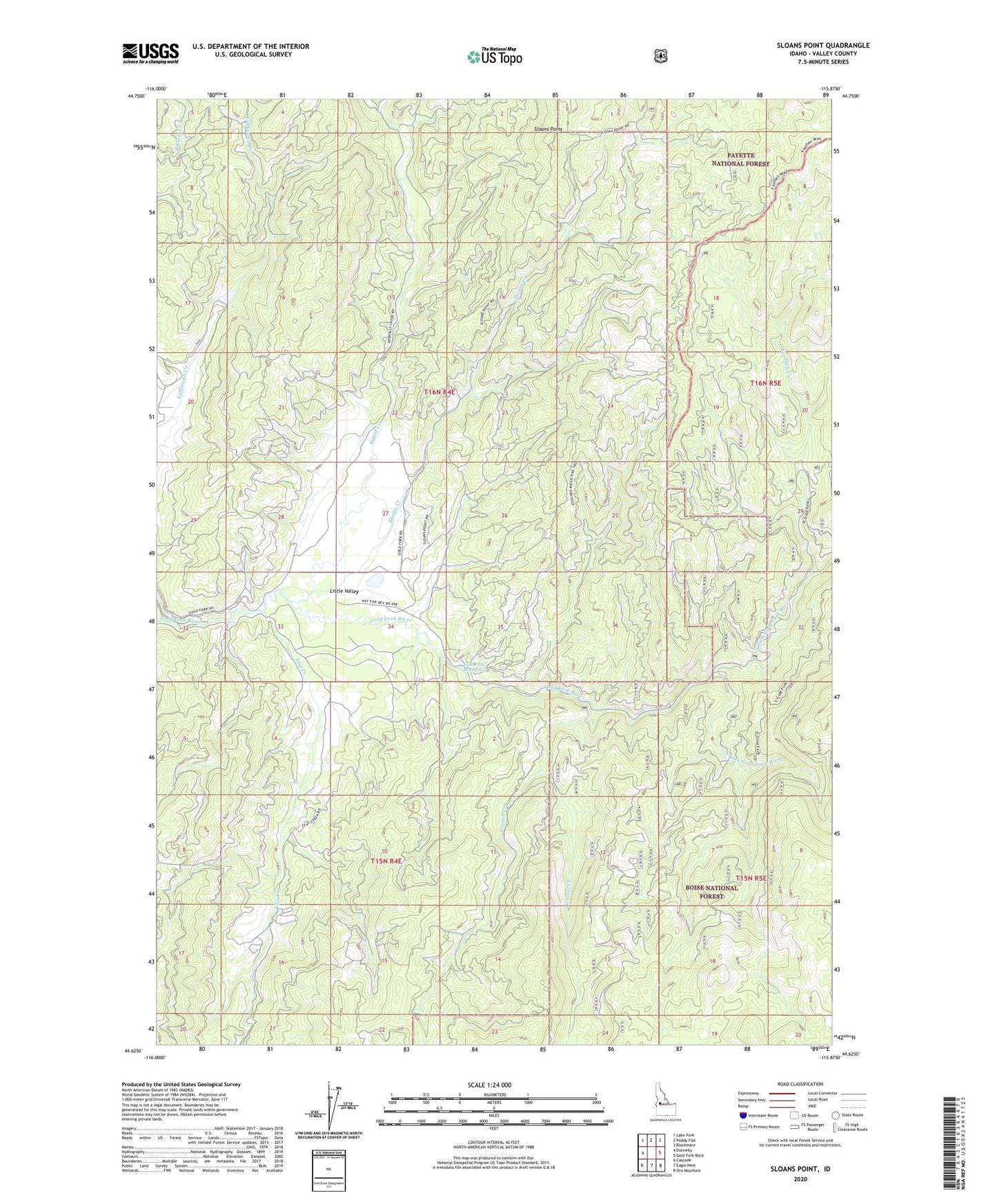
Sloans Point Idaho US Topo Map
Couldn't load pickup availability
Also explore the Sloans Point Forest Service Topo of this same quad for updated USFS data
2024 topographic map quadrangle Sloans Point in the state of Idaho. Scale: 1:24000. Based on the newly updated USGS 7.5' US Topo map series, this map is in the following counties: Valley. The map contains contour data, water features, and other items you are used to seeing on USGS maps, but also has updated roads and other features. This is the next generation of topographic maps. Printed on high-quality waterproof paper with UV fade-resistant inks.
Quads adjacent to this one:
West: Donnelly
Northwest: Lake Fork
North: Paddy Flat
Northeast: Blackmare
East: Gold Fork Rock
Southeast: Oro Mountain
South: Eagle Nest
Southwest: Cascade
This map covers the same area as the classic USGS quad with code o44115f8.
Contains the following named places: Brown Dam, Flat Creek, Foolhen Creek, Foolhen Ridge Fire Trail, French Creek, Gold Fork Hot Spring, Grouse Creek, Kennally Creek, Little Valley, North Fork Gold Fork River, Rapid Creek, Sloans Creek, Sloans Point, Sloans Point Fire Trail, Sloans Point Lookout, South Fork Gold Fork River