MyTopo
Eightmile Mountain Idaho US Topo Map
Couldn't load pickup availability
Also explore the Eightmile Mountain Forest Service Topo of this same quad for updated USFS data
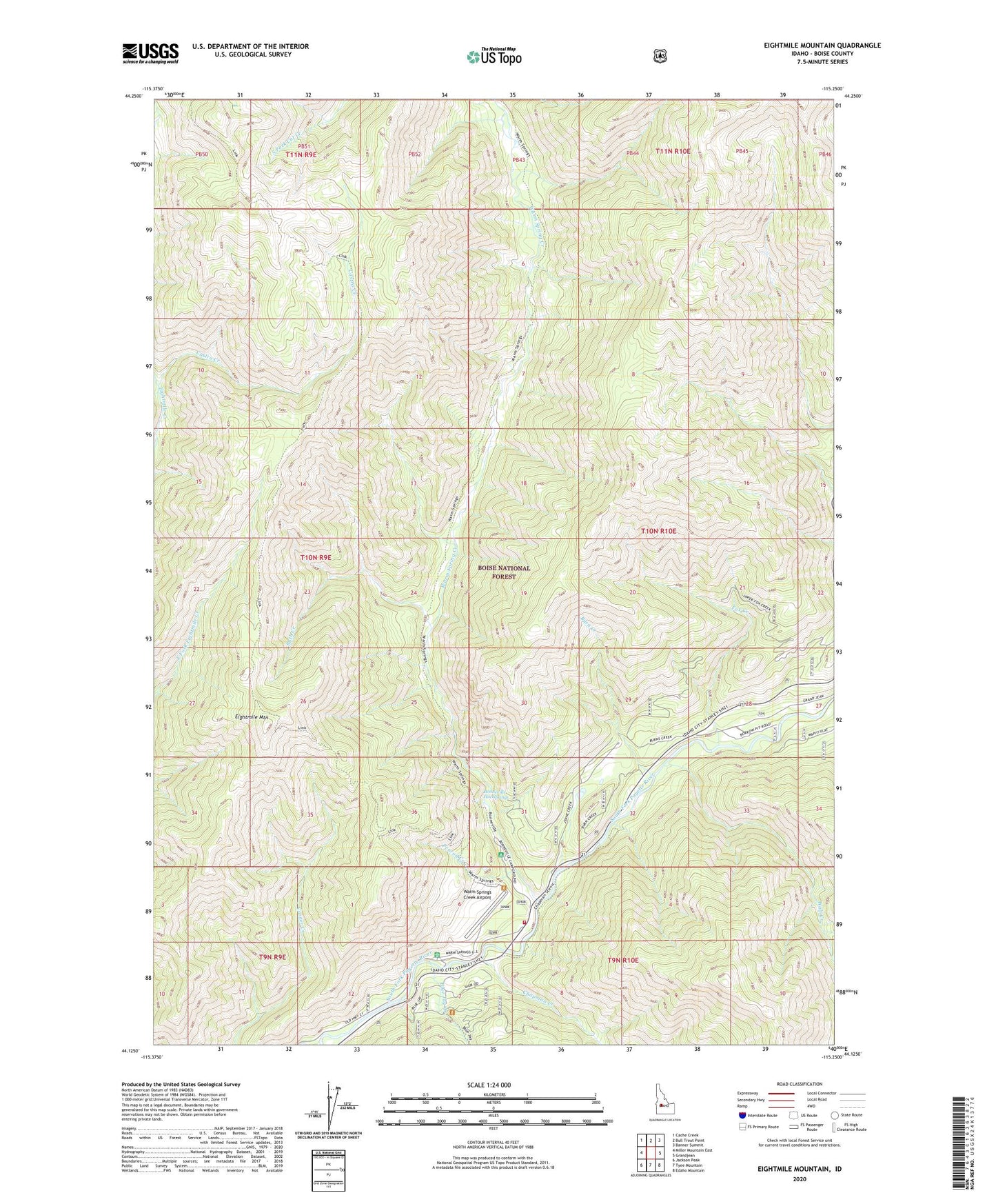
2024 topographic map quadrangle Eightmile Mountain in the state of Idaho. Scale: 1:24000. Based on the newly updated USGS 7.5' US Topo map series, this map is in the following counties: Boise. The map contains contour data, water features, and other items you are used to seeing on USGS maps, but also has updated roads and other features. This is the next generation of topographic maps. Printed on high-quality waterproof paper with UV fade-resistant inks.
Quads adjacent to this one:
West: Miller Mountain East
Northwest: Cache Creek
North: Bull Trout Point
Northeast: Banner Summit
East: Grandjean
Southeast: Edaho Mountain
South: Tyee Mountain
Southwest: Jackson Peak
This map covers the same area as the classic USGS quad with code o44115b3.
Contains the following named places: Blue Jay Creek, Bonneville Hot Springs, Burn Creek, Bush Creek, Castro Creek, Chapman Creek, Eightmile Mountain, Fox Creek, Lowman City Ambulance, Lowman Volunteer Fire Department Station 1, MacDonald Creek, Penrod Access Area, Penrod Creek, South Fork Payette River Game Preserve, Warm Spring Creek, Warm Springs Campground, Warm Springs Creek Airport, Warm Springs Forest Service Station, Wolf Creek