
MyTopo
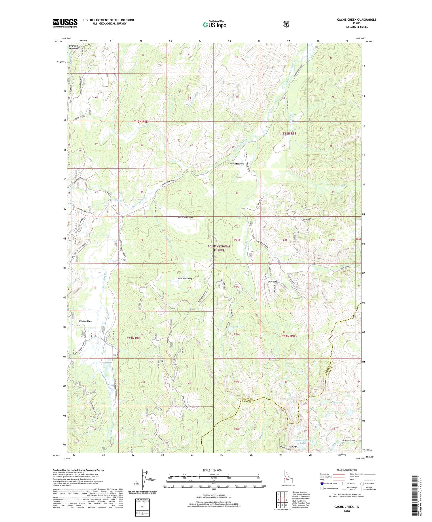
Cache Creek Idaho US Topo Map
Couldn't load pickup availability
Also explore the Cache Creek Forest Service Topo of this same quad for updated USFS data
2024 topographic map quadrangle Cache Creek in the state of Idaho. Scale: 1:24000. Based on the newly updated USGS 7.5' US Topo map series, this map is in the following counties: Valley, Boise. The map contains contour data, water features, and other items you are used to seeing on USGS maps, but also has updated roads and other features. This is the next generation of topographic maps. Printed on high-quality waterproof paper with UV fade-resistant inks.
Quads adjacent to this one:
West: Whitehawk Mountain
Northwest: Bernard Mountain
North: Bear Valley Mountain
Northeast: Blue Bunch Mountain
East: Bull Trout Point
Southeast: Eightmile Mountain
South: Miller Mountain East
Southwest: Miller Mountain West
This map covers the same area as the classic USGS quad with code o44115c4.
Contains the following named places: Big Meadows, Cache Creek, Cache Meadows, Casner Creek, Cat Lakes, Cub Creek, Lost Lake, Lost Lakes, Lost Meadows, Mace Creek, Mace Meadows, Red Mountain, Red Mountain Lakes, Sack Creek, Sack Creek Campground, Sheep Trail Creek, Transfer Cabin


