MyTopo
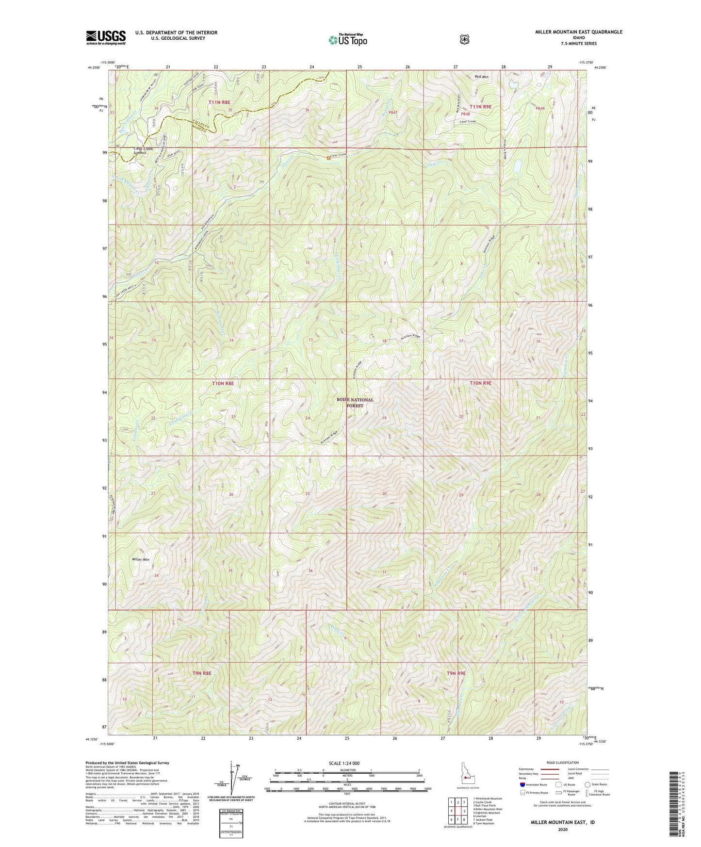
Miller Mountain East Idaho US Topo Map
Couldn't load pickup availability
Also explore the Miller Mountain East Forest Service Topo of this same quad for updated USFS data
2024 topographic map quadrangle Miller Mountain East in the state of Idaho. Scale: 1:24000. Based on the newly updated USGS 7.5' US Topo map series, this map is in the following counties: Boise, Valley. The map contains contour data, water features, and other items you are used to seeing on USGS maps, but also has updated roads and other features. This is the next generation of topographic maps. Printed on high-quality waterproof paper with UV fade-resistant inks.
Quads adjacent to this one:
West: Miller Mountain West
Northwest: Whitehawk Mountain
North: Cache Creek
Northeast: Bull Trout Point
East: Eightmile Mountain
Southeast: Tyee Mountain
South: Jackson Peak
Southwest: Lowman
This map covers the same area as the classic USGS quad with code o44115b4.
Contains the following named places: Clear Creek Summit, East Fork Eightmile Creek, Elkhorn Creek, Kirkham Ridge Trail, Miller Mountain, Monument Creek, North Fork Elkhorn Creek, Rough Creek, South Fork Clear Creek