
MyTopo
Elkhorn Creek Idaho US Topo Map
Couldn't load pickup availability
Also explore the Elkhorn Creek Forest Service Topo of this same quad for updated USFS data
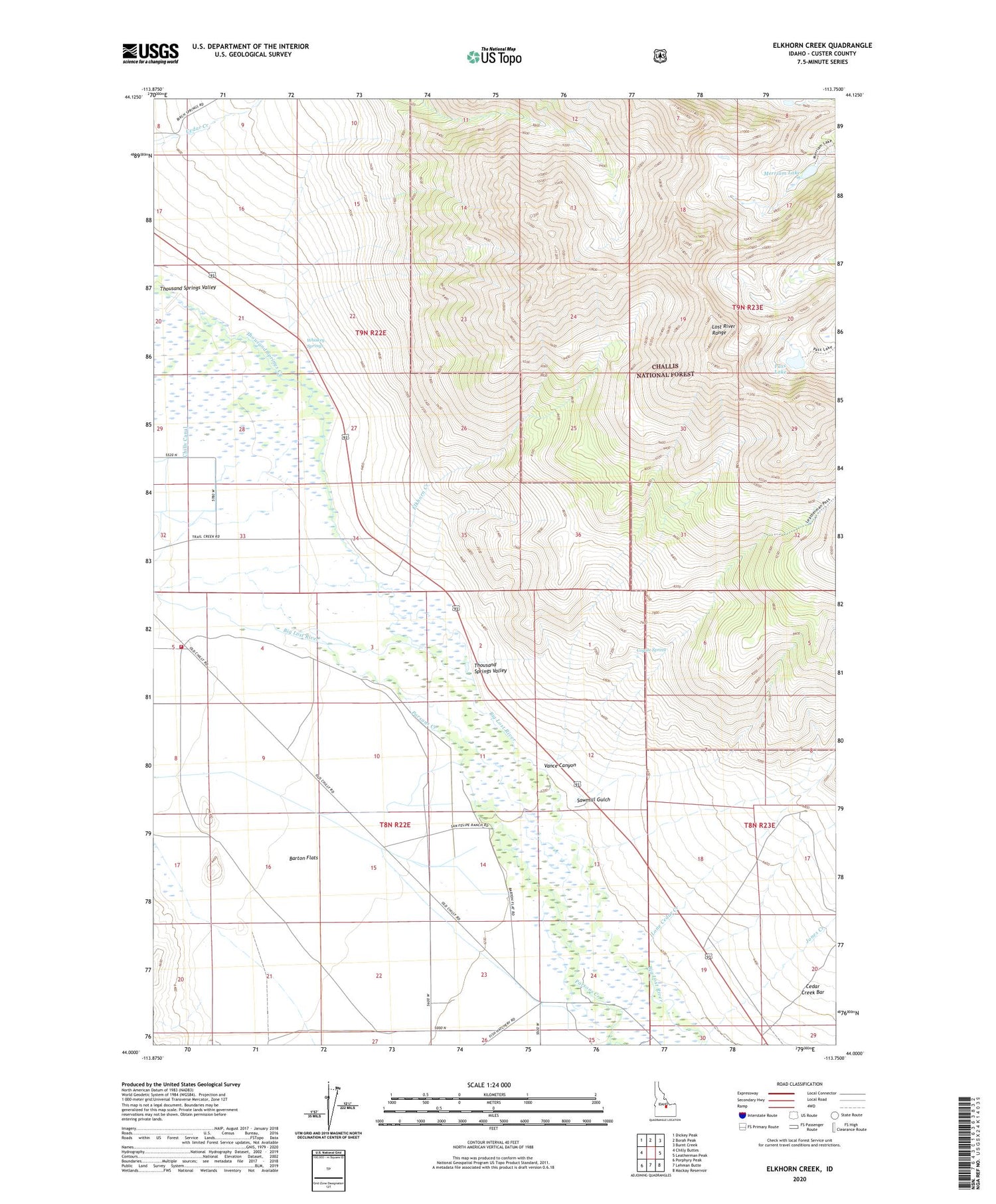
2024 topographic map quadrangle Elkhorn Creek in the state of Idaho. Scale: 1:24000. Based on the newly updated USGS 7.5' US Topo map series, this map is in the following counties: Custer. The map contains contour data, water features, and other items you are used to seeing on USGS maps, but also has updated roads and other features. This is the next generation of topographic maps. Printed on high-quality waterproof paper with UV fade-resistant inks.
Quads adjacent to this one:
West: Chilly Buttes
Northwest: Dickey Peak
North: Borah Peak
Northeast: Burnt Creek
East: Leatherman Peak
Southeast: Mackay Reservoir
South: Lehman Butte
Southwest: Porphyry Peak
This map covers the same area as the classic USGS quad with code o44113a7.
Contains the following named places: Barton Flats, Cedar Creek Bar, Coyote Spring, Elkhorn Creek, Elkhorn Ranch, Jones Creek, Lone Cedar Creek, Merriam Lake, Pass Lake, Sawmill Gulch, South Custer Rural Fire District, Thousand Springs Creek, Thousand Springs Valley, Vance Canyon, Whiskey Springs


