MyTopo
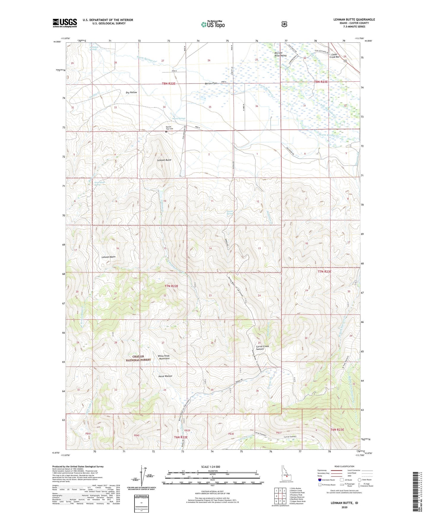
Lehman Butte Idaho US Topo Map
Couldn't load pickup availability
Also explore the Lehman Butte Forest Service Topo of this same quad for updated USFS data
2023 topographic map quadrangle Lehman Butte in the state of Idaho. Scale: 1:24000. Based on the newly updated USGS 7.5' US Topo map series, this map is in the following counties: Custer. The map contains contour data, water features, and other items you are used to seeing on USGS maps, but also has updated roads and other features. This is the next generation of topographic maps. Printed on high-quality waterproof paper with UV fade-resistant inks.
Quads adjacent to this one:
West: Porphyry Peak
Northwest: Chilly Buttes
North: Elkhorn Creek
Northeast: Leatherman Peak
East: Mackay Reservoir
Southeast: Shelly Mountain
South: Copper Basin Knob
Southwest: Big Black Dome
This map covers the same area as the classic USGS quad with code o43113h7.
Contains the following named places: Barton Flat Cemetery, Barton School, Boone Creek, Corral Creek Summit, Dry Hollow, East Fork Lehman Creek, Garden Creek, Hamilton Creek, Hamilton Springs, Horse Wallow, Leavitt Spring, Lehman Basin, Lehman Butte, Lehman Creek, Mackay Division, Mackay Fish Hatchery, Warm Springs, West Fork Lehman Creek, West Fork Navarre Creek, Wood Road Spring