MyTopo
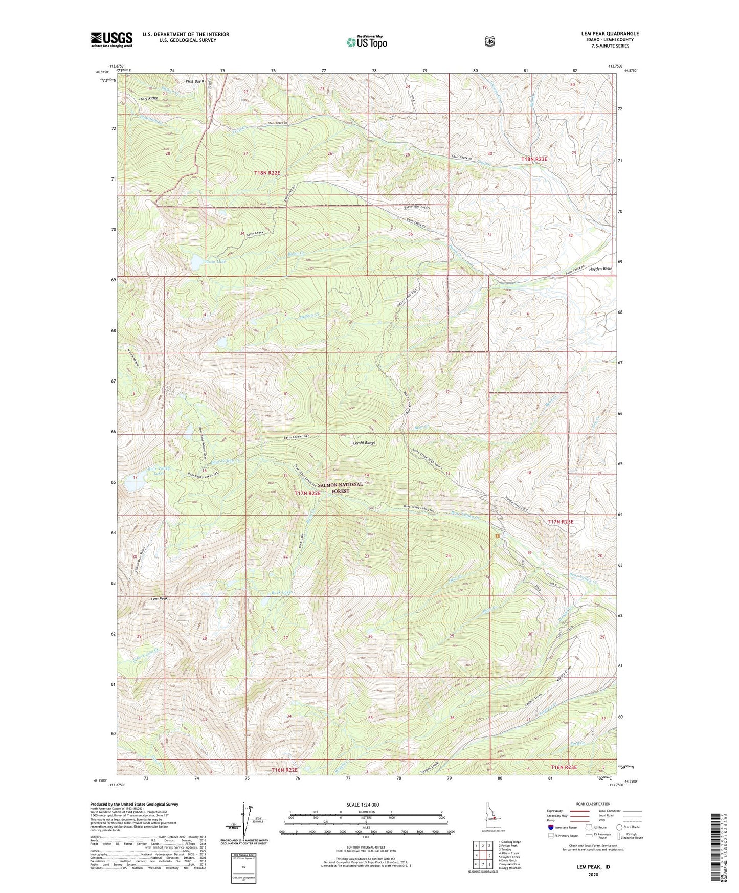
Lem Peak Idaho US Topo Map
Couldn't load pickup availability
Also explore the Lem Peak Forest Service Topo of this same quad for updated USFS data
2024 topographic map quadrangle Lem Peak in the state of Idaho. Scale: 1:24000. Based on the newly updated USGS 7.5' US Topo map series, this map is in the following counties: Lemhi. The map contains contour data, water features, and other items you are used to seeing on USGS maps, but also has updated roads and other features. This is the next generation of topographic maps. Printed on high-quality waterproof paper with UV fade-resistant inks.
Quads adjacent to this one:
West: Allison Creek
Northwest: Goldbug Ridge
North: Poison Peak
Northeast: Tendoy
East: Hayden Creek
Southeast: Mogg Mountain
South: May Mountain
Southwest: Ennis Gulch
This map covers the same area as the classic USGS quad with code o44113g7.
Contains the following named places: Basin Lake, Bear Valley Lakes, Buck Creek, Bull Creek, Deer Creek, Grouse Creek, Lem Peak, Long Ridge, McNutt Creek, Short Creek, Trail Creek, Wright Creek