MyTopo
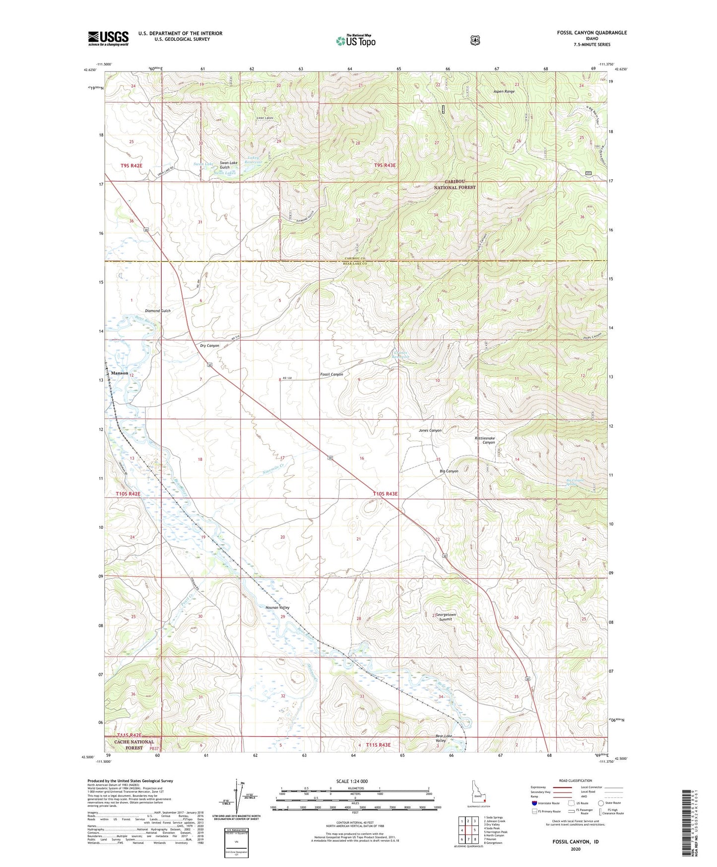
Fossil Canyon Idaho US Topo Map
Couldn't load pickup availability
Also explore the Fossil Canyon Forest Service Topo of this same quad for updated USFS data
2023 topographic map quadrangle Fossil Canyon in the state of Idaho. Scale: 1:24000. Based on the newly updated USGS 7.5' US Topo map series, this map is in the following counties: Bear Lake, Caribou. The map contains contour data, water features, and other items you are used to seeing on USGS maps, but also has updated roads and other features. This is the next generation of topographic maps. Printed on high-quality waterproof paper with UV fade-resistant inks.
Quads adjacent to this one:
West: Soda Peak
Northwest: Soda Springs
North: Johnson Creek
Northeast: Dry Valley
East: Harrington Peak
Southeast: Georgetown
South: Nounan
Southwest: North Canyon
This map covers the same area as the classic USGS quad with code o42111e4.
Contains the following named places: Big Canyon, Big Canyon Spring, Cavanaugh Siding, Cranes Reservoir, Diamond Gulch, Dry Canyon, Fossil Canyon, Georgetown Summit, Georgetown Summit Wildlife Management Area, Jones Canyon, Lakey Reservoir, Manson, Ninemile Creek, North Hill, Nounan Valley, Pearl Creek, Rattlesnake Canyon, Skinner Creek, Stewart Ranch Dam, Swan Lake, Swan Lake Gulch, Swan Lakes