MyTopo
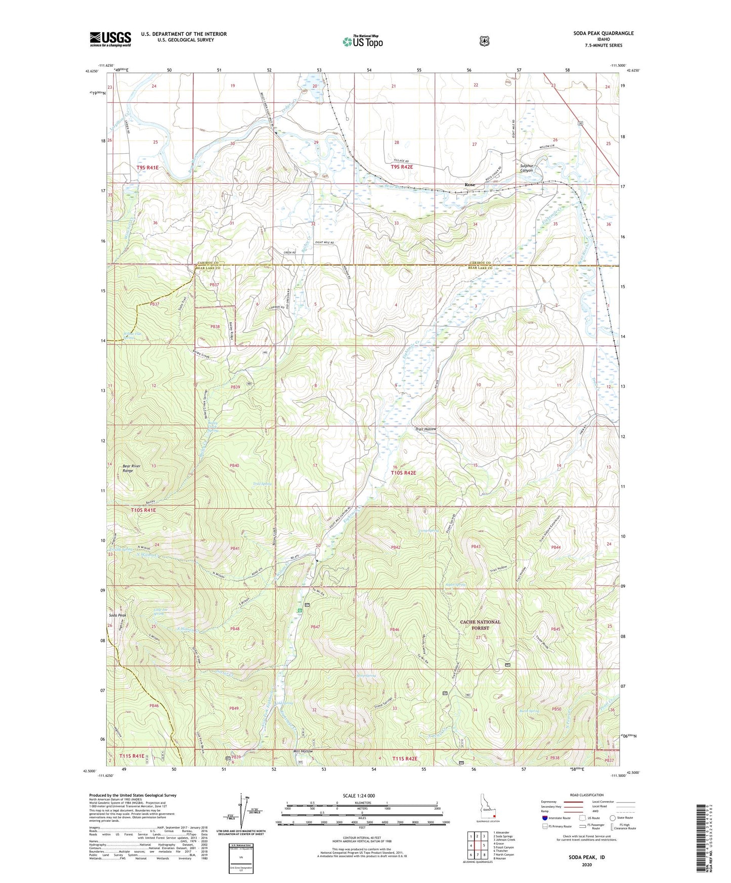
Soda Peak Idaho US Topo Map
Couldn't load pickup availability
Also explore the Soda Peak Forest Service Topo of this same quad for updated USFS data
2024 topographic map quadrangle Soda Peak in the state of Idaho. Scale: 1:24000. Based on the newly updated USGS 7.5' US Topo map series, this map is in the following counties: Bear Lake, Caribou. The map contains contour data, water features, and other items you are used to seeing on USGS maps, but also has updated roads and other features. This is the next generation of topographic maps. Printed on high-quality waterproof paper with UV fade-resistant inks.
Quads adjacent to this one:
West: Grace
Northwest: Alexander
North: Soda Springs
Northeast: Johnson Creek
East: Fossil Canyon
Southeast: Nounan
South: North Canyon
Southwest: Thatcher
This map covers the same area as the classic USGS quad with code o42111e5.
Contains the following named places: Aspen Spring, Bailey Creek, Bailey Creek Spring, Burnt Spring, Camp Ho-Nok, Camp Spring, Cold Spring, Cold Spring Campground, Cow Fork Eightmile Creek, Eightmile Creek, Eightmile Ranger Station, Eightmile School, Largilliere Creek, Ledger Creek, Little Joe Spring, Mill Fork Eightmile Creek, Mill Hollow, North Wilson Creek, Rose, Sotter Creek, South Wilson Creek, Steep Spring, Sulphur Canyon, Trail Creek, Trail Hollow, Trail Spring, Willow Flat Spring, Winchell Creek