MyTopo
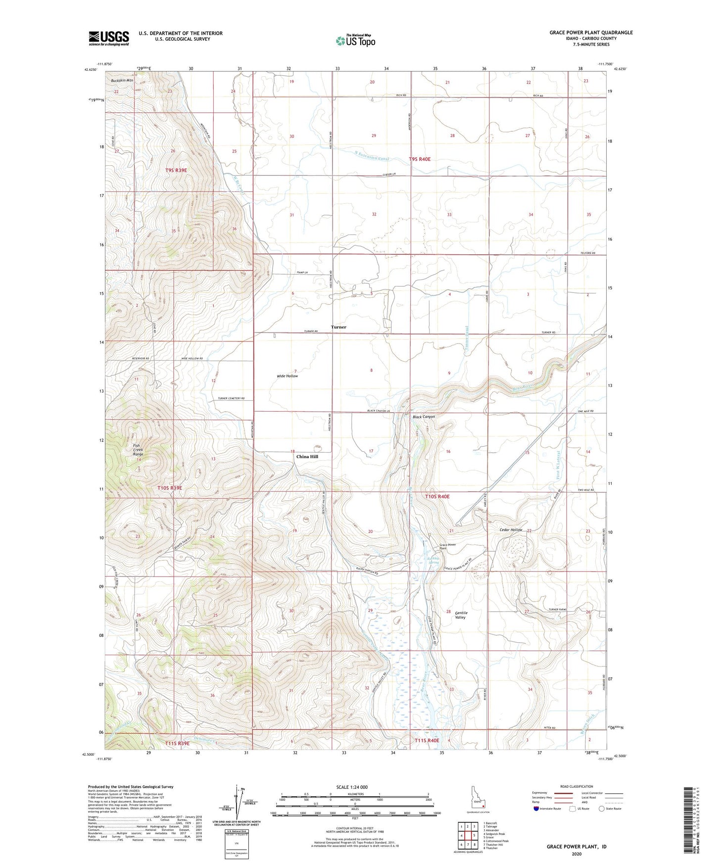
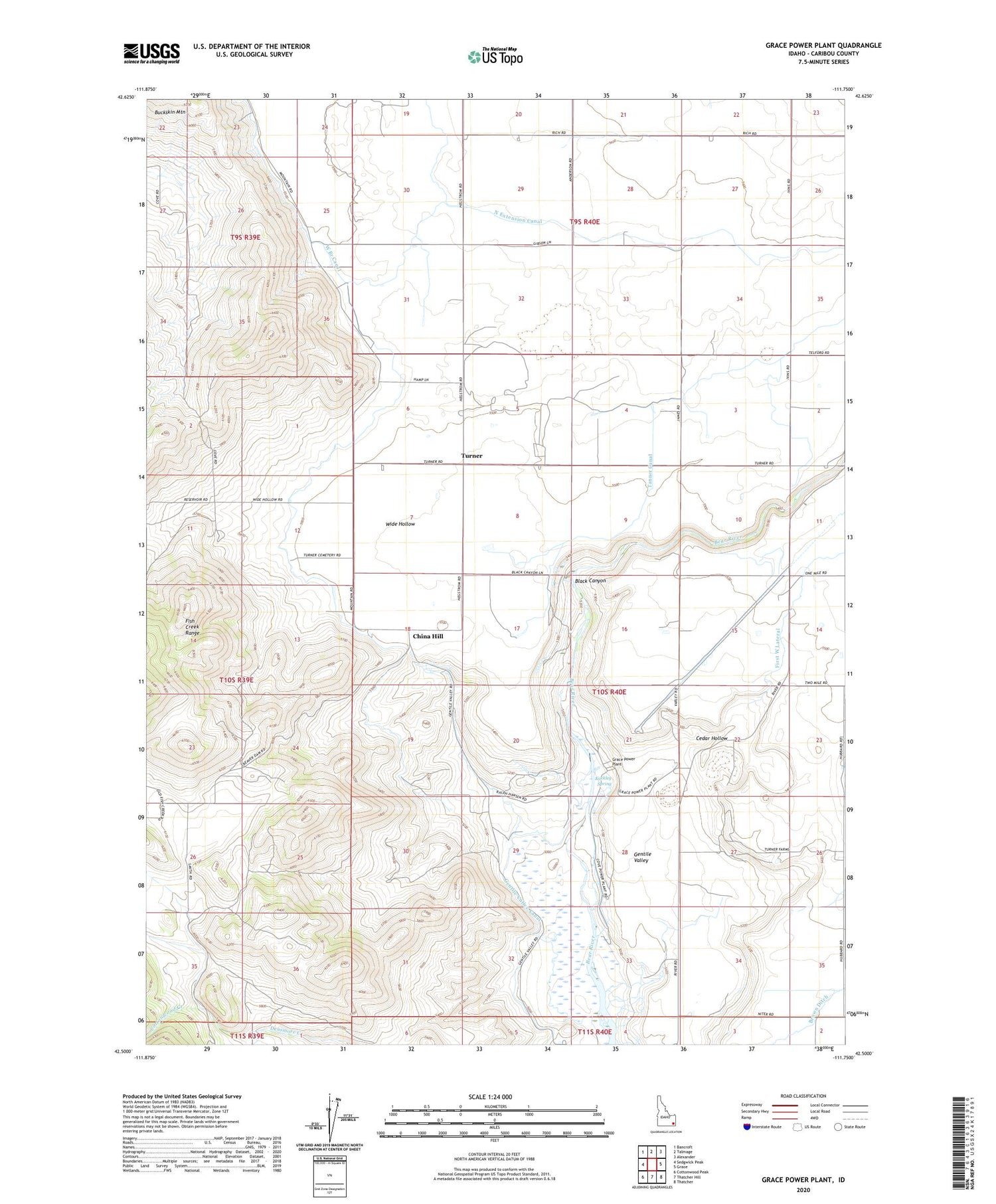
Grace Power Plant Idaho US Topo Map
Couldn't load pickup availability
2023 topographic map quadrangle Grace Power Plant in the state of Idaho. Scale: 1:24000. Based on the newly updated USGS 7.5' US Topo map series, this map is in the following counties: Caribou. The map contains contour data, water features, and other items you are used to seeing on USGS maps, but also has updated roads and other features. This is the next generation of topographic maps. Printed on high-quality waterproof paper with UV fade-resistant inks.
Quads adjacent to this one:
West: Sedgwick Peak
Northwest: Bancroft
North: Talmage
Northeast: Alexander
East: Grace
Southeast: Thatcher
South: Thatcher Hill
Southwest: Cottonwood Peak
This map covers the same area as the classic USGS quad with code o42111e7.
Contains the following named places: Black Canyon, Cedar Hollow, China Hill, Cottonwood Creek, Cove Dam, First West Lateral, Grace Division, Grace Power Plant, Kackley Spring, North Extension Canal, Tanner Canal, Telluride, Telluride School, Turner, West Branch Canal, Wide Hollow, ZIP Code: 83241