MyTopo
Bancroft Idaho US Topo Map
Couldn't load pickup availability
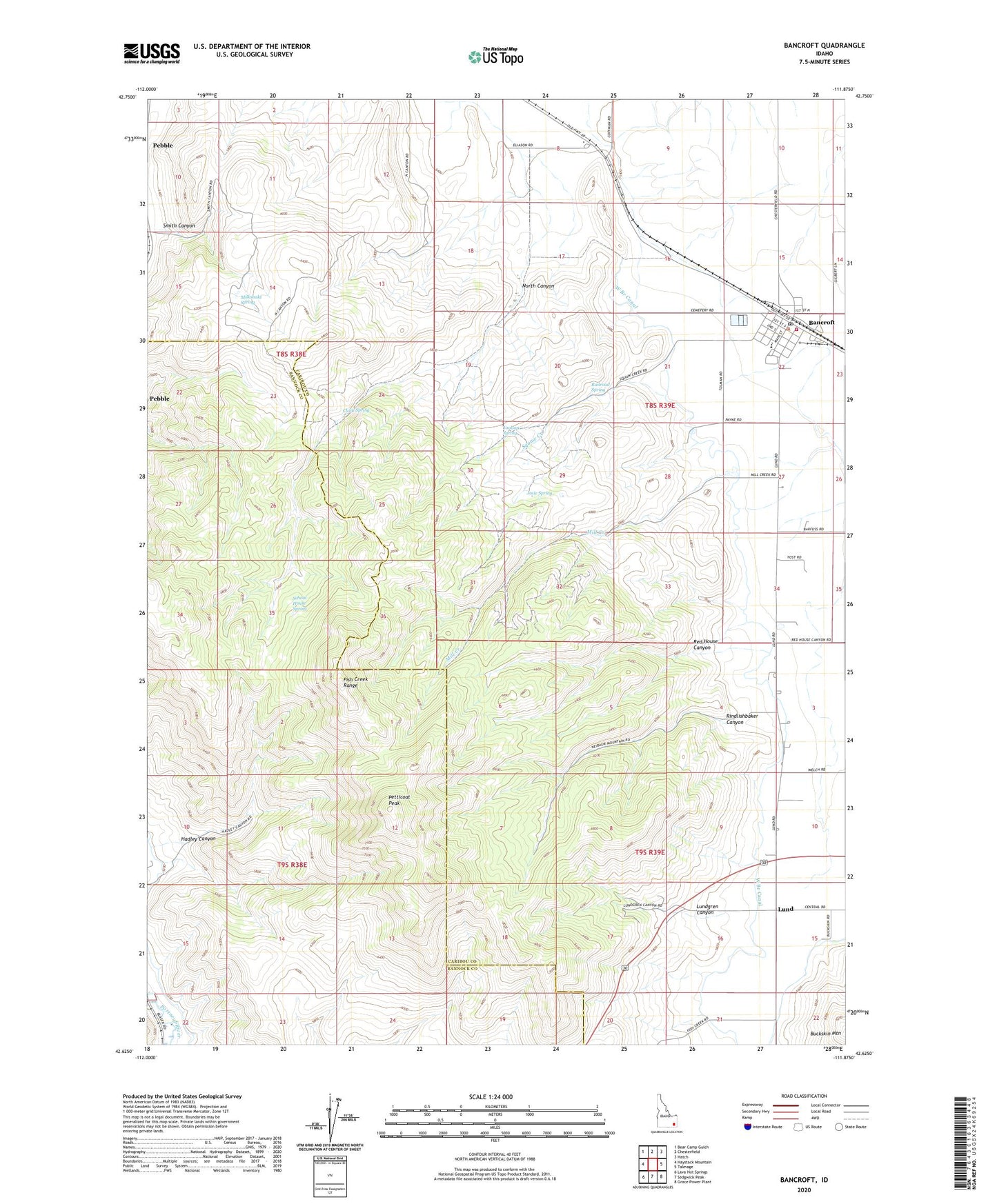
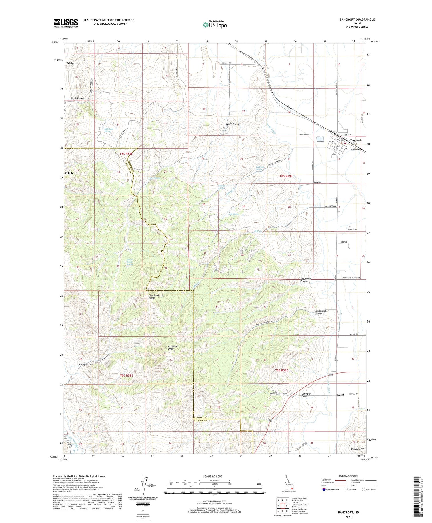
2023 topographic map quadrangle Bancroft in the state of Idaho. Scale: 1:24000. Based on the newly updated USGS 7.5' US Topo map series, this map is in the following counties: Caribou, Bannock. The map contains contour data, water features, and other items you are used to seeing on USGS maps, but also has updated roads and other features. This is the next generation of topographic maps. Printed on high-quality waterproof paper with UV fade-resistant inks.
Quads adjacent to this one:
West: Haystack Mountain
Northwest: Bear Camp Gulch
North: Chesterfield
Northeast: Hatch
East: Talmage
Southeast: Grace Power Plant
South: Sedgwick Peak
Southwest: Lava Hot Springs
This map covers the same area as the classic USGS quad with code o42111f8.
Contains the following named places: Bancroft, Bancroft Cemetery, Bancroft Fire Department, Bancroft Post Office, Caribou County Emergency Medical Services Bancroft, City of Bancroft, Clark Spring, Conklin Well, Fish Creek Range, Hadley Canyon, Josie Spring, Lund, Lundgren Canyon, Milkshake Spring, Mill Creek, North Canyon, North Gem Elementary School, North Gem Junior-Senior High School, Pebble Well, Petticoat Peak, Railroad Spring, Red House Canyon, Rindlishbaker Canyon, School House Spring, Smith Canyon, Squaw Creek, Toolson Spring