MyTopo
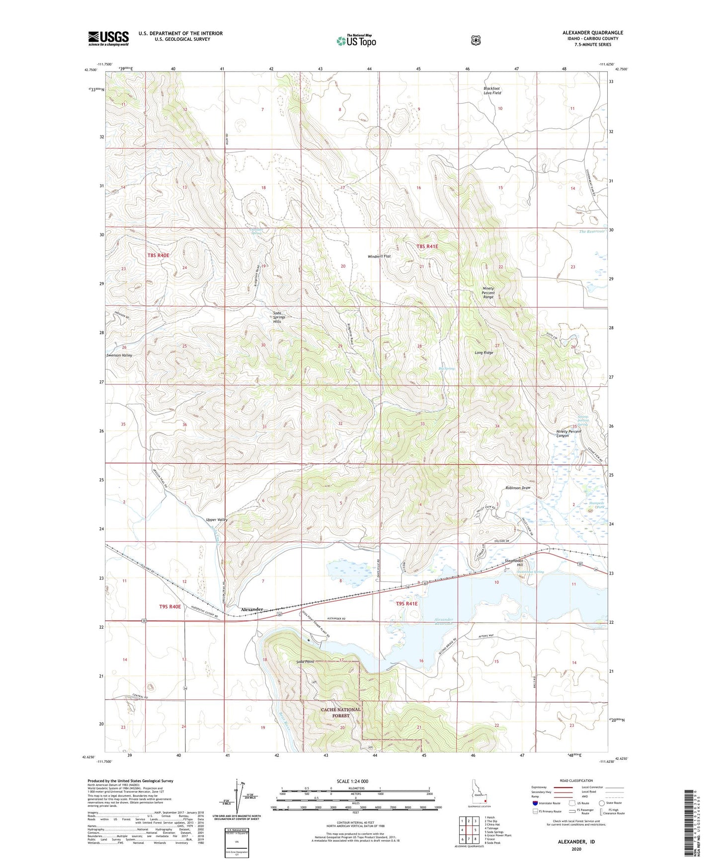
Alexander Idaho US Topo Map
Couldn't load pickup availability
Also explore the Alexander Forest Service Topo of this same quad for updated USFS data
2024 topographic map quadrangle Alexander in the state of Idaho. Scale: 1:24000. Based on the newly updated USGS 7.5' US Topo map series, this map is in the following counties: Caribou. The map contains contour data, water features, and other items you are used to seeing on USGS maps, but also has updated roads and other features. This is the next generation of topographic maps. Printed on high-quality waterproof paper with UV fade-resistant inks.
Quads adjacent to this one:
West: Talmage
Northwest: Hatch
North: The Dip
Northeast: China Hat
East: Soda Springs
Southeast: Soda Peak
South: Grace
Southwest: Grace Power Plant
This map covers the same area as the classic USGS quad with code o42111f6.
Contains the following named places: Alexander, Alexander Dam, Alexander Reservoir, Big Spring, Chandler Spring, Idaho Ranch, Long Ridge, Ninety Percent Canyon, Ninety Percent Range, Ninety Percent Spring, Robinson Draw, Soda Dam, Soda Point, Soda Springs Hills, Stampede Park, Steamboat Hill, Steamboat Spring, Swenson Valley, Upper Valley, Windmill Flat