MyTopo
Grand View Idaho US Topo Map
Couldn't load pickup availability
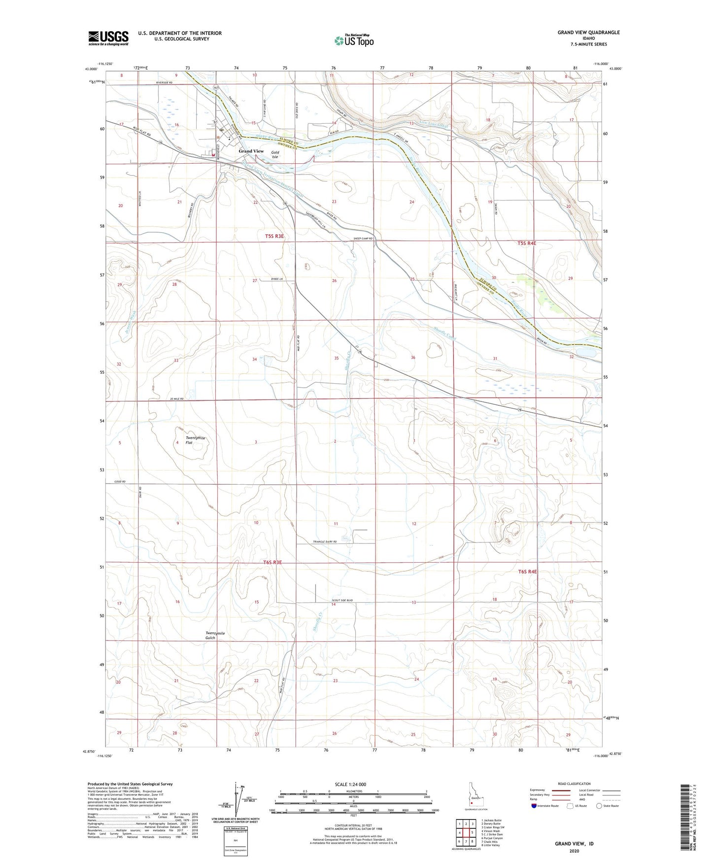
2023 topographic map quadrangle Grand View in the state of Idaho. Scale: 1:24000. Based on the newly updated USGS 7.5' US Topo map series, this map is in the following counties: Owyhee, Elmore. The map contains contour data, water features, and other items you are used to seeing on USGS maps, but also has updated roads and other features. This is the next generation of topographic maps. Printed on high-quality waterproof paper with UV fade-resistant inks.
Quads adjacent to this one:
West: Vinson Wash
Northwest: Jackass Butte
North: Dorsey Butte
Northeast: Crater Rings SW
East: C J Strike Dam
Southeast: Little Valley
South: Chalk Hills
Southwest: Purjue Canyon
This map covers the same area as the classic USGS quad with code o42116h1.
Contains the following named places: City of Grand View, Dixie Ranch, Gold Isle, Grand View, Grand View Ambulance Service, Grand View Elementary School, Grand View Fire Department, Grand View Irrigation District Canal, Grand View Post Office, Hinton Reservoir, Jensen Wash, Low Line Canal, Shoofly Canal, Shoofly Creek, Shoofly Ranch, Twentymile Flat, Twentymile Gulch, Whitson Ranch