MyTopo
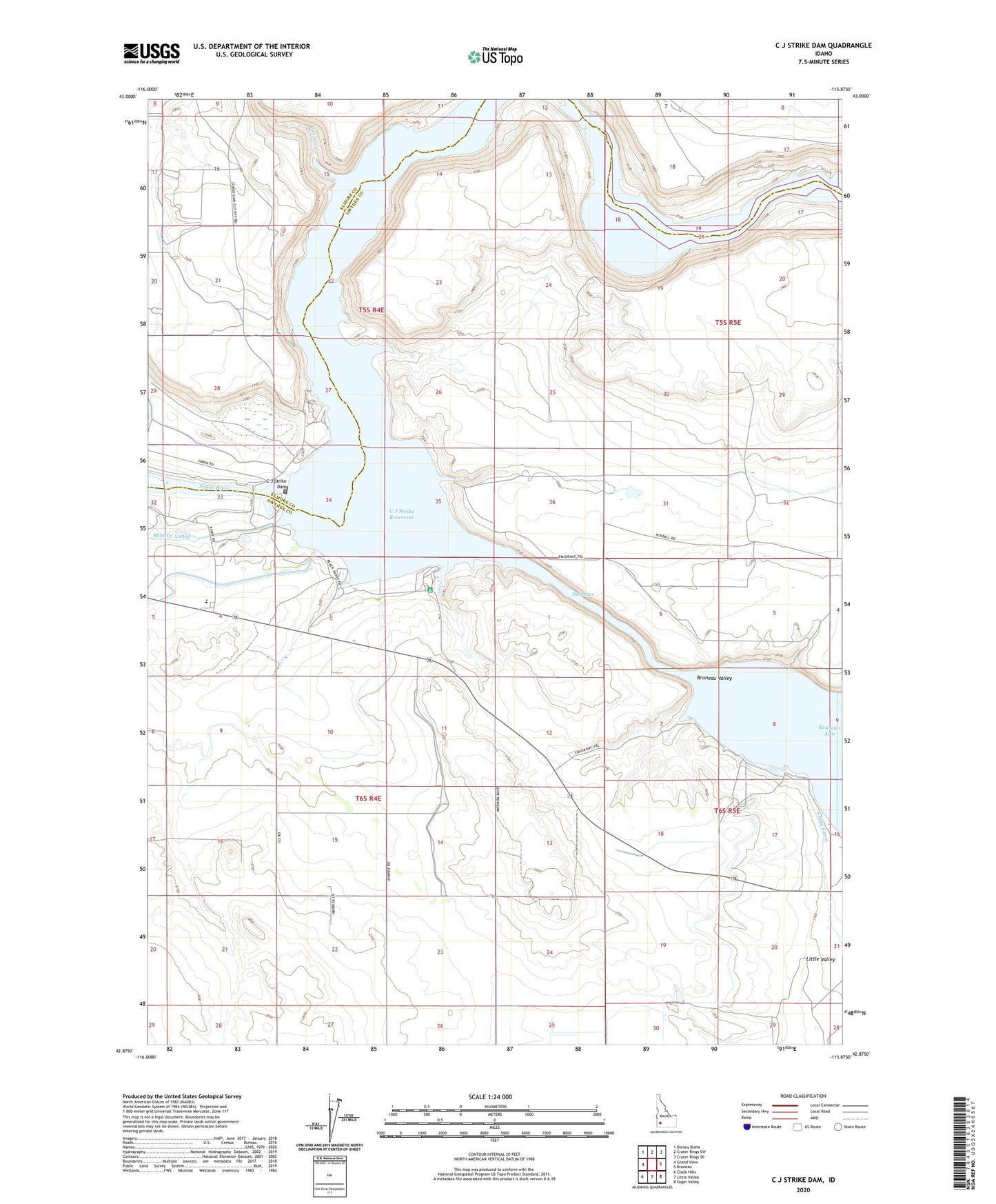
C J Strike Dam Idaho US Topo Map
Couldn't load pickup availability
2024 topographic map quadrangle C J Strike Dam in the state of Idaho. Scale: 1:24000. Based on the newly updated USGS 7.5' US Topo map series, this map is in the following counties: Owyhee, Elmore. The map contains contour data, water features, and other items you are used to seeing on USGS maps, but also has updated roads and other features. This is the next generation of topographic maps. Printed on high-quality waterproof paper with UV fade-resistant inks.
Quads adjacent to this one:
West: Grand View
Northwest: Dorsey Butte
North: Crater Rings SW
Northeast: Crater Rings SE
East: Bruneau
Southeast: Sugar Valley
South: Little Valley
Southwest: Chalk Hills
This map covers the same area as the classic USGS quad with code o42115h8.
Contains the following named places: Borden Lake, Bruneau River, Bruneau Valley, C J Strike Dam, C J Strike Reservoir, C J Strike Wildlife Management Area, Canyon Creek, Cottonwood Campground, Cove Recreation Site, Halls Ferry, Locust Park, Narrows, Ninefoot Rapids, North Park, Rimrock Junior - Senior High School, Rimrock Junior-Senior High School, Roy Johnson Ranch, South Park