MyTopo
Grassy Hills Idaho US Topo Map
Couldn't load pickup availability
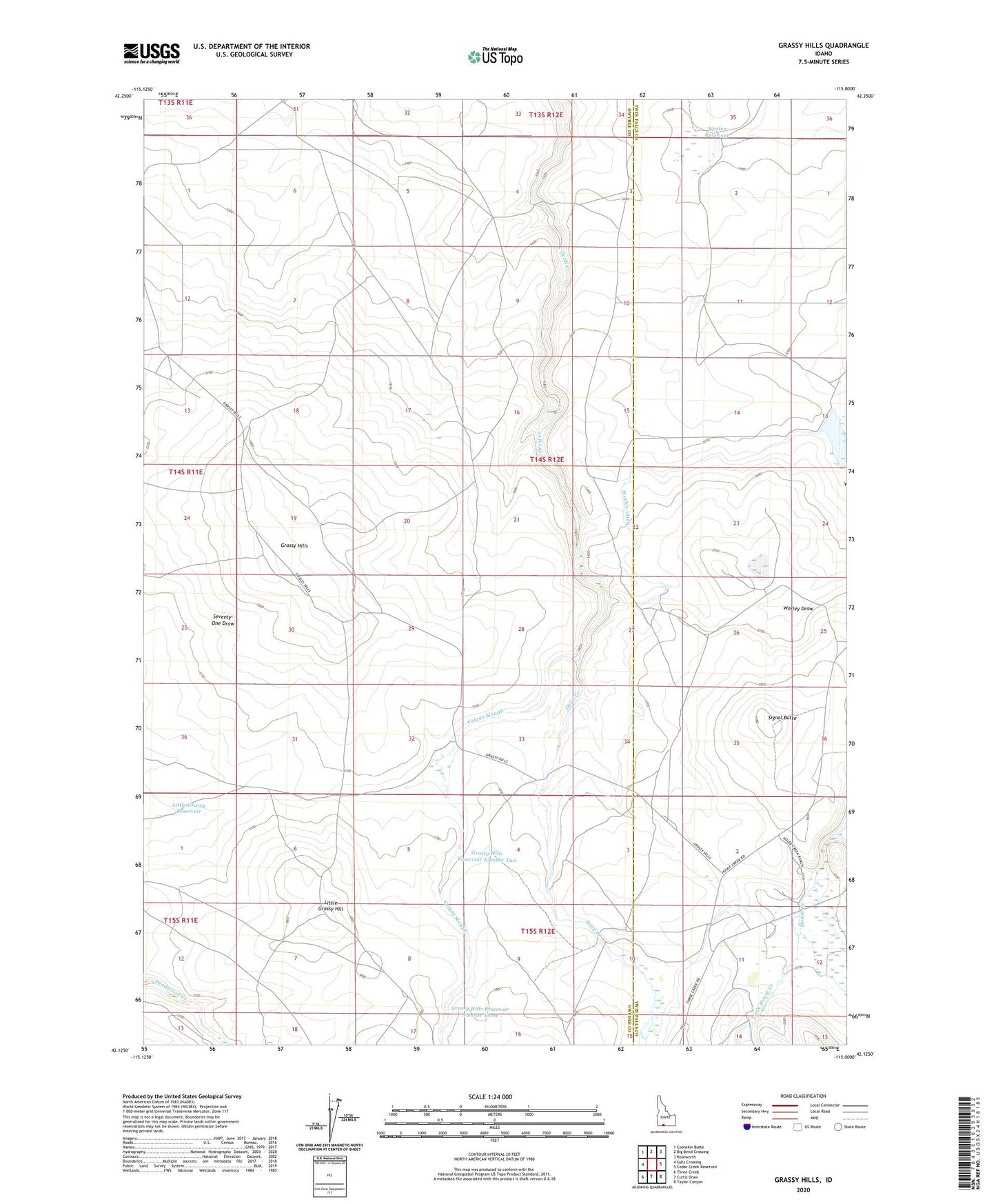
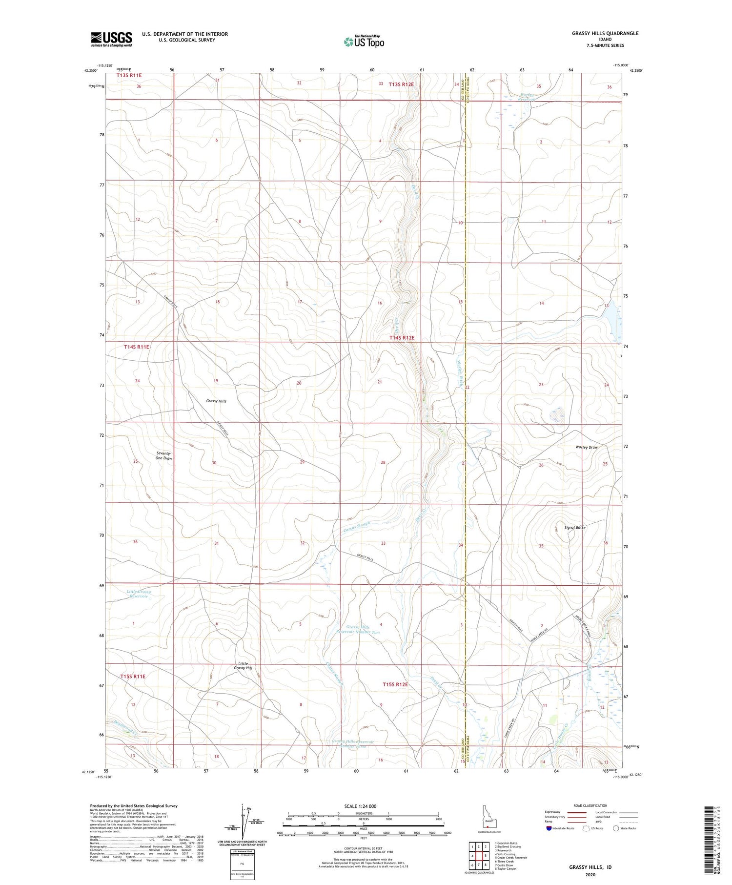
2023 topographic map quadrangle Grassy Hills in the state of Idaho. Scale: 1:24000. Based on the newly updated USGS 7.5' US Topo map series, this map is in the following counties: Owyhee, Twin Falls. The map contains contour data, water features, and other items you are used to seeing on USGS maps, but also has updated roads and other features. This is the next generation of topographic maps. Printed on high-quality waterproof paper with UV fade-resistant inks.
Quads adjacent to this one:
West: Salls Crossing
Northwest: Coonskin Butte
North: Big Bend Crossing
Northeast: Roseworth
East: Cedar Creek Reservoir
Southeast: Taylor Canyon
South: Curtis Draw
Southwest: Three Creek
This map covers the same area as the classic USGS quad with code o42115b1.
Contains the following named places: Bengeochea Crossing, Camas Slough, Grassy Hills, Grassy Hills Reservoir Number Three, Grassy Hills Reservoir Number Two, Heil Dam, House Creek Ranch, Little Grassy Hill, Little Grassy Reservoir, Little House Creek, Marshall Butte Crossing, Signal Butte, The Windmill, Worley Ditch, Worley Reservoir, ZIP Code: 83302