MyTopo
Three Creek Idaho US Topo Map
Couldn't load pickup availability
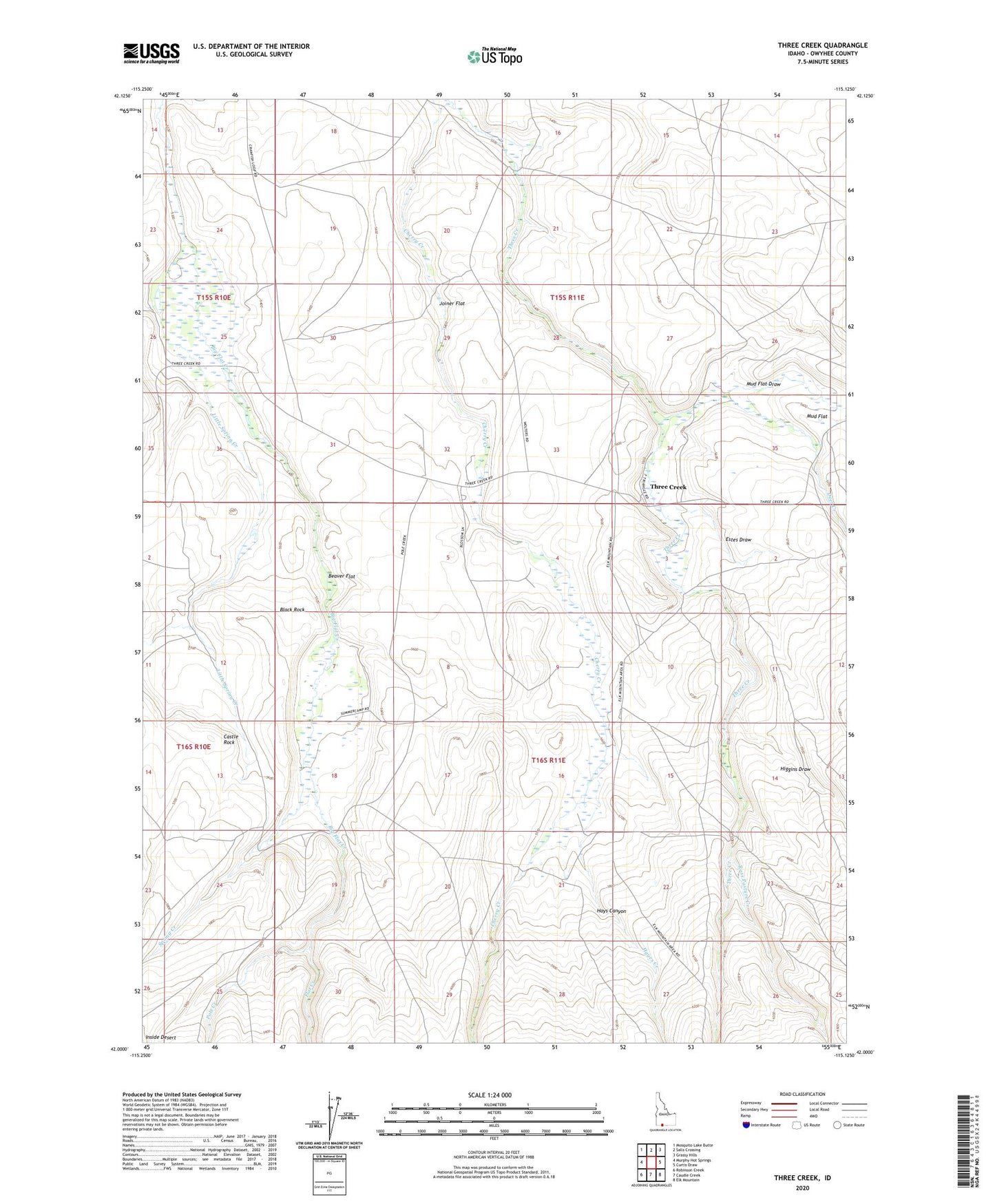
2023 topographic map quadrangle Three Creek in the state of Idaho. Scale: 1:24000. Based on the newly updated USGS 7.5' US Topo map series, this map is in the following counties: Owyhee. The map contains contour data, water features, and other items you are used to seeing on USGS maps, but also has updated roads and other features. This is the next generation of topographic maps. Printed on high-quality waterproof paper with UV fade-resistant inks.
Quads adjacent to this one:
West: Murphy Hot Springs
Northwest: Mosquito Lake Butte
North: Salls Crossing
Northeast: Grassy Hills
East: Curtis Draw
Southeast: Elk Mountain
South: Caudle Creek
Southwest: Robinson Creek
This map covers the same area as the classic USGS quad with code o42115a2.
Contains the following named places: Beaver Flat, Black Rock, Castle Rock, Deer Creek, Estes Draw, Flat Creek, Hayes Creek, Hays Canyon, Higgins Draw, Joiner Flat, Little Spring Creek, Mud Flat, Mud Flat Draw, Pole Creek, Ross Pasture Creek, Spring Creek, Three Creek, Three Creek Elementary School