
MyTopo
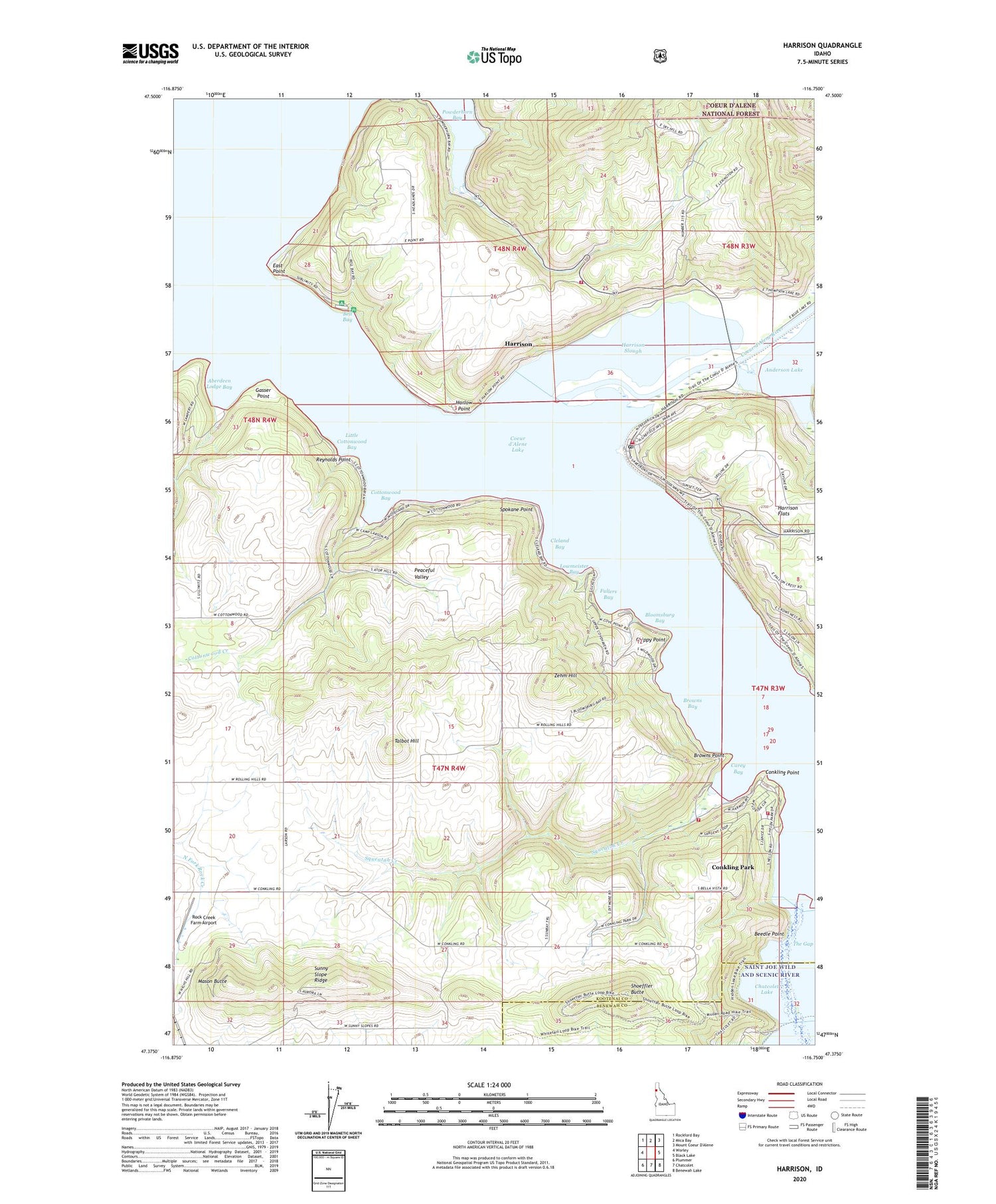
Harrison Idaho US Topo Map
Couldn't load pickup availability
Also explore the Harrison Forest Service Topo of this same quad for updated USFS data
2024 topographic map quadrangle Harrison in the state of Idaho. Scale: 1:24000. Based on the newly updated USGS 7.5' US Topo map series, this map is in the following counties: Kootenai, Benewah. The map contains contour data, water features, and other items you are used to seeing on USGS maps, but also has updated roads and other features. This is the next generation of topographic maps. Printed on high-quality waterproof paper with UV fade-resistant inks.
Quads adjacent to this one:
West: Worley
Northwest: Rockford Bay
North: Mica Bay
East: Black Lake
Southeast: Benewah Lake
South: Chatcolet
Southwest: Plummer
This map covers the same area as the classic USGS quad with code o47116d7.
Contains the following named places: Aberdeen Lodge Bay, Beedle Point, Bell Bay, Bell Bay Campground, Bloomsburg Bay, Browns Bay, Browns Point, Camp Easterseal, Carey Bay, Chippy Point, Chl'ach'alqw Landing, City of Harrison, Cleland Bay, Coeur d'Alene River, Conkling Park, Conkling Park Census Designated Place, Conkling Park Post Office, Conkling Point, Cottonwood Bay, Cottonwood Creek, East Point, East Side Fire District 3, Easterseal Camp, Fullers Bay, Gasser Point, Harlow Point, Harrison, Harrison Boat Landing, Harrison City Park, Harrison Post Office, Harrison Slough, Hidden Lake, Kootenai Junior-Senior High School, Little Cottonwood Bay, Lowmeister Bay, Mason Butte, Mowry State Park, Ne'atsqhaqhst'm Flat, Peaceful Valley, Powderhorn Bay, Reynolds Point, Rock Creek Farm Airport, Saint Joe River, Saint Maries Fire Protection District Station 3, Shoeffler Butte, Spokane Point, Squeatah Creek, Sunny Slope Ridge, Talbot Hill, The Gap, Worley Division, Worley Fire District Station 3, Worley Fire District Station 4, Zehm Hill


