MyTopo
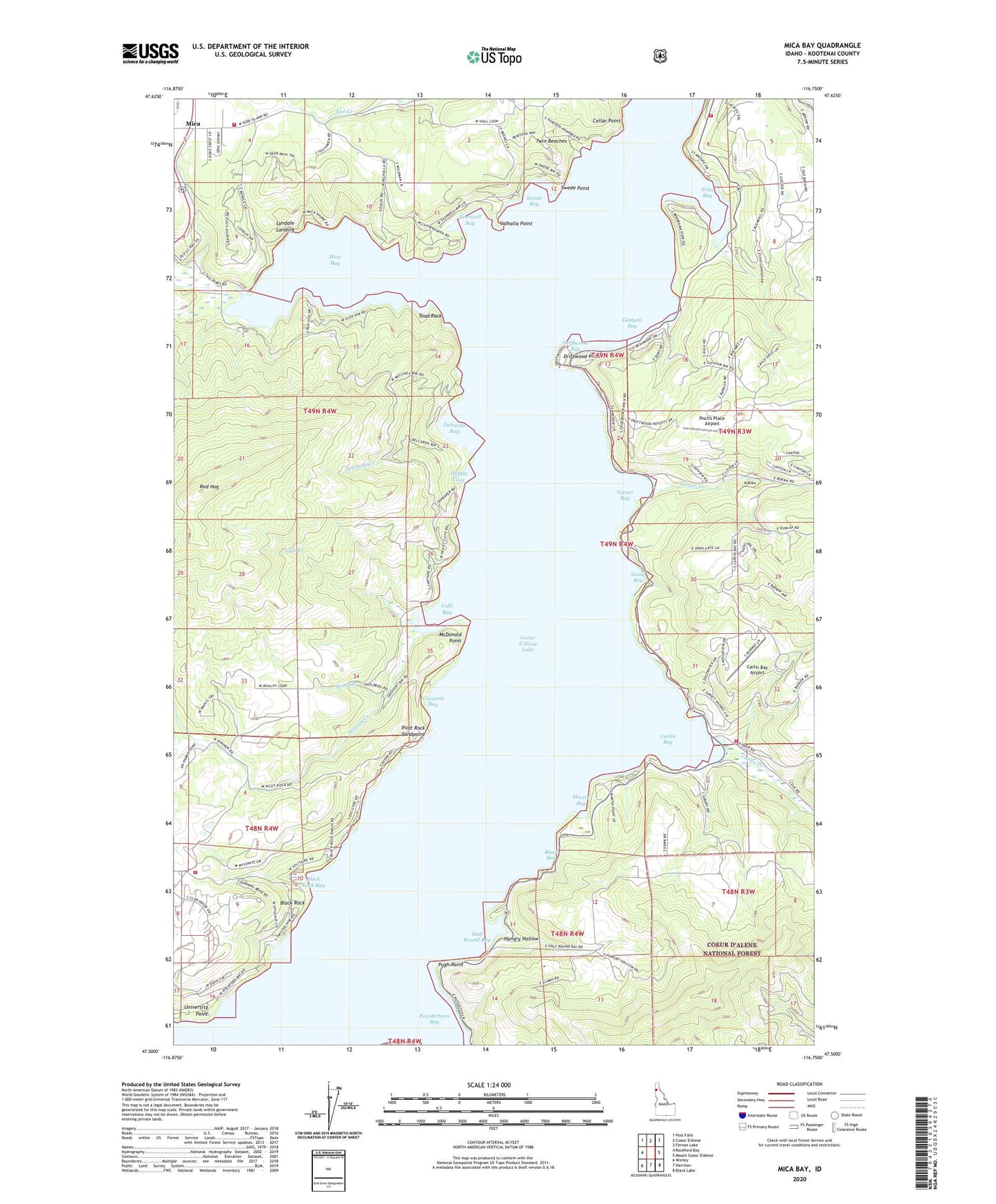
Mica Bay Idaho US Topo Map
Couldn't load pickup availability
Also explore the Mica Bay Forest Service Topo of this same quad for updated USFS data
2024 topographic map quadrangle Mica Bay in the state of Idaho. Scale: 1:24000. Based on the newly updated USGS 7.5' US Topo map series, this map is in the following counties: Kootenai. The map contains contour data, water features, and other items you are used to seeing on USGS maps, but also has updated roads and other features. This is the next generation of topographic maps. Printed on high-quality waterproof paper with UV fade-resistant inks.
Quads adjacent to this one:
West: Rockford Bay
Northwest: Post Falls
Northeast: Fernan Lake
Southeast: Black Lake
South: Harrison
Southwest: Worley
This map covers the same area as the classic USGS quad with code o47116e7.
Contains the following named places: Black Bay, Black Rock, Black Rock Bay, Camp Easton, Carlin Bay, Carlin Bay Airport, Carlin Creek, Carlin Grange, Cellar Point, Coeur d'Alene Lake, Crescent Bay, Delcardo Bay, Delcardo Creek, Driftwood Bay, Driftwood Point, East Side Fire District 1, East Side Fire District 2, Echo Bay, Everwell Bay, Gand Bay, Gotham Bay, Goulds Landing, Half Round Bay, Happy Cove, Hungry Hollow, Len Landing, Loffs Bay, Loffs Bay Access, Luther, Lyle Creek, Lyndale Landing, Lyondale, Martin Bay, McDonald Point, Mica, Mica - Kidd Island Fire Department, Mica Bay, Mica Bay Access Area, Mica Bay County Campground, Mica Creek, Pilot Rock Sandpoint, Pisch's Place Airport, Pugh Point, Red Hog, Scott Creek, Stinson Creek, Swede Bay, Swede Point, Swewla'qn Grove, Toad Rock, Turner Bay, Turner Creek, Twin Beaches, University Point, Valhalla Point, Worley Fire District Station 6