MyTopo
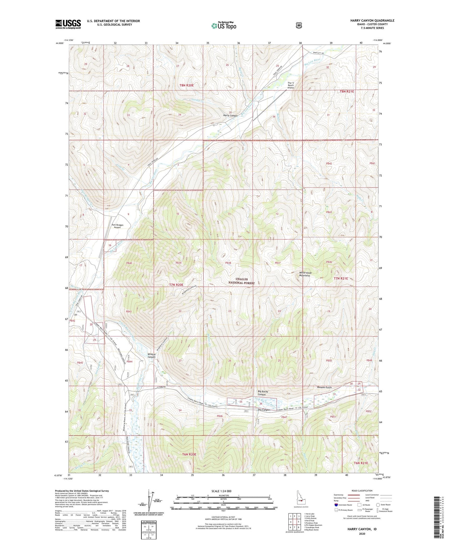
Harry Canyon Idaho US Topo Map
Couldn't load pickup availability
Also explore the Harry Canyon Forest Service Topo of this same quad for updated USFS data
2024 topographic map quadrangle Harry Canyon in the state of Idaho. Scale: 1:24000. Based on the newly updated USGS 7.5' US Topo map series, this map is in the following counties: Custer. The map contains contour data, water features, and other items you are used to seeing on USGS maps, but also has updated roads and other features. This is the next generation of topographic maps. Printed on high-quality waterproof paper with UV fade-resistant inks.
Quads adjacent to this one:
West: Herd Peak
Northwest: Herd Lake
North: Jerry Peak
Northeast: Chilly Buttes
East: Porphyry Peak
Southeast: Big Black Dome
South: Standhope Peak
Southwest: Phi Kappa Mountain
This map covers the same area as the classic USGS quad with code o43114h1.
Contains the following named places: Bady Creek, Bailey Creek, Banana Gulch, Big Rocky Canyon, Burnt Creek, Deep Creek, Deep Creek Recreation Site, Deer Creek, Dry Canyon, East Fork Big Lost River, Garden Creek, Harry Canyon, Lake Creek, Newton Creek, North Fork Big Lost River, Pole Creek, Stag Creek, Star 'S' Ranch Airport, Twin Bridges Airport, Twin Bridges Creek, Wildcat Canyon, Wildhorse Creek, Wildhorse Guard Station, Willow Creek