MyTopo
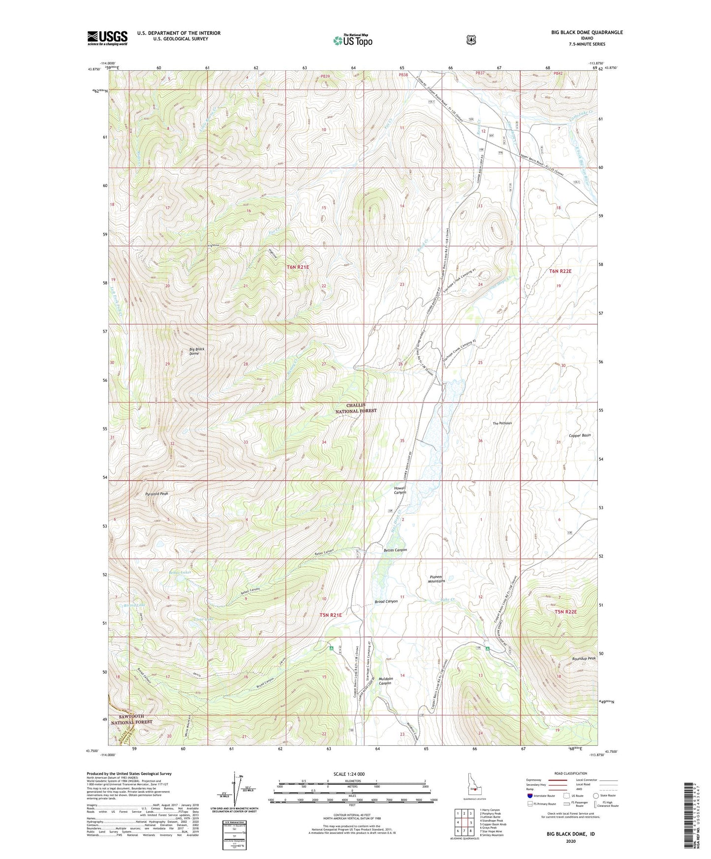
Big Black Dome Idaho US Topo Map
Couldn't load pickup availability
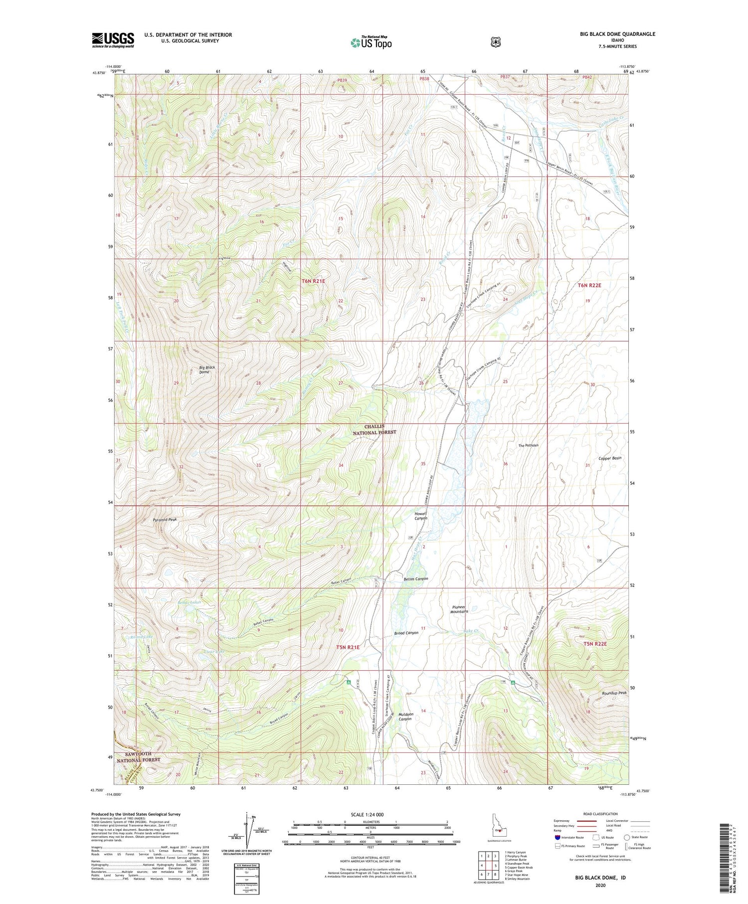
Also explore the Big Black Dome Forest Service Topo of this same quad for updated USFS data
2023 topographic map quadrangle Big Black Dome in the state of Idaho. Scale: 1:24000. Based on the newly updated USGS 7.5' US Topo map series, this map is in the following counties: Custer, Blaine. The map contains contour data, water features, and other items you are used to seeing on USGS maps, but also has updated roads and other features. This is the next generation of topographic maps. Printed on high-quality waterproof paper with UV fade-resistant inks.
Quads adjacent to this one:
West: Standhope Peak
Northwest: Harry Canyon
North: Porphyry Peak
Northeast: Lehman Butte
East: Copper Basin Knob
Southeast: Smiley Mountain
South: Star Hope Mine
Southwest: Grays Peak
This map covers the same area as the classic USGS quad with code o43113g8.
Contains the following named places: Bellas Canyon, Bellas Lakes, Big Black Dome, Bleas Canyon Recreation Site, Broad Canyon, Broad Canyon Recreation Site, Clear Lake, Copper Basin, Copper Basin Cow Camp, Howell Canyon, Lake Creek, Lake Creek Recreation Site, Little Lake Creek, Muldoon Canyon, Pyramid Peak, Ramey Creek, Road Creek, Round Lake, Roundup Peak, Star Hope Creek, The Potholes