MyTopo
Herd Peak Idaho US Topo Map
Couldn't load pickup availability
Also explore the Herd Peak Forest Service Topo of this same quad for updated USFS data
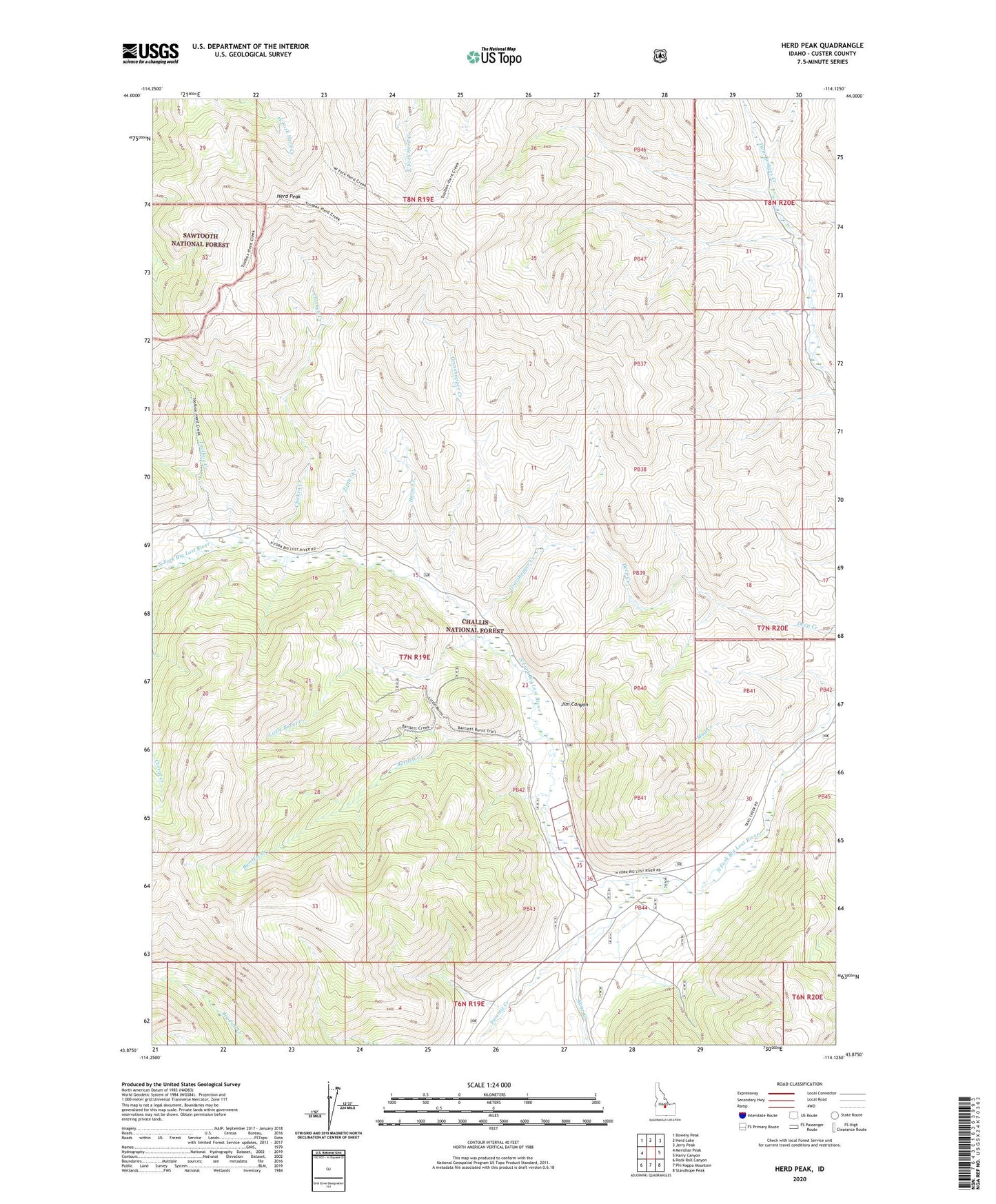
2023 topographic map quadrangle Herd Peak in the state of Idaho. Scale: 1:24000. Based on the newly updated USGS 7.5' US Topo map series, this map is in the following counties: Custer. The map contains contour data, water features, and other items you are used to seeing on USGS maps, but also has updated roads and other features. This is the next generation of topographic maps. Printed on high-quality waterproof paper with UV fade-resistant inks.
Quads adjacent to this one:
West: Meridian Peak
Northwest: Bowery Peak
North: Herd Lake
Northeast: Jerry Peak
East: Harry Canyon
Southeast: Standhope Peak
South: Phi Kappa Mountain
Southwest: Rock Roll Canyon
This map covers the same area as the classic USGS quad with code o43114h2.
Contains the following named places: Bartlett Creek, Chicken Creek, Grasshopper Creek, Herd Peak, Horse Creek, Jim Canyon, Kane Creek, Little Burnt Creek, Mud Creek, Summit Creek, Toolbox Creek, Zipper Creek