MyTopo
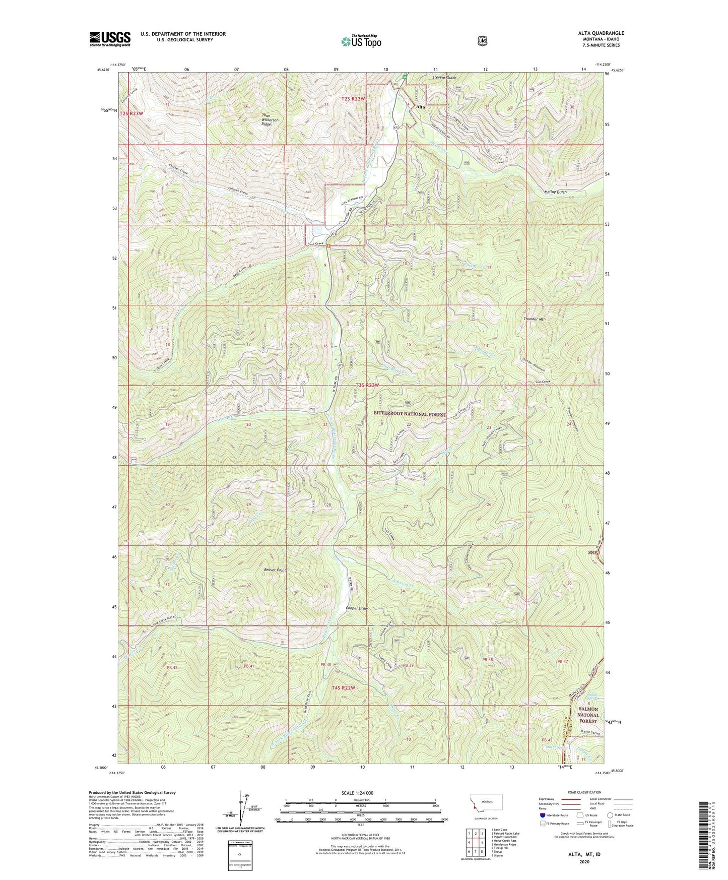
Alta Montana US Topo Map
Couldn't load pickup availability
Also explore the Alta Forest Service Topo of this same quad for updated USFS data
2024 topographic map quadrangle Alta in the states of Idaho, Montana. Scale: 1:24000. Based on the newly updated USGS 7.5' US Topo map series, this map is in the following counties: Ravalli, Lemhi. The map contains contour data, water features, and other items you are used to seeing on USGS maps, but also has updated roads and other features. This is the next generation of topographic maps. Printed on high-quality waterproof paper with UV fade-resistant inks.
Quads adjacent to this one:
West: Horse Creek Pass
Northwest: Bare Cone
North: Painted Rocks Lake
Northeast: Piquett Mountain
East: Henderson Ridge
Southeast: Ulysses
South: Shoup
Southwest: Tincup Hill
This map covers the same area as the classic USGS quad with code o45114e3.
Contains the following named places: Alta, Alta Campground, Alta Forest Service Station, Alta Post Office, Alta Recreation Site, Beaver Creek, Beaver Point, Castner Creek, Chicken Creek, Cooper Draw, Cooper Place, Copper Queen Mine, Deer Creek, Devil Creek, Hughes Creek, Johnson Creek, Lucky Joe Mine, Malloy Gulch, Marlin Spring, NE NE Section 20 Mine, NW NW Section 21 Mine, Saddle Spring, Salt Block Creek, Salt Creek, SE SW Section 3 Mine, Sheep Creek, Sheep Creek Columbite Mine, Solider Creek, SW NW Section 21 Mine, SW SE Section 21 Mine, Than Wilkerson Ridge, Thunder Creek, Thunder Mountain, Woods Creek