MyTopo
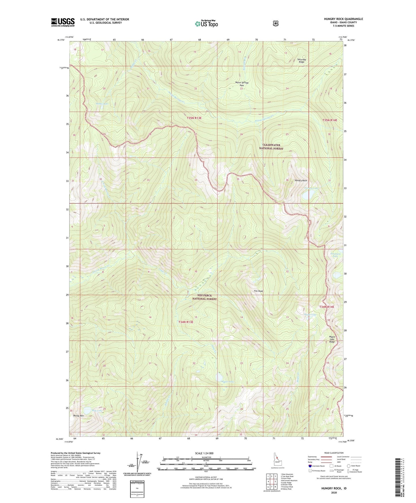
Hungry Rock Idaho US Topo Map
Couldn't load pickup availability
Also explore the Hungry Rock Forest Service Topo of this same quad for updated USFS data
2024 topographic map quadrangle Hungry Rock in the state of Idaho. Scale: 1:24000. Based on the newly updated USGS 7.5' US Topo map series, this map is in the following counties: Idaho. The map contains contour data, water features, and other items you are used to seeing on USGS maps, but also has updated roads and other features. This is the next generation of topographic maps. Printed on high-quality waterproof paper with UV fade-resistant inks.
Quads adjacent to this one:
West: McConnell Mountain
Northwest: Bear Mountain
North: Tom Beal Peak
Northeast: Grave Peak
East: Cedar Ridge
Southeast: Wahoo Peak
South: Freeman Peak
Southwest: Shissler Peak
This map covers the same area as the classic USGS quad with code o46114c7.
Contains the following named places: Bailey Mountain, Dodge Creek, Dodge Lake, Fox Peak, Hungry Lake, Hungry Rock, Isaac Creek, Isaac Lake, Maple Lake, Maple Lake Ridge, May Lake, Porphyry Lake, Saturday Ridge, Warm Springs Pass