MyTopo
Wahoo Peak Idaho US Topo Map
Couldn't load pickup availability
Also explore the Wahoo Peak Forest Service Topo of this same quad for updated USFS data
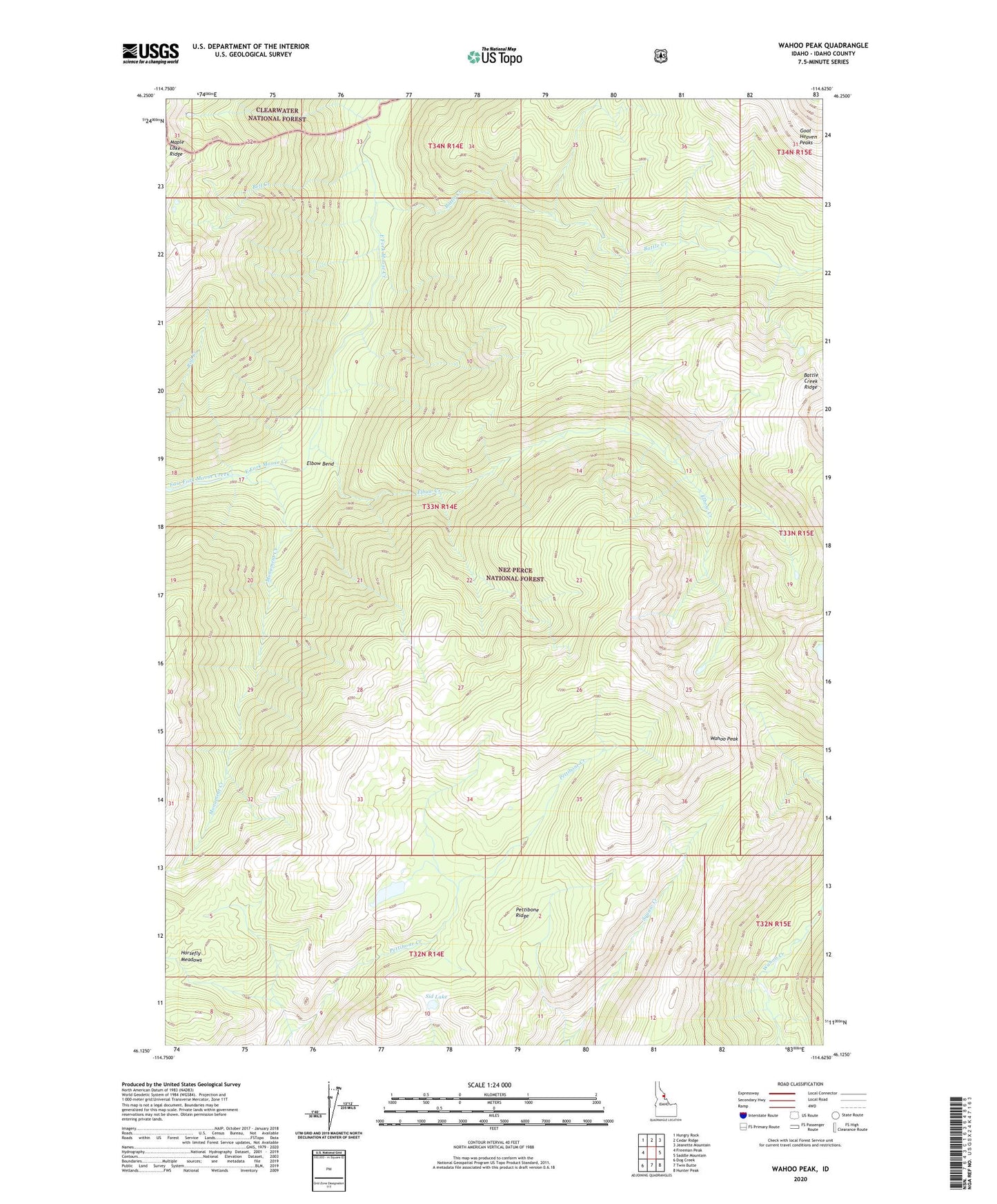
2024 topographic map quadrangle Wahoo Peak in the state of Idaho. Scale: 1:24000. Based on the newly updated USGS 7.5' US Topo map series, this map is in the following counties: Idaho. The map contains contour data, water features, and other items you are used to seeing on USGS maps, but also has updated roads and other features. This is the next generation of topographic maps. Printed on high-quality waterproof paper with UV fade-resistant inks.
Quads adjacent to this one:
West: Freeman Peak
Northwest: Hungry Rock
North: Cedar Ridge
Northeast: Jeanette Mountain
East: Saddle Mountain
Southeast: Hunter Peak
South: Twin Butte
Southwest: Dog Creek
This map covers the same area as the classic USGS quad with code o46114b6.
Contains the following named places: Battle Creek, Bell Creek, Bell Point, Cedar Creek, Elbow Bend, Elbow Creek, Goat Heaven Peaks, Horsefly Meadows, Indian Lake, Monument Creek, Pettibone Ridge, Selway-Bitterroot Wilderness, Sid Lake, Wahoo Peak