
MyTopo
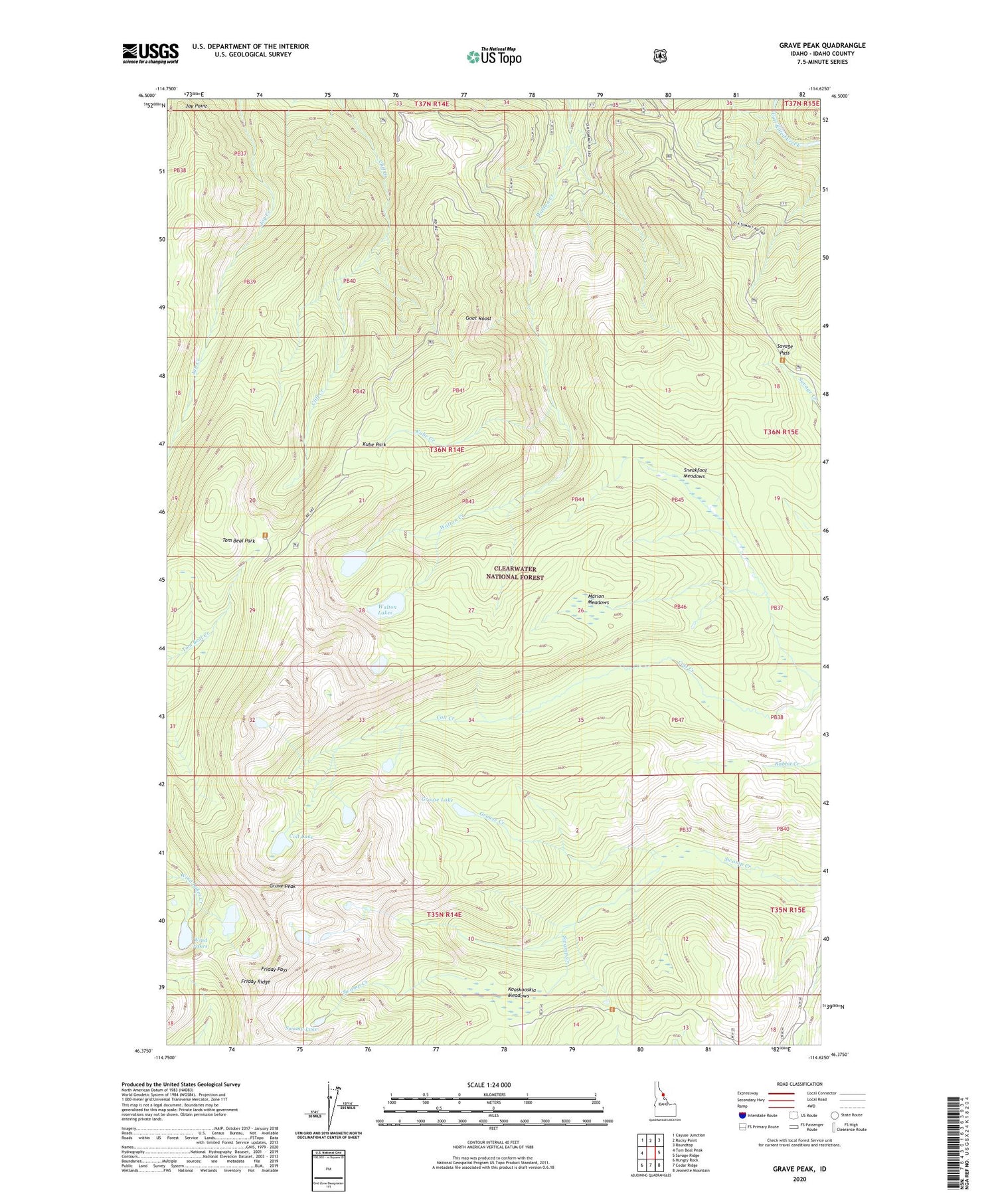
Grave Peak Idaho US Topo Map
Couldn't load pickup availability
Also explore the Grave Peak Forest Service Topo of this same quad for updated USFS data
2024 topographic map quadrangle Grave Peak in the state of Idaho. Scale: 1:24000. Based on the newly updated USGS 7.5' US Topo map series, this map is in the following counties: Idaho. The map contains contour data, water features, and other items you are used to seeing on USGS maps, but also has updated roads and other features. This is the next generation of topographic maps. Printed on high-quality waterproof paper with UV fade-resistant inks.
Quads adjacent to this one:
West: Tom Beal Peak
Northwest: Cayuse Junction
North: Rocky Point
Northeast: Roundtop
East: Savage Ridge
Southeast: Jeanette Mountain
South: Cedar Ridge
Southwest: Hungry Rock
This map covers the same area as the classic USGS quad with code o46114d6.
Contains the following named places: Colt Lake, Friday Pass, Friday Ridge, Goat Roost, Grave Peak, Grouse Creek, Grouse Lake, Idaho Game Department, Jay Point, Kooskooskia Meadows, Kube Creek, Kube Park, Marion Meadows, Savage Pass, Sneakfoot Meadows, Swamp Lake, Tom Beal Park, Walton Lakes, Wind Lakes


